Best Radar App for Accuracy in the U.S.: How to Choose (and Where Clime Fits)
Last updated: 2026-03-12
For most people in the United States who care about accurate, easy-to-read radar and timely warnings, starting with Clime’s NOAA-based radar and NWS polygons is a strong default choice. If you’re a power user who needs raw NEXRAD Level II/III data for deep analysis, a specialist tool like RadarScope can complement Clime in your toolkit.
Summary
- For day‑to‑day radar accuracy in the U.S., what matters most is NOAA/NEXRAD data, timely updates, and clear overlays like NWS warning polygons.
- Clime combines real‑time radar, NWS polygons, and multi‑hazard trackers (hurricanes, lightning, wildfires) in a single map‑first app, with advanced layers available on paid plans. (Clime on the App Store)
- Other options like The Weather Channel, AccuWeather, and Windy.app emphasize timelines, hyperlocal nowcasting, or multi‑model overlays rather than a simple radar‑first workflow.
- For most U.S. users, Clime covers accuracy needs for storm tracking and alerts; you only need niche radar apps when you’re doing professional‑level analysis or storm chasing.
What does “accuracy” in a radar app actually mean?
When people ask for the “most accurate” radar app, they often mix together several different ideas:
- Data source quality – In the U.S., that typically means how well the app ingests and visualizes NOAA’s NEXRAD radar network.
- Timeliness – How close the radar imagery is to real time (within the natural 5–10 minute delay it takes for scans to complete and be processed). Many consumer apps, including radar‑centric tools, explain that ground radar stations push data about every 5 minutes and it takes several more minutes to ingest and display it. (MyRadar support)
- Spatial resolution and smoothing – Whether the app uses native radar data or smoothed mosaics, and how clearly it draws storm structure.
- Interpretation help – Overlays like storm tracks, watches/warnings, and hazard layers that make the radar easier to use for real decisions.
No app can change the underlying physics: all U.S. radar apps are ultimately visualizing similar NOAA/NEXRAD data. The differences show up in how that data is processed, how fast it loads, and how well the interface helps you understand what’s happening.
Why is Clime a strong default for radar accuracy in the U.S.?
For most people, radar accuracy isn’t about exotic products—it’s about answering simple, high‑stakes questions: “Is this storm coming toward me?” and “Do I need to change my plans?”
At Clime, we designed the app around exactly those moments:
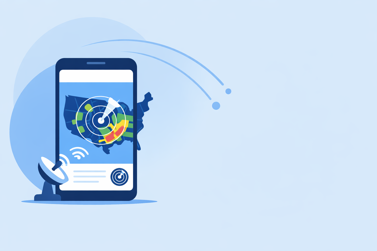
- Real‑time radar with precipitation types – Clime’s interactive map shows high‑resolution radar overlays with distinct rain, snow, and mixed precipitation areas, making it easier to read at a glance. (Clime on the App Store)
- NWS watches and warnings as polygons – In the U.S., Clime displays National Weather Service watches, warnings, and alerts as interactive polygons right on the radar map, with access to full text and alert details. (Clime on the App Store)
- Multi‑hazard awareness on one screen – On paid plans, you can layer in hurricane tracking, lightning, wildfires, snow depth, animated wind, and air quality on top of the core radar, so you see more of the risk picture without hopping between apps. (Clime on the App Store)
- Global coverage with U.S. focus – Radar imagery covers the Continental U.S., most of Alaska, Hawaii, Puerto Rico, and parts of Canada and Mexico, with additional coverage in Europe, Australia, Japan, and more, while forecasts extend to 14 days on paid plans. (Clime on the App Store)
From an accuracy standpoint, this setup gives you:
- A reliable picture of where precipitation is now
- Clear context via official warning polygons
- Enough forecast horizon (24‑hour, 7‑day, or 14‑day on paid plans) to understand what’s next
For most U.S. households, that combination offers more practical “radar accuracy” than chasing small differences in model performance.
How do major radar apps differ on “accuracy” for everyday users?
Because all of these apps draw on similar observational networks, the differences that matter most tend to be about workflow and interpretation, not raw data.
Clime vs. The Weather Channel
The Weather Channel app offers local radar, short‑term precipitation forecasts, and severe weather alerts, plus a Premium tier that emphasizes extended forecasts and more radar options. (The Weather Channel – App Store) The separate Storm Radar app focuses more tightly on high‑resolution storm and hurricane tracking, again using NOAA/NWS alerts. (Storm Radar)
The Weather Channel also markets a Premium Radar product that converts radar into a start/stop timeline for precipitation, which can be helpful for planning. (Weather.com Premium Radar)
For many U.S. users, though, Clime’s combination of:
- real‑time radar
- NWS warning polygons
- and built‑in hurricane and lightning trackers on the same map
means you can get the key answers you need without juggling multiple apps or bundles.
Clime vs. AccuWeather
AccuWeather’s app mixes live radar and a hurricane tracker with its MinuteCast nowcasting system, which provides hyperlocal precipitation forecasts with start/end times for about four hours ahead. (AccuWeather – App Store) AccuWeather also offers Premium+ subscriptions aimed at severe‑weather threat scenarios, and has promoted a Future Radar feature that visualizes precipitation progression for roughly a two‑hour horizon on some platforms. (NextTV)
If minute‑by‑minute timing is your top concern, pairing AccuWeather’s nowcast with radar can be useful. For most people, though, the difference between a four‑hour hyperlocal nowcast and Clime’s precipitation forecasts plus live radar is small compared with simply watching the storm approach on radar and receiving timely NWS alerts.
Clime vs. Windy.app
Windy.app is built for outdoor and marine enthusiasts who want a multi‑model, multi‑layer view of the atmosphere. It offers rain radar, a combined Radar & Satellite layer, hurricane tracking, weather warnings, and more than 50 different weather maps powered by over 15 forecast models. (Windy.app – App Store)
For power users, these layered visualizations can be extremely informative. For a typical U.S. resident deciding whether to drive home now or wait out a storm, that complexity can be more than you need. Clime focuses squarely on helping you see current precipitation and official warnings quickly, without sorting through dozens of parameters.
When is a specialist app like RadarScope more “accurate” for you?
There is one clear case where a dedicated radar app can be more useful than a general‑purpose tool: professional or enthusiast analysis of raw NEXRAD data.
RadarScope is a good reference point here. It displays native NEXRAD Level II and III radar data in its original radial format, explicitly noting that it does not show smoothed PNG or GIF mosaics. (RadarScope – App Store) It also updates scans automatically every few minutes, depending on the radar’s scanning strategy. (RadarScope – App Store)
For storm chasers, meteorology students, or aviation professionals who need to inspect velocity products, dual‑pol signatures, and other fine‑grained details, this kind of raw‑data access is valuable.
For most U.S. users, though, the gains from raw Level II/III views are marginal compared with having:
- a clean, legible radar mosaic
- NWS polygons on the same map
- and quick access to forecasts and hazard trackers
That’s the space where Clime is a sensible default, and tools like RadarScope become specialized add‑ons rather than daily drivers.
How accurate are “future radar” / nowcast overlays across apps?
A lot of marketing focuses on “future radar” or short‑term nowcasts—animated maps of where rain and storms might be in the near future. These layers can be helpful, but it’s important to understand their limits:
- They are model‑based predictions, not direct observations. Even the best nowcasts can misplace narrow bands of heavy rain or underestimate storm intensity.
- Different apps choose different horizons. AccuWeather has promoted a Future Radar experience with about a two‑hour horizon on some iOS versions, and its broader MinuteCast product covers about four hours. (NextTV; AccuWeather – App Store) The Weather Channel offers 15‑minute rain intensity forecasts for up to seven hours ahead. (The Weather Channel – App Store)
- Shorter horizons are often more reliable. Approximating the next 60–120 minutes tends to work better than predicting exact intensity 6–7 hours ahead.
At Clime, we lean on precipitation forecast maps, extended forecasts (up to 14 days on paid plans), and alerting rather than turning radar into a long‑range future animation. This keeps your focus on what we can see with high confidence now, supported by forecast context, instead of suggesting that any app can “perfectly” show where every storm cell will be in several hours.
In practice, a sound approach for accuracy is:
- Use live radar and polygons (Clime as your default) to understand what’s happening now.
- Layer in short‑term guidance from timelines or nowcasts only when you’re making specific timing decisions, like “do I have 30 minutes for a run?”
How often do radar apps update radar imagery?
Update speed is a key part of perceived accuracy. If you open a radar app and see imagery that stops 10–15 minutes before the current time, it’s natural to worry the data is “stale.”
In reality, radar updates go through a predictable cycle:
- Ground radar stations typically complete a volume scan about every few minutes.
- The data is then processed, composited, and distributed to consumer apps.
- Support documentation from radar‑focused apps notes that this process often means a practical delay of around 5–10 minutes between the current time and the latest available frame in your app. (MyRadar support)
RadarScope’s description underscores that even pro‑grade tools depend on each radar’s scan strategy; they update “every two to ten minutes” automatically based on those cycles. (RadarScope – App Store)
Clime works within the same physical constraints. The key is that you’re seeing near real‑time mosaics from trusted sources, not outdated snapshots.
For most U.S. users, the more important questions are:
- Does the app clearly show the timestamp for the latest frame?
- Can you animate several frames to understand motion and trend?
- Are the warning polygons and alerts aligned with what you see on the radar?
Clime is designed to make all three of those tasks straightforward.
Which apps include NWS polygon warnings and push alerts?
Radar accuracy isn’t just about where the rain is—it’s also about understanding official risk information in context.
Several major apps surface NWS warnings in different ways:
- Clime overlays National Weather Service watches, warnings, and alerts as interactive polygons on the radar map for U.S. locations, and offers push notifications for severe weather on saved places, with broader alert coverage on paid plans. (Clime on the App Store)
- The Weather Channel and its Storm Radar app also integrate NOAA/NWS alerts, providing local storm warnings in addition to radar views. (Storm Radar)
- Windy.app includes weather warnings and hurricane tracking within its broader maps, tying alerts into multi‑layer visualizations. (Windy.app – App Store)
For clarity and safety, many users prefer an app where the polygon itself is aligned with the radar imagery, rather than seeing alerts only as text or generic icons.
Clime puts those polygons directly on the radar, which makes it much easier to judge whether your home, workplace, or route is inside the warning area, and how the storm is moving relative to that boundary.
Choosing a radar app for storm chasing: which data and features matter?
If you chase storms, work in aviation, or study meteorology, your definition of “accuracy” will be stricter than the typical user’s. You might care about:
- Native Level II/III radar data with minimal smoothing
- Velocity and dual‑pol products for detecting rotation, hail, and debris
- Fine‑grained control over radar sites and scan elevation angles
Apps like RadarScope are engineered for that use case, exposing native NEXRAD data and frequent updates in radial format. (RadarScope – App Store) Windy.app’s multi‑model and CAPE/thunderstorm layers can also support scenario planning at the synoptic scale. (Windy.app – App Store)
In this context, Clime plays a different role:
- A fast, map‑centric overview for radar plus NWS polygons
- Multi‑hazard context (hurricanes, lightning, wildfire, air quality) on paid plans
- A cleaner interface for sharing screenshots or quickly briefing non‑experts
Many advanced users end up with a two‑tier setup:
- Clime as the everyday radar and alert app for family, friends, or quick checks
- A specialist app like RadarScope for deep dives during active severe weather
This combination keeps your day‑to‑day experience simple while still giving you access to advanced data when you need it.
What we recommend
- Start with Clime as your main radar app if you’re in the United States and want accurate, understandable radar plus NWS polygons and multi‑hazard tracking in one place. (Clime on the App Store)
- Add a specialist app like RadarScope only if you routinely analyze raw Level II/III radar or chase storms and need professional‑grade products. (RadarScope – App Store)
- Consider The Weather Channel, AccuWeather, or Windy.app if you specifically value long timeline‑style nowcasts, extended planning tools, or multi‑model visualizations alongside your radar.
- Whichever app you choose, pair it with official NWS guidance and local emergency instructions—apps are powerful tools, but real‑world decisions should draw on multiple trusted sources.