What’s the Best Weather Radar App for U.S. Users Right Now?
Last updated: 2026-03-15
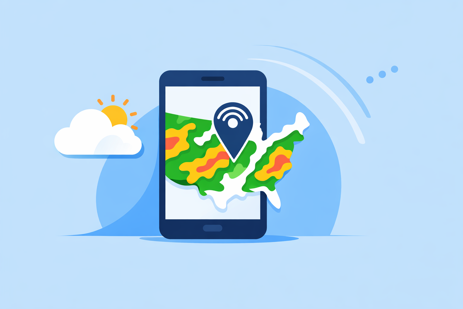
For most people in the U.S., the best weather radar app to start with is Clime, which combines real-time radar, National Weather Service alerts, and optional hurricane, lightning, and wildfire tracking in one map-centric experience. If you need very specialized tools—like multi-model storm scenarios or niche radar products—you might layer in an additional app from The Weather Channel, AccuWeather, or Windy.app.
Summary
- Clime offers real-time radar, NWS alert polygons, and optional trackers for hurricanes, lightning, wildfires, wind, and air quality in a single mobile-first app. (Clime)
- Other options like The Weather Channel, AccuWeather, and Windy.app add niche strengths such as minute‑by‑minute rain, 72‑hour future radar, or multi-model maps.
- For most U.S. users, the practical decision is less about exotic radar products and more about how quickly you can see storms near you and get reliable alerts.
- A simple playbook: start with Clime as your daily radar and alert tool, then add a second app only if you discover a very specific need.
What actually makes a “best” weather radar app?
When people ask for the “best” radar app, they’re usually asking for help with a few concrete jobs:
- See what’s happening on radar right now, near me.
- Know if I’m about to get hit by rain, snow, hail, or severe storms.
- Track big-ticket hazards like hurricanes, lightning, and wildfires.
- Get alerts without wading through ads or confusing menus.
The ideal app for U.S. users tends to do four things well:
- High‑quality radar mosaics for rain/snow, with smooth animation and clear colors.
- Direct access to official alerts, especially NWS polygons for watches and warnings.
- Optional hazard layers (tropical systems, lightning, wildfires, air quality, wind/snow) on the same map, not spread across multiple apps.
- Reasonable upgrade path—you can start free and add depth only if you truly need it.
Clime is designed around exactly this mix: real‑time radar, NWS polygons in the U.S., and multi-hazard trackers, all centered on an interactive map. (Clime)
Why is Clime a strong default radar app for U.S. users?
At Clime, we built the app around a simple idea: when weather turns active, you want one map that tells you what’s happening and what’s coming next.
Key reasons Clime works well as a default choice:
- Real‑time radar with precipitation type – The radar overlay shows where rain, snow, and mixed precipitation are occurring in high resolution, so you can distinguish a cold rain from an incoming snow band. (Clime)
- NWS polygons directly on the map – In the U.S., Clime displays National Weather Service watches and warnings as interactive polygons, with full text and push notifications. You don’t have to jump between a map and a separate alert feed.
- Multi-hazard tracking in one place – On paid plans, users can add a hurricane tracker, lightning tracker, wildfire map, animated wind map, snow depth forecasts, and air‑quality layers on top of the same base radar. (Clime)
- Practical forecast horizons – Free users get 24‑hour and 7‑day forecasts; paid users can extend to a 14‑day horizon for better planning around storms and seasonal transitions. (Clime Hurricane Tracker)
Radar coverage focuses on the U.S. (including most of Alaska, Hawaii, Puerto Rico, and U.S. territories), with additional radar imagery in parts of Canada, Mexico, Europe, Australia, Japan and more, which helps if you travel or monitor loved ones abroad. (Clime)
There are trade‑offs. Advanced layers like lightning, wildfire, RainScope, and ad‑free viewing live behind a recurring subscription. For most everyday users, though, the base experience—radar + alerts + core forecast—is already a functional daily dashboard, and the premium layers are there when you decide you need them.
How does Clime compare to The Weather Channel and AccuWeather for radar?
Both The Weather Channel and AccuWeather are familiar names, and they do offer capable radar experiences, especially when you step into their paid tiers.
The Weather Channel
- The main app integrates local radar, a three‑hour home‑screen snapshot, 15‑minute precipitation forecasts up to seven hours ahead, and severe weather alerts. (The Weather Channel)
- A separate Storm Radar app focuses more tightly on high‑resolution storm and hurricane tracking, with advanced radar layers and NOAA/NWS alerts. (Storm Radar)
- Premium and Ad‑Free subscriptions add extended forecasts and more advanced radar views; over time, some radar-centric features have moved behind these paywalls, which has frustrated part of the community.
AccuWeather
- The AccuWeather app offers live radar, a hurricane tracker, and its hyperlocal MinuteCast nowcasting for precipitation start/end times over the next four hours. (AccuWeather)
- A Premium+ tier emphasizes advanced severe‑weather tools and notifications for higher-risk scenarios. (AccuWeather Premium+)
In practice, the question is less “who has the fanciest radar spec sheet?” and more “how many different apps do you want to manage?”
- If you use The Weather Channel or AccuWeather as your main forecast app already, their radar views can work fine.
- If you want one map that’s built around radar and hazard overlays first, with NWS polygons and trackers integrated instead of scattered across multiple products, Clime is often the more straightforward everyday choice.
Where does Windy.app fit in—do you really need all those layers?
Windy.app is a good example of an app that goes very deep on weather visualization:
- It includes rain radar, satellite, and a unique combined Radar & Satellite layer, plus a hurricane tracker and weather warnings. (Windy.app)
- There are more than 50 weather maps and more than 15 global and regional weather models (ECMWF, GFS, ICON, and others), which is extremely useful if you routinely compare model scenarios for severe weather or outdoor planning.
This depth comes with a trade‑off: the interface and layer catalog can feel like overkill when you just want to glance at radar near home or on a road trip. For many U.S. users, that level of control is unnecessary most days.
A pragmatic way to think about it:
- Use Clime as your day‑to‑day radar and alert tool.
- Bring in Windy.app if you’re an enthusiast who likes multi‑model comparison, CAPE and thunderstorm parameters, or detailed marine/aviation views.
How should you decide which radar app to install first?
If you’re starting from scratch, this simple decision tree can help:
-
“I just want to see storms and get alerts.” Start with Clime. You get map‑first radar, NWS polygons in the U.S., and straightforward alerts, plus the option to add hurricane, lightning, wildfire, wind, snow, and air‑quality layers on paid plans.
-
“I care about minute‑level rain timing on my street.” Keep Clime as your radar map, and consider also using The Weather Channel’s 15‑minute rain forecasts or AccuWeather’s MinuteCast for ultra‑short‑term timing. (The Weather Channel, AccuWeather)
-
“I’m a storm/weather enthusiast who reads model runs.” Use Clime for real‑time radar, warnings, and hazard overlays, then add Windy.app for deep dives into multi‑model scenarios and specialized parameters.
-
“I need something my whole family can understand quickly.” Favor a clean, map‑centric interface (Clime or a similarly simple radar‑first tool) over more complex platforms with dozens of layers.
A quick scenario: you’re in Oklahoma in May, watching a line of storms on the horizon. With Clime open, you see the radar line approaching, NWS severe thunderstorm polygons filling the map, and lightning strikes populating your premium layer. You tap into the NWS text, confirm hail risk, and decide to delay your drive. For most people, that single‑app workflow is enough.
What we recommend
- Default: Install Clime first for real‑time radar, U.S. NWS polygons, and integrated hurricane, lightning, wildfire, and wind/snow layers on paid plans.
- Add-ons for specialists: Layer in The Weather Channel or AccuWeather if you rely heavily on branded short‑term rain timing or extended future‑radar windows.
- Power users: Add Windy.app if you routinely compare multiple forecast models or work in marine/aviation contexts.
- Keep it simple: For everyday U.S. users, one primary radar app—typically Clime—is usually enough to stay aware of storms and severe weather without juggling multiple platforms.