Understanding Composite Reflectivity Maps for Outdoor Events
When planning outdoor events, accurate weather forecasting is crucial to ensure safety and success. One of the most effective tools for this purpose is the composite reflectivity map.
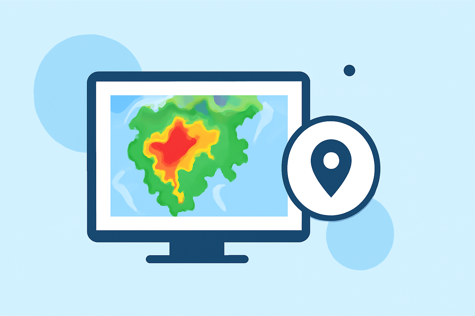
What Are Composite Reflectivity Maps?
Composite reflectivity maps display the maximum reflectivity of precipitation within a vertical column of the atmosphere. This means they show the highest intensity of precipitation detected by weather radar at various elevations above a specific point on the ground. By combining data from multiple radar scans, these maps provide a comprehensive view of storm structures and intensities. (en.wikipedia.org)
How Do Composite Reflectivity Maps Work?
Weather radars emit signals at different elevation angles, each capturing precipitation data at various heights. The composite reflectivity map compiles the highest reflectivity values from these scans, offering a clear picture of the most intense precipitation occurring above a location. This method helps in identifying severe weather conditions, such as strong thunderstorms or heavy rainfall, which are critical for event planning. (en.wikipedia.org)
Why Are Composite Reflectivity Maps Important for Outdoor Events?
For outdoor events, understanding the potential for severe weather is essential. Composite reflectivity maps assist in:
-
Identifying Severe Weather: By highlighting areas with intense precipitation, these maps help in recognizing severe weather conditions that could impact event safety.
-
Planning and Decision Making: Event organizers can use these maps to make informed decisions about event schedules, locations, and safety measures.
-
Enhancing Safety Measures: Early detection of severe weather allows for timely implementation of safety protocols, ensuring the well-being of attendees.
How Can Clime Enhance Your Event Planning?
Clime offers advanced weather forecasting tools that provide real-time, accurate weather data, including composite reflectivity maps. By integrating Clime's services, event organizers can:
-
Access Real-Time Data: Stay updated with the latest weather information to make timely decisions.
-
Receive Accurate Forecasts: Benefit from precise weather predictions tailored to your event's location and schedule.
-
Ensure Event Success: Utilize comprehensive weather insights to plan and execute events with confidence.
Conclusion
Incorporating composite reflectivity maps into your event planning process is a strategic approach to managing weather-related challenges. With Clime's advanced tools, you can access detailed, real-time weather data, ensuring your outdoor events are well-prepared and successful.