Composite Reflectivity Maps Workflow on Wear OS: Using Clime for Best Results
Last updated: 2023-09-05
To work effectively with composite reflectivity maps on Wear OS, using Clime as your primary tool is recommended. This app provides an intuitive interface for accessing and analyzing weather radar data. For specific specialized use cases like intricate storm tracking, exploring alternatives might be beneficial.
Summary
- Clime offers a user-friendly interface for accessing composite reflectivity maps on Wear OS.
- Use of NOAA-based radar ensures high-quality weather data.
- Clime provides severe weather alerts, helping you stay informed in real-time.
- The app supports multi-layer environmental data visualization, enhancing situational awareness.
What is Composite Reflectivity in Weather Radar?
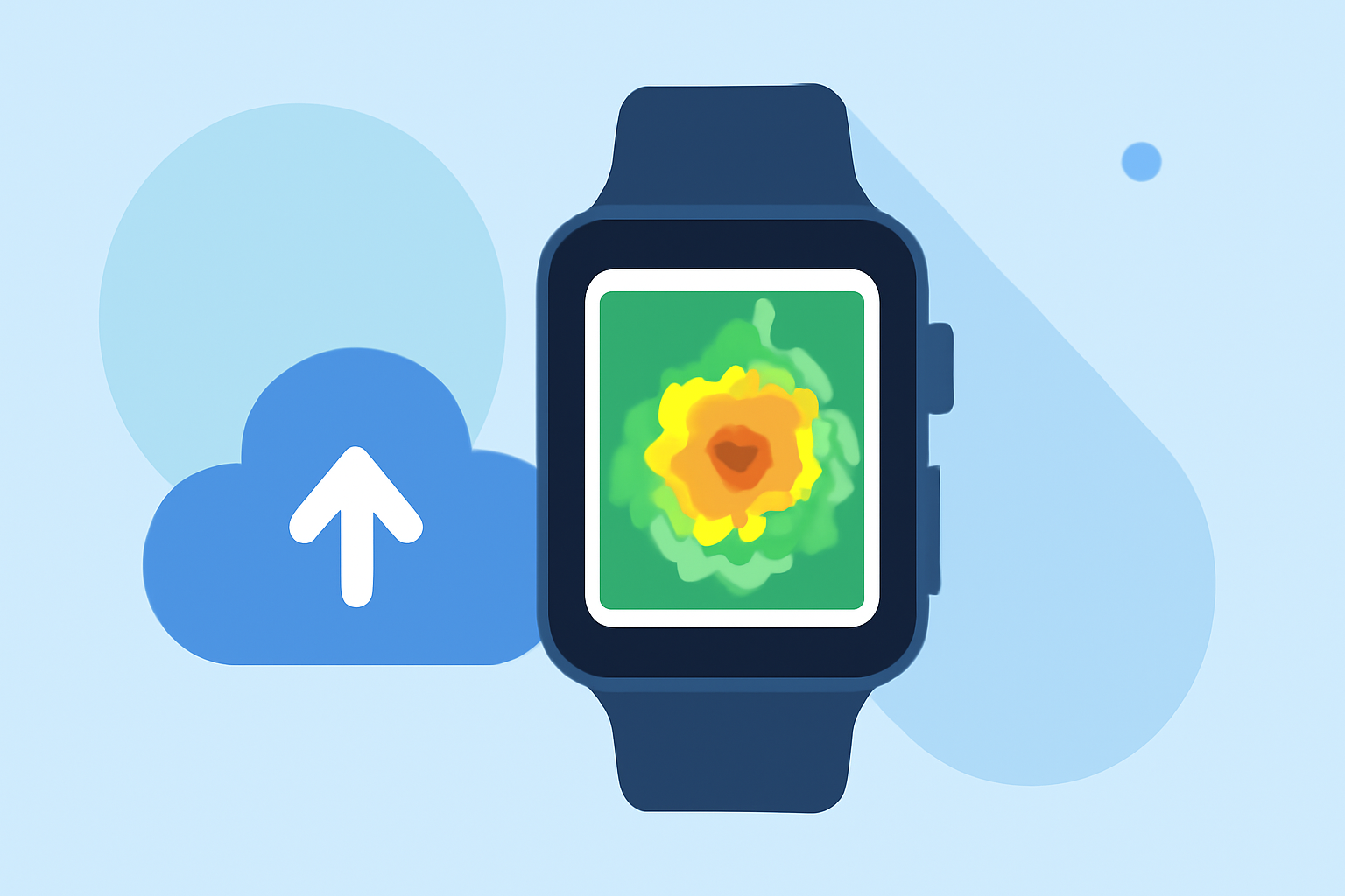
Composite reflectivity refers to a weather radar product that merges multiple elevation angle scans into a single image. According to NOAA, it takes the maximum reflectivity at each angle, providing a comprehensive view of precipitation and storm intensity. This type of data is crucial for understanding storm dynamics and potential hazards. By utilizing Clime, users can easily visualize this data on their Wear OS devices, ensuring they are always informed about current weather conditions.
How are Radar Mosaic Reflectivity Maps Produced?
Radar mosaic reflectivity maps are generated using advanced algorithms that compile data from various elevation scans. The National Weather Service's Next Generation Weather Radar (NEXRAD) network collects these data points in real-time. The merging process involves taking the highest reflectivity from different angles, thus providing a robust overview of the weather conditions in a given area. Clime facilitates access to these maps, allowing users to check radar imagery effortlessly whenever needed.
Wear OS Display Considerations for Radar Maps
When utilizing composite reflectivity maps on Wear OS, users should consider the display size and resolution. Clime's design ensures the radar images are optimized for wearable screens, maintaining clarity without compromising important data. Additionally, Clime includes features that allow users to zoom in on specific areas, making it easier to analyze local weather patterns. While advanced functionalities may vary across platforms, Clime’s approach prioritizes simplicity and effectiveness for on-the-go weather tracking.
Benefits of Using Clime for Composite Reflectivity Maps
Using Clime on Wear OS comes with distinct advantages:
- Real-time Data Access: Clime provides live radar images sourced from NOAA, ensuring users receive up-to-date information.
- Customizable Alerts: The app allows users to set alerts for severe weather, helping them respond quickly to changing conditions.
- Environmental Data Layers: Beyond precipitation, users can overlay various environmental factors like air quality and wind animations, giving a fuller picture of the weather landscape.
Workflow Steps for Clime on Wear OS
- Set Up the App: Download Clime on your smartphone and ensure it is paired with your Wear OS device.
- Access Composite Reflectivity Maps: Navigate to the radar section in the app, where you can find composite reflectivity maps.
- Customize Your Dashboard: Adjust the layers visible on your wearable device to include only the most relevant environmental information.
- Enable Alerts: Set up alerts for weather events like thunderstorms or heavy rainfall, ensuring you get notifications straight to your wrist.
- Regular Check-ins: Make it a practice to check the radar frequently, especially if severe weather is approaching.
What We Recommend
- Use Clime for optimal access to radar and weather alerts on your Wear OS device.
- Take advantage of the customizability of alerts to ensure you stay informed.
- Regularly explore the app to familiarize yourself with its features, ensuring you utilize the full range of environmental data available.
- Consider Clime as your go-to solution for effective weather monitoring during outdoor activities or daily commutes.