How Weather Radar Actually Tracks Storms (And How to Read It in Clime)
Last updated: 2026-03-05
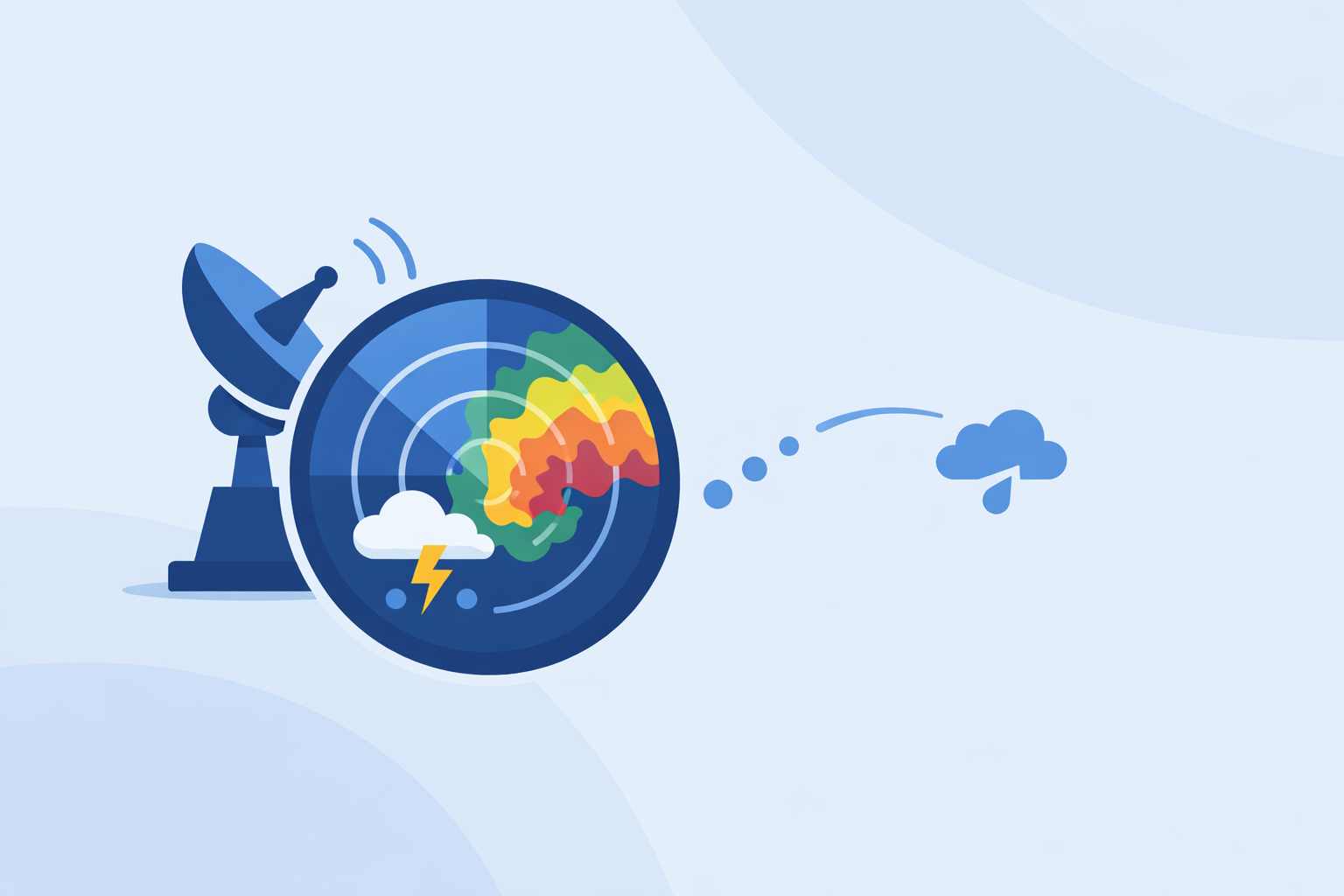
Weather radar tracks storms by sending out microwave pulses, timing how long they take to return to measure distance, and using the strength and Doppler shift of those echoes to map where rain and wind are inside the storm. For most people in the U.S., the easiest way to see this in action is through a radar app like Clime that visualizes NOAA’s NEXRAD network with storm‑focused layers.
Summary
- Weather radar sends out pulses, measures their round‑trip time to locate precipitation, and uses return strength (reflectivity) to estimate intensity.
- Doppler processing converts phase shifts in the returned signal into radial wind, revealing storm motion and rotation signatures.National Weather Service
- Dual‑polarization radar adds extra data to distinguish rain, hail, snow, and even debris within severe storms.NOAA NCEI
- In the U.S., the NEXRAD network of over 150 Doppler radars feeds this data into public sites and apps; Clime builds on that to give a radar‑first, storm‑tracking view for everyday users.NOAA NWS
How does weather radar find storms in the first place?
Think of weather radar as a very fast, very sensitive tape measure made of radio waves.
A radar unit sends out short bursts (pulses) of microwave energy. When those pulses hit raindrops, hailstones, or snowflakes, a tiny fraction of the energy scatters back to the antenna. By measuring how long it took the pulse to go out and come back, the radar computes the distance to the target—this is basic time‑of‑flight ranging.National Weather Service
The radar also knows which direction it was pointing when it sent each pulse, so every echo can be placed at a specific range and angle. As the antenna spins, it builds a 2D picture of where precipitation is located around the site.
In the U.S., this is handled by the WSR‑88D Doppler radars in the NEXRAD network, each scanning out to roughly 250 miles in all directions.NOAA NWS That coverage is what you see behind almost every U.S. radar map, including the one in Clime.
What does "reflectivity" show on your radar app?
Most people’s mental image of radar is the familiar greens, yellows, and reds on a map. Those colors represent reflectivity—the strength of the returned signal.
Heavier precipitation has more and larger hydrometeors, which reflect more of the radar’s energy back. In NWS products and many apps, higher reflectivity values are mapped to warmer colors: green for light rain, yellow/orange for moderate, and red and beyond for heavy rain, hail, or extremely intense cores.National Weather Service
When you open Clime’s radar map, you’re essentially seeing a smoothed, tiled version of these reflectivity fields. For a typical U.S. user deciding “Is this storm going to flood my street?” the reflectivity layer is the fastest way to see where the downpours really are.
How does Doppler radar track storm motion and rotation?
Classic reflectivity tells you where the storm is and how strong the precipitation looks, but it doesn’t directly show wind. That’s where Doppler processing comes in.
Because raindrops are moving, the frequency and phase of the returned radar wave are slightly shifted—a Doppler shift. The radar compares the phase of successive pulses to determine whether targets are moving toward or away from the antenna, and at what speed. This is converted into radial velocity.
On standard Doppler velocity products, inbound motion (toward the radar) is typically shown in green and outbound motion (away from the radar) in red.National Weather Service When you see tightly packed green‑next‑to‑red in a thunderstorm, that can flag rotation. Forecasters scrutinize these signatures to identify mesocyclones and possible tornado development.
Consumer apps rarely expose all the raw velocity and dual‑pol products, but this information underpins the severe weather alerts you receive. When we surface a thunderstorm or tornado warning in Clime, it’s based on the same Doppler‑derived signatures NWS uses to issue those alerts.
Dual-polarization explained: how does radar know rain vs hail vs debris?
Modern NEXRAD radars transmit and receive pulses in both horizontal and vertical orientations—this is dual‑polarization. It gives a richer look at the size, shape, and consistency of what’s in the beam.
In addition to classic reflectivity, dual‑pol radars provide base quantities like differential reflectivity, correlation coefficient, and differential phase.NOAA NCEI Together, these help classify hydrometeors:
- Broad, consistent shapes with high correlation often indicate steady rain.
- Very high reflectivity but low correlation can indicate hail.
- Extremely low correlation and chaotic signatures may show non‑meteorological debris lofted by a tornado.
You won’t usually see “correlation coefficient” called out in a consumer app, but it’s part of what makes NWS storm analysis and warning decisions more confident. For someone glancing at Clime before a drive, this science is quietly baked into the warnings and hurricane, lightning, and fire layers we surface on top of the radar map.Clime
What role does the NEXRAD network play in U.S. storm tracking?
In the United States, essentially all mainstream radar views sit on top of the same federal backbone: NEXRAD.
There are 158 WSR‑88D Doppler radars in the national network, operated by NOAA’s National Weather Service and partner agencies.NOAA NWS Each site continuously scans the atmosphere in multiple elevation angles, generating Level‑II data that include reflectivity, mean radial velocity, and spectrum width.NOAA NCEI
The raw data are processed into mosaics and products distributed via public NWS portals like the national radar site, and then consumed by apps and services. Clime’s radar map is built around these NOAA‑sourced mosaics, then layered with additional context like wildfire hotspots, lightning, and hurricane tracks so you get a single, coherent view instead of juggling separate tools.Clime
Other options in the U.S. also visualize NEXRAD—sites like the official NWS radar viewer or general‑purpose weather apps that mix in forecasts and radar.National Weather Service In day‑to‑day use, the underlying data are similar; what changes is how quickly and clearly each app helps you answer “Where is the worst of this storm, and is it headed my way?”
How accurate are "future radar" or predictive radar overlays?
Many apps now offer “future radar” or forecast overlays that show where the rain might be 1–3 hours from now. Under the hood, these products extrapolate radar frames forward in time using models and motion vectors rather than measuring new returns.AccuWeather API
That makes them useful for a quick sense of trend—will the main band slide north or stay south of me—but they’re not as concrete as actual reflectivity from the radar dish. Performance can degrade when storms rapidly intensify, weaken, or change direction.
Our view at Clime is practical: for decisions like “do I leave now or in 20 minutes,” the live radar loop plus short‑range alerts tends to matter more than an intricate future‑radar animation. If you enjoy looking at predictive overlays from other platforms, they can be a helpful second opinion, but they shouldn’t replace watching how the real echoes evolve.
How does an app like Clime turn radar science into something you can use?
You could, in theory, load raw NEXRAD Level‑II data and browse every tilt, velocity product, and dual‑pol field. That’s what professional meteorologists and some enthusiasts do. For most people, that level of detail just gets in the way of a fast decision.
At Clime, we start from NOAA’s radar mosaics and:
- Center the experience on an interactive radar map so you can pan, zoom, and animate storms in seconds.Clime
- Add layers oriented to real risks—lightning, wildfire hotspots, and hurricane tracking—so the same map covers summer thunderstorms, fall burns, and tropical systems.Clime
- Pair the map with hourly and 10‑day forecasts to frame what you see on radar in time.Clime
- Deliver severe weather and rain alerts on supported paid tiers, built on the same warning infrastructure as other major U.S. weather apps.Apple App Store
If you enjoy fine‑tuned precipitation timing or extended future‑radar animations, some other tools emphasize those angles. In practice, many U.S. users keep one radar‑first app like Clime as their daily driver and check specialized options only when they need a niche feature.
Phased-array versus classic radar: will storm tracking get faster?
Traditional NEXRAD radars use a mechanically rotating dish. Completing a full volume scan at multiple elevation angles takes several minutes, which is why new imagery typically appears every 5–10 minutes.
Phased‑array radar research points to where things are heading: with electronically steered beams, the radar can scan key parts of the sky in less than a minute and focus attention where storms are most intense.NOAA NSSL That could mean much faster updates on rapidly evolving severe storms.
This technology is still largely in the research and limited‑deployment phase for weather. For now, apps like Clime remain bound by the NEXRAD update cycle—but as federal networks modernize, the benefits will flow straight through to consumer radar products.
What we recommend
- Use the radar map as your primary storm‑tracking tool: watch where the echoes are, how they move over a 30–60 minute loop, and which colors (intensities) are approaching you.
- Treat Doppler‑based alerts and warnings seriously; they’re based on velocity and dual‑pol signatures that are more nuanced than the simple color shading you see.
- Rely on short‑range radar plus alerts in Clime as your default; dip into more specialized future‑radar or pro‑grade tools only if you’re making higher‑stakes decisions or enjoy deeper analysis.
- When in doubt, cross‑check radar trends with local forecasts and official NWS warnings—not just a single app frame—before making safety‑critical calls.