How to Find Severe Storm Radar Alerts (and Actually Use Them in Time)
Last updated: 2026-03-15
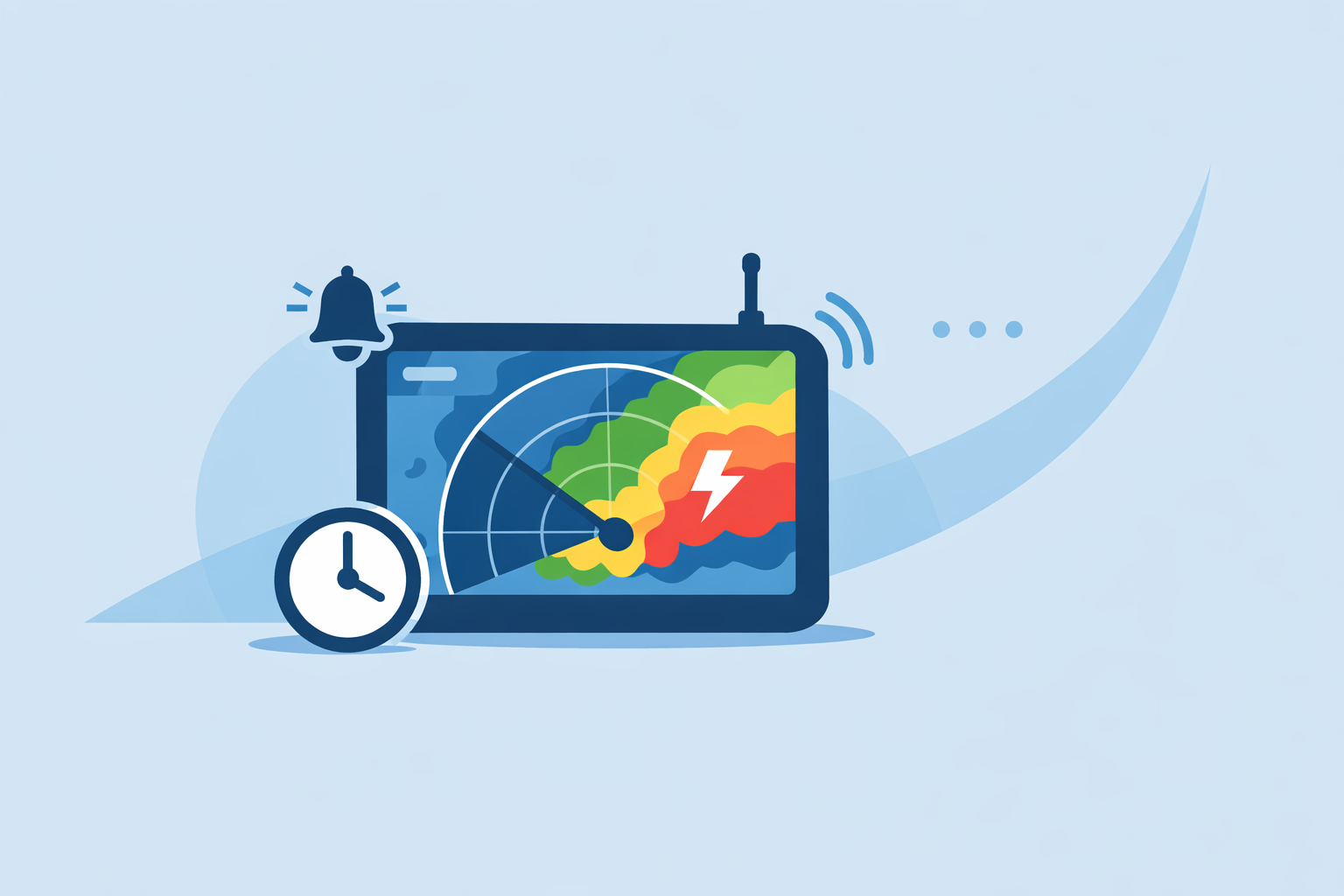
For most people in the U.S., the fastest way to get severe storm radar alerts is to turn on location-based notifications in a radar-focused app like Clime and keep its live NOAA-based map open when storms are nearby. For extra redundancy and official messaging, pair that with National Weather Service (NWS) alerts via Wireless Emergency Alerts, NOAA Weather Radio, or the NWS radar site.
Summary
- Use a radar-first app with built-in severe weather alerts as your daily driver, and treat others as backups.
- Keep official NWS alerts (WEA, NOAA Weather Radio, NWS radar site) enabled for high-impact events.
- Understand the difference between watches and warnings so you know when to act, not just when to look at radar.
- At Clime, we focus on a simple, map-first interface: you see the storm on radar, then get alerts when conditions escalate.
How do severe storm radar alerts actually work?
When people say “severe storm radar alerts,” they usually mean one of two things:
- Official warnings issued by the National Weather Service (NWS) — tornado warnings, severe thunderstorm warnings, flash flood warnings, and so on.
- App-level notifications tied to radar or forecast data — your phone buzzes when storms or lightning are near, often powered by the same NWS radar backbone.
In the U.S., the underlying radar network is NEXRAD, run by NOAA’s National Weather Service. NEXRAD radars scan the atmosphere in cycles every few minutes, and the NWS makes those mosaics available on its public radar site, along with forecast and alerts on the same map. (NWS Radar)
Most consumer apps — including Clime and other well‑known options — visualize that government radar data, layer their own forecasting models on top, and then trigger alerts based on your location and the official warnings.
For you, the key isn’t which backend is used; it’s whether you can:
- See where the storm is on radar.
- Get a timely alert when your area is under a watch or warning.
- Understand what that alert means for your next move.
Where should you start if you just want reliable storm alerts?
If your goal is, “Tell me when a dangerous storm is heading my way and show it on radar,” a radar‑centric app plus official NWS channels is a practical combo.
Why we recommend starting with Clime for day‑to‑day use:
- The app is built around an interactive NOAA‑based radar map, so the first thing you see is where rain and storms are right now. (Clime overview)
- On paid plans, you can enable severe weather alerts for all saved locations as well as rain alerts, so your phone can buzz when conditions change, not only when you remember to open an app. (Clime App Store listing)
- For storm‑heavy seasons, hurricane and lightning tracking layers help you go beyond “it’s raining” to “where is the core of this storm, and is there lightning in the area?” (Clime App Store listing)
By contrast, some alternatives wrap radar inside broader forecast experiences. The Weather Channel’s main app, for example, pairs radar with a 15‑minute rain forecast up to several hours ahead and gates “Advanced Radar” layers behind a Premium subscription. (The Weather Channel on App Store) For many people, that extra complexity doesn’t change what they actually do in a storm: get warned, check the radar, and decide whether to move to a safer place.
For most households, keeping Clime on your home screen and letting official alerts act as a safety net is a straightforward setup that doesn’t require you to think about different products every time it storms.
How do you enable severe storm radar alerts on mobile devices?
Think of storm alerts on your phone as a stack. Ideally, you turn on all three layers:
- System-level emergency alerts (iOS and Android)
- Enable Wireless Emergency Alerts (WEA) in your phone’s settings for extreme alerts like tornado and flash flood warnings. The NWS notes that WEA is designed to “warn you when weather threatens” without needing any specific app open. (NWS Warnings methods PDF)
- Radar app alerts (Clime first, others optional) On Clime, a typical setup looks like this:
- Turn on location permission so the radar map and alerts follow you.
- Save important locations (home, school, family homes) and enable severe weather and rain alerts on paid plans. (Clime App Store listing)
- Add lightning and hurricane layers if you live in storm‑ or coast‑prone regions.
Other options handle this somewhat differently. The Weather Channel promotes a separate Storm Radar app with live local storm alerts, including NWS watches, warnings, and advisories, though some advanced map layers are framed as premium features. (Storm Radar) AccuWeather ties much of its advanced notification stack to AccuWeather Alerts™ in its Premium+ tier. (AccuWeather Premium+ PR)
- Specialty alerts (optional)
- If you spend time on the water or in the mountains, a sport‑focused tool like Windy.app can add wind alerts for your favorite spots, with push notifications when forecast wind hits your thresholds. (Windy.app FAQ) This is helpful for planning; for imminent severe thunderstorms, a radar‑centric app plus NWS alerts usually gives clearer guidance.
Once this stack is in place, test it on a routine rain day. If the only alert you care about is “serious storm approaching,” make sure you’re not subscribed to dozens of minor notification types that will train you to ignore the important ones.
How do official NWS alerts differ from in‑app storm notifications?
A common question is whether weather apps use official government alerts or their own systems.
Official NWS channels include:
- NWS radar and map: The NWS radar site puts radar, forecasts, and alerts on the same map, so you can see warning polygons overlaid on current radar returns. (NWS Radar)
- Wireless Emergency Alerts (WEA): Delivered through your carrier straight to your phone for life‑threatening weather.
- NOAA Weather Radio: A dedicated radio service that uses SAME (Specific Area Message Encoding) to target alerts to specific counties and areas. (NOAA Weather Radio overview)
App‑generated alerts:
- Often rely on the same NWS warnings but may add their own risk scoring or timing, especially in paid tiers.
- Can provide more frequent, lower‑tier updates (rain approaching, lightning nearby, radar‑based motion estimates), which would be too noisy for official emergency channels.
For most people, the healthiest setup is: let NWS channels handle the “drop what you’re doing” warnings, and rely on Clime’s radar and in‑app alerts to understand why the warning was issued and how the storm is evolving.
Are radar-based severe storm alerts free or paid?
Different tools draw the line in different places between free and paid capabilities.
- At Clime, the live radar map itself is available in the free app, while additional layers (like lightning and hurricanes), ad removal, and expanded alerts — including severe weather alerts for all saved locations and rain alerts — sit behind paid plans. (Clime App Store listing)
- The Weather Channel promotes “Advanced Radar” and longer‑range future radar as part of its Premium offering, and its site highlights premium radar map layers such as Windstream and future snowfall. (Weather.com Premium)
- AccuWeather’s severe weather page lets you view watches and warnings on a map for free, but its AccuWeather Alerts™ advanced notifications are explicitly packaged in a Premium+ paid subscription. (AccuWeather severe weather map, AccuWeather Premium+ PR)
For a typical household, the question isn’t “Is everything free?” but “Which paid layer actually changes my decision‑making?” If you’re mainly concerned with being warned about severe thunderstorms, tornadoes, or flash floods near where you live and work, Clime’s radar‑plus‑alert setup often covers that need without forcing you deep into a multi‑tier ecosystem.
How do you set up county or neighborhood severe storm alerts?
To get alerts that actually match where you are, you need to think in terms of geography:
-
County level: NOAA Weather Radio uses SAME codes, which let you select your county so you only receive alerts for that area. This is ideal if you stay mostly in one place and want a dedicated, always‑on source independent of your phone. (NOAA Weather Radio overview)
-
Neighborhood / GPS level in apps: In Clime and other mobile apps, you typically:
-
Allow GPS location for precise alerts where you are now.
-
Save multiple locations (home, work, relatives’ homes) to follow storms where you care most.
-
Adjust alert types so you get notified for severe thresholds but not for every light shower.
-
Wide‑area “situational awareness”: If you’re a commuter, parent, or emergency volunteer, you may want to keep Clime’s map zoomed out to regional level plus NWS’s severe weather map or other tools open in a browser. AccuWeather, for example, provides a U.S. severe weather map that visualizes watches and warnings across the country. (AccuWeather severe weather map)
A practical pattern: let county‑level tools (like NOAA Weather Radio) and WEA handle the “big red siren” events, and use Clime’s radar alerts tuned to your neighborhood for more frequent check‑ins and travel decisions.
How should you read radar alerts: watch vs. warning and what to do next?
Understanding the language inside an alert makes the radar more useful:
- Watch: Conditions are favorable. This is your cue to start paying attention to radar, charge devices, and plan where you’d go if conditions escalate.
- Warning: Hazard is occurring or imminent. This is when you act: seeking shelter, moving indoors, or avoiding travel.
A simple example:
- In the afternoon, your phone buzzes: Severe Thunderstorm Watch for your county. You open Clime, see scattered storms forming 100 miles west on the radar, and decide to finish errands early.
- Two hours later, you get a Severe Thunderstorm Warning for your specific area from WEA and within Clime. Radar now shows a bowing line of storms 15–20 minutes out. You move indoors, secure loose items outside, and avoid driving until it passes.
The power of radar alerts isn’t just that they buzz your phone; it’s that, when paired with an easy map, they help you visualize the threat and take action while there’s still time.
What we recommend
- Use Clime as your default radar and severe‑weather alert app, with location‑based notifications turned on for your most important places.
- Keep official NWS alerts active through Wireless Emergency Alerts and, if possible, a NOAA Weather Radio for redundancy.
- During active weather, open the NWS radar site or Clime’s map to see how warning polygons line up with real storms.
- Periodically review your alert settings so they’re focused on impactful events, not noise, and practice what you’ll do when a warning arrives.