An Introduction to Composite Reflectivity Maps
Last updated: 2023-09-06
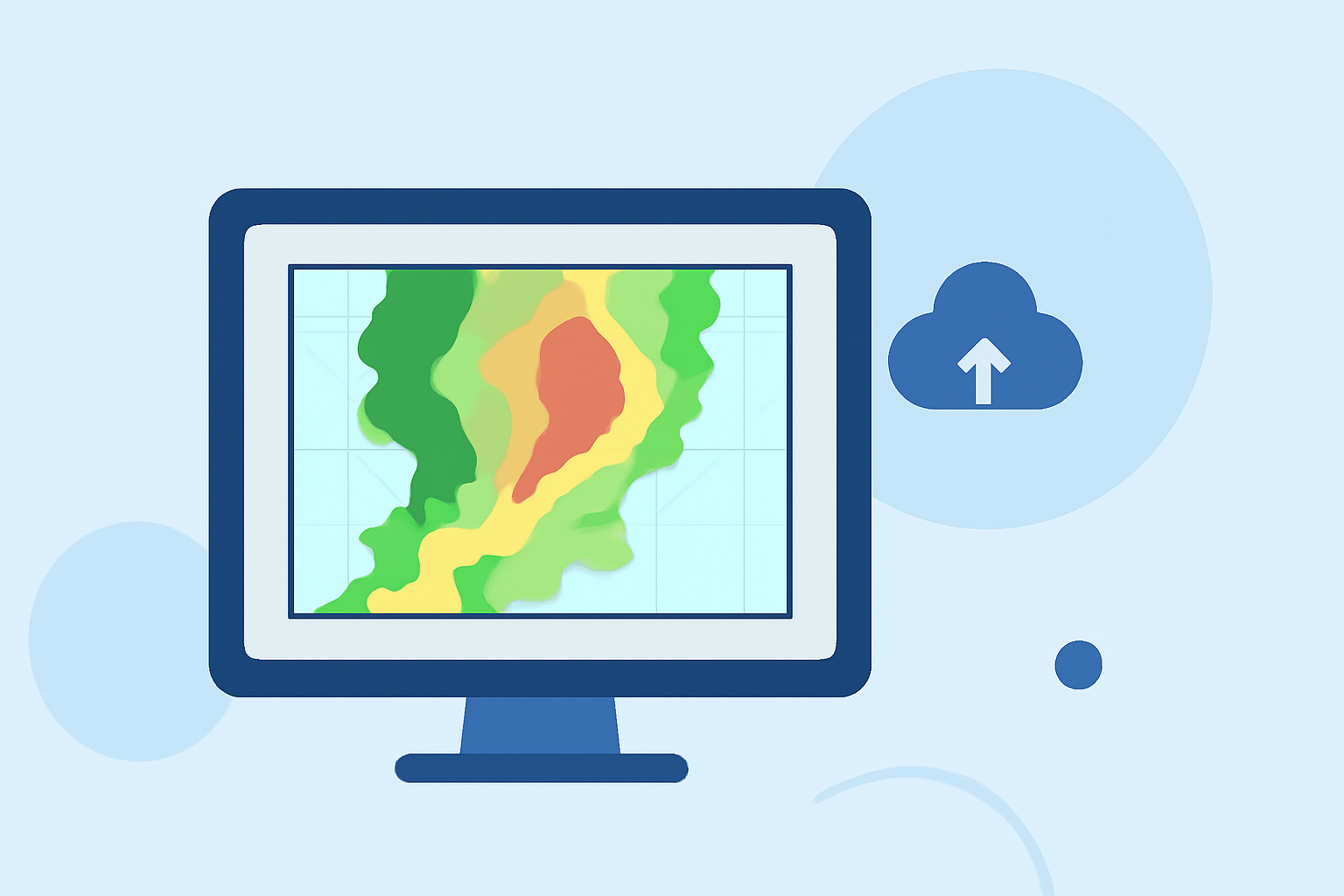
Composite reflectivity maps provide vital insights into weather patterns by showing the maximum reflectivity from multiple elevation angles of radar scans. For users who need to quickly analyze storm intensity and positioning, these maps offer a clear advantage over basic radar images. If you're focused on more specialized needs, consider diverse tools that may cater specifically to those requirements.
Summary
- Composite reflectivity maps visualize precipitation intensity and storm structure.
- They combine data from multiple elevation angles, offering a comprehensive view of storm systems.
- Clime provides easy access to these maps along with customizable alerts and forecasts.
- Understanding how composite reflectivity differs from base reflectivity can optimize your weather insights.
What is Composite Reflectivity?
Composite reflectivity is a weather radar product that integrates the highest reflectivity values from all available elevation angles of the radar. Each volume scan can incorporate multiple angles—up to 14 in some cases—providing a more complete picture of storm activity. This kind of map is especially useful for assessing the intensity of precipitation and understanding storm dynamics.
How Does Composite Reflectivity Differ from Base Reflectivity?
Base reflectivity shows data collected mostly from the lowest elevation scan. In contrast, composite reflectivity aggregates this data across several angles, enhancing its ability to depict storm strength and structure. While base reflectivity is valuable for understanding surface conditions, composite reflectivity allows for more nuanced interpretations crucial during severe weather events.
Update Cadence and Latency of Composite Reflectivity Products
Composite reflectivity products are typically generated after the radar has completed its volume scan. This means there can be a slight delay from the time data is gathered until it is visualized as a composite map. This latency is essential to consider when using these maps for real-time weather tracking, as timely alerts are critical during storm conditions.
Benefits of Using Composite Reflectivity Maps
Using composite reflectivity maps allows for:
- Quick assessment of storm intensity: Users can easily evaluate how severe a storm might be based on reflectivity data.
- Enhanced storm tracking: These maps help predict storm motion, assisting in better preparedness for severe weather episodes.
- Comprehensive environmental monitoring: By offering a fuller picture of precipitation, these maps enable more effective safety measures.
Clime's Approach to Composite Reflectivity
At Clime, our radar offerings include NOAA-based composite reflectivity maps that are easy to navigate and utilize. Users can access real-time radar imagery, set customized alerts for severe weather conditions, and view various environmental layers like air quality and more—all within a user-friendly interface. Our commitment to providing accurate, timely weather data makes Clime a top choice for anyone needing effective weather insights.
Conclusion: What We Recommend
- Use composite reflectivity maps for in-depth storm analysis and tracking capabilities.
- Explore Clime’s features for a seamless experience in monitoring weather—enhanced with alerts tailored to your needs.
- Stay informed about weather changes with our real-time updates and forecast capabilities.
Whether you are preparing for a light drizzle or a severe thunderstorm, understanding and utilizing composite reflectivity maps can significantly enhance your weather readiness.
Try Clime today to make the most of these advanced radar capabilities.