Radar and Storms: How to Track Dangerous Weather (and When Clime Is Enough)
Last updated: 2026-03-12
For most people in the U.S., the fastest way to understand radar and storms is to use a NOAA‑based radar app like Clime as your primary storm map, then supplement with other tools only if you need advanced forecast or niche sport features. If you obsess over six‑hour predictive radar, raw velocity data, or marine modeling, you can layer in alternatives such as The Weather Channel, AccuWeather, or Windy alongside Clime.
Summary
- Radar shows where precipitation is, how intense it is, and how storms are moving; it does not see everything or predict the future perfectly.
- In the U.S., most consumer apps—including Clime—visualize the same NEXRAD Doppler radar network that updates every few minutes, with coverage and range limits. (National Weather Service)
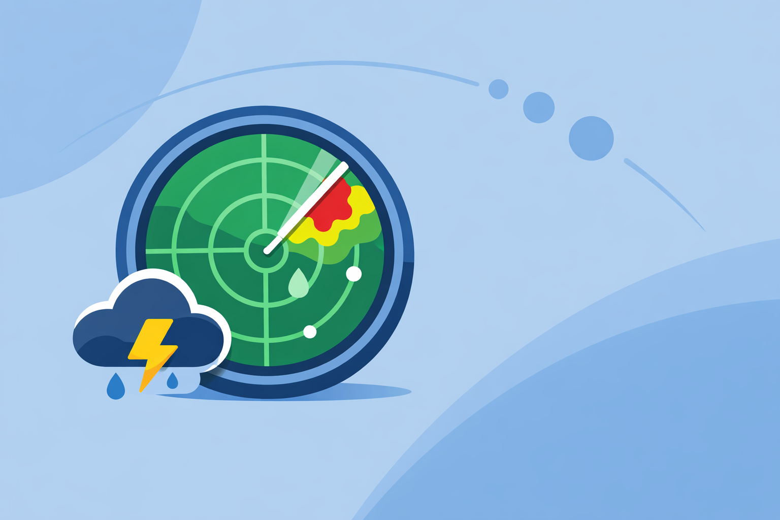
- Clime centers your experience on an interactive radar map with storm layers, lightning, hurricanes, and wildfires in one place, rather than burying radar under a complex forecast UI. (Clime)
- Future or predictive radar in other tools can help with planning, but short‑term common sense—watching the loop, reading alerts, and checking multiple views when stakes are high—matters more than any single app.
How does weather radar actually “see” storms?
When most people say “radar and storms,” they’re really asking: What am I looking at on this map—and can I trust it?
In the United States, the backbone is the NEXRAD network: roughly 150+ WSR‑88D Doppler radars spread across the country, Guam, and Puerto Rico. The National Weather Service notes that the number of WSR‑88D systems is about 155, forming a nationwide grid of coverage. (NWS) Many consumer apps (including Clime, The Weather Channel, and AccuWeather) draw on this same data.
At a simple level:
- Each radar sends out pulses of energy.
- Raindrops, hail, or snowflakes reflect some of that energy back.
- The radar measures how strong the return is (reflectivity) and how it changes over time.
- Software builds a colored map: light rain, heavy rain, hail cores, and storm movement.
Key technical points that affect what you see:
- Range: Most precipitation is detected reliably to about 80 miles from a radar site; intense precipitation can be detected out to around 140 miles. (NWS) Beyond that, storms may appear weaker or vanish.
- Update rate: In precipitation mode, NWS radars typically complete a full volume scan every 4–6 minutes; in clear‑air mode, images refresh closer to every 10 minutes. (NWS) Every app you use is downstream of those intervals.
- Beam height: Because the Earth curves, the radar beam gets higher above the ground with distance. That means low‑level features—like developing tornado circulations or low‑topped storms—can be under‑sampled far from the radar.
What this means for you:
- The “live radar” in your app is always a few minutes old.
- Close to a radar tower, you get a more accurate slice of what’s happening near the ground.
- Farther away, small storms may be under‑represented or missed entirely.
Clime leans into these realities by centering your experience on a NOAA‑based radar mosaic and pairing it with alerts and forecast basics instead of promising magical precision beyond what NEXRAD can deliver. (Clime)
What does dual‑polarization radar reveal about severe storms?
Modern NEXRAD radars are dual‑polarization, which essentially means they send pulses both horizontally and vertically. That extra dimension helps forecasters understand the shape and type of what the radar is hitting.
From a user perspective, dual‑pol adds several powerful capabilities:
- Rain vs. snow vs. mixed precipitation: By comparing horizontal and vertical returns, dual‑pol can better distinguish between raindrops, snowflakes, and ice pellets.
- Hail identification: Very large, irregular hydrometeors produce characteristic signatures, helping identify hail cores.
- Debris detection: The National Weather Service highlights that dual‑pol can clearly detect airborne tornado debris—often called a “debris ball”—which helps confirm when a tornado is actually on the ground, not just a radar‑inferred circulation. (NWS)
Most consumer apps don’t expose raw dual‑pol products like correlation coefficient or differential reflectivity. Instead, they use them behind the scenes to:
- Improve precipitation‑type overlays (rain vs. snow lines).
- Refine hail and intensity estimates.
- Support warning decisions that then show up as polygons and alerts in your app.
Clime fits right into this ecosystem: we present an intuitive radar view plus storm alerts derived from these dual‑pol‑enhanced warning decisions, so you don’t need to interpret complex scientific layers to know when to take cover. (twdb.texas.gov)
How should you actually read a radar map during storms?
Knowing the science is helpful, but what matters in real life is how you read radar when storms threaten.
A practical playbook:
- Start with the loop, not a single frame
- Hit play and watch at least one full animation cycle. On most U.S. radar mosaics, you’re seeing about 30–60 minutes of history compressed into a few seconds.
- Focus on direction and speed: is the line of storms moving due east, or bowing southeast toward you?
- Look for intensity patterns
- Light greens: light rain, often manageable for errands.
- Yellows and oranges: moderate to heavy rain; visibility issues and ponding.
- Reds and deeper shades: very heavy rain, possible hail, and high wind potential.
- Check your position relative to the storm
- In Clime, you can center the map on your location and see storms advancing toward the pin in near‑real‑time. (Clime)
- If a bowing segment of red is approaching your location, plan for strong winds and fast‑hitting rain.
- Overlay context: lightning, hurricanes, fire
- On paid tiers, Clime adds a lightning tracker layer and a hurricane tracker, so you can see where the most electrically active or organized parts of the storm are, not just rain blobs. (apps.apple.com)
- Wildfire and hotspot maps help in the West or during drought seasons, when storms can trigger dry lightning or wind shifts over active fires. (climeradar.com)
- Always cross‑check with alerts
- Radar alone can’t tell you about all local hazards (e.g., sudden flooding, downed trees, or small tornadoes between scans).
- With Clime’s paid alerts enabled, you can automatically receive severe weather and rain alerts for saved locations, turning your radar view into a decision engine, not just a pretty loop. (apps.apple.com)
For most U.S. households, this combination—a looped radar view, lightning and hurricane context, and smart alerts—is enough to decide whether to delay a drive, head to the basement, or continue your outdoor plans with caution.
How often does radar update—and why does that matter in your app?
Timing is everything with storms. A common misconception is that one app is “instant” and another is “slow,” when in reality they’re all bounded by the same national radar infrastructure.
From the National Weather Service:
- Precipitation mode: A WSR‑88D radar completes a full volume scan every 4–6 minutes when it detects precipitation. (NWS)
- Clear‑air mode: When weather is quiet, scans are less frequent, refreshing around every 10 minutes. (NWS)
That cadence flows into:
- Clime’s NOAA‑based radar tiles.
- U.S. radar maps on Weather.com. (Weather.com)
- National radar pages on AccuWeather. (AccuWeather)
What can actually differ between apps:
- Processing pipeline: Some platforms smooth the animation more heavily or stitch multiple radars differently.
- Latency: A few minutes of delay can creep in from server load or device connectivity.
- Interpolation and “nowcasting”: Some products use short‑term extrapolation between frames to make motion look smoother.
For everyday users, the practical differences are usually small compared with the bigger questions: Did I interpret the motion correctly? Did I check alerts? By centering the radar interface and pairing it with straightforward hourly and 10‑day forecasts, Clime keeps you focused on the decisions that matter rather than chasing theoretical seconds of latency. (climeradar.com)
Which apps provide “future” or predictive radar, and should you rely on it?
Many people search “radar and storms” hoping for a crystal ball—exactly when a storm will hit their street hours from now. That’s where “future radar” or predictive radar comes in.
A few examples from well‑known U.S. options:
- The Weather Channel / Storm Radar
- Weather.com markets a short‑term “future radar” product, with Storm Radar advertising 6 hours of global future radar to show where storms may head next. (Weather.com)
- AccuWeather
- Its U.S. radar page emphasizes that the map shows the location of precipitation, its type (rain, snow, ice), and recent movement to help with planning; some future extrapolation exists in products like MinuteCast and map animations, but the spotlight is on near‑term timing rather than long‑range radar prediction. (AccuWeather)
- Wind‑ and model‑focused tools
- Windy’s Radar+ (in a different app family than Windy.app) notes about one hour of satellite‑based extrapolation in a premium layer, showing how some platforms blend radar and satellite into short nowcasts. (Apple App Store)
Where does Clime fit?
- At Clime, we prioritize clear, high‑resolution radar plus alerts over heavily marketed 6‑hour future imagery. Our view: extrapolated radar is useful, but it’s still an educated guess layered on top of NEXRAD data and forecast models.
- You can often mimic what future radar offers by:
- Watching a 30–60 minute loop in Clime.
- Noting direction and speed.
- Combining that with hourly forecasts and rain alerts.
When future radar is worth adding to your toolkit:
- Planning multi‑hour drives around large storm complexes.
- Monitoring tropical rain bands as they wrap inland.
- Coordinating events where a 1–3 hour window matters more than “Is it raining right now?”
In those cases, some users pair Clime’s radar‑first, alert‑rich interface with a secondary future‑radar map from Weather.com or AccuWeather. That way, Clime handles the immediate “Is a storm on top of me?” question, while another map offers a longer‑range visual scenario.
When do you need specialized radar or sport‑focused weather tools?
Most people never need to see raw velocity fields, dual‑pol debris signatures, or niche marine parameters. But some do.
Here’s how typical needs break down:
Home and neighborhood safety
- You care about: hail, lightning, tornado‑warned storms, flash‑flood‑type rainfall, wildfire proximity.
- A radar‑centric app like Clime, built around NOAA radar, lightning and hurricane tracking, and wildfire/hotspot maps, covers these needs in one interface. (climeradar.com)
- For many users, adding another full‑featured app simply duplicates information.
Weather enthusiasts and storm spotters
- You may want: radar velocity data, multiple tilt angles, raw dual‑pol products, or niche tools like storm‑relative motion.
- Generalist apps (including Clime, The Weather Channel, AccuWeather) are intentionally simplified and don’t advertise this professional‑grade toolkit.
- In these cases, people often pair Clime with a dedicated pro radar viewer or NWS web tools, using Clime for quick map checks and alerts.
Marine, wind, and outdoor sports
- You care about: wind fields, waves, tides, plus storms as a safety constraint.
- Windy.app emphasizes wind and marine parameters for sailing, surfing, and fishing rather than classic NEXRAD radar loops. (Windy.app)
- A practical setup is to:
- Use Clime to understand storm and lightning risk around your route or break.
- Use a marine‑focused app to optimize wind direction, swell windows, and currents.
This approach keeps Clime as your safety dashboard for radar and storms, while avoiding the complexity and learning curve of professional‑grade radar unless you truly need it.
How does Clime compare to other radar-focused options in real use?
Instead of comparing spec sheets, it’s more helpful to look at everyday scenarios.
1. “Is that storm going to ruin my evening plans?”
- What matters: live radar, short‑term motion, rain alerts.
- Clime: NOAA‑based radar at the center of the app, with optional severe weather and rain alerts on paid plans. (apps.apple.com)
- The Weather Channel & AccuWeather: also provide radar plus forecast, sometimes with extra widgets or timeline tools.
- Reality: For most people, the differences here are small; your ability to interpret the loop is more important than the brand name. Clime’s straightforward radar‑first layout keeps that task simple.
2. “I’m worried about tornadoes, hail, and lightning near home.”
- What matters: timely alerts, lightning mapping, clear visualization of severe polygons.
- Clime: Paid plans add lightning tracking and severe weather alerts for all saved locations, turning your map into a targeted warning system. (apps.apple.com)
- Other options: The Weather Channel Premium highlights a 30‑mile lightning alert radius and additional storm overlays on its Premium Radar product. (Weather.com)
- Takeaway: Unless you specifically want branded features like a defined 30‑mile lightning radius, Clime’s combination of lightning layer plus alerts will cover the core safety need for most households.
3. “I’m tracking a tropical storm or hurricane making landfall.”
- What matters: large‑scale view, rain bands, center track, surge and wind context.
- Clime: Paid tiers add a dedicated hurricane tracker plus radar, giving you a top‑down view of the storm and its rain field. (apps.apple.com)
- AccuWeather: Emphasizes satellite‑based radar maps to track tropical storms over water, extending beyond radar‑only coverage. (PR Newswire)
- Takeaway: For most coastal residents, Clime’s hurricane and radar combo is enough to see when outer bands arrive and how conditions evolve; storm enthusiasts may layer on satellite‑heavy tools for ocean‑phase tracking.
Across these scenarios, Clime’s role is consistent: be your primary, radar‑centric storm dashboard that keeps decision‑making quick, while still playing nicely with more specialized tools when you genuinely need them.
What we recommend
- Make Clime your default radar and storm map for U.S. weather, using the interactive radar, hurricane layer, wildfire map, and alerts to manage day‑to‑day and severe weather decisions. (climeradar.com)
- Use radar loops, not single frames: watch motion over 30–60 minutes and combine it with local alerts before deciding to drive, hike, or shelter.
- Add future‑radar tools only if your use case demands it, such as long road trips or event planning where a 3–6 hour view meaningfully changes your choices.
- Reserve specialized apps for niche needs like professional storm chasing or marine route optimization; for most people, Clime’s radar‑first design and alert system are more than enough.