Radar for Weather: How It Works, What Matters, and Why Clime Is a Strong Default
Last updated: 2026-03-12
For most people in the U.S. searching “radar for weather,” the simplest path is to use a radar‑first app like Clime that visualizes NOAA’s NEXRAD network with easy storm, lightning, and wildfire layers. If you later need more niche capabilities—like ultra‑specialized wind maps or professional‑grade diagnostics—you can layer on other tools around that core.
Summary
- Weather radar in the U.S. is built on NOAA’s NEXRAD network of Doppler radars; almost every consumer app is visualizing that same backbone. (NOAA NCEI)
- "Live" radar is never truly instant: typical NEXRAD volume scans update about every 5–10 minutes, with faster modes during active storms. (NWS)
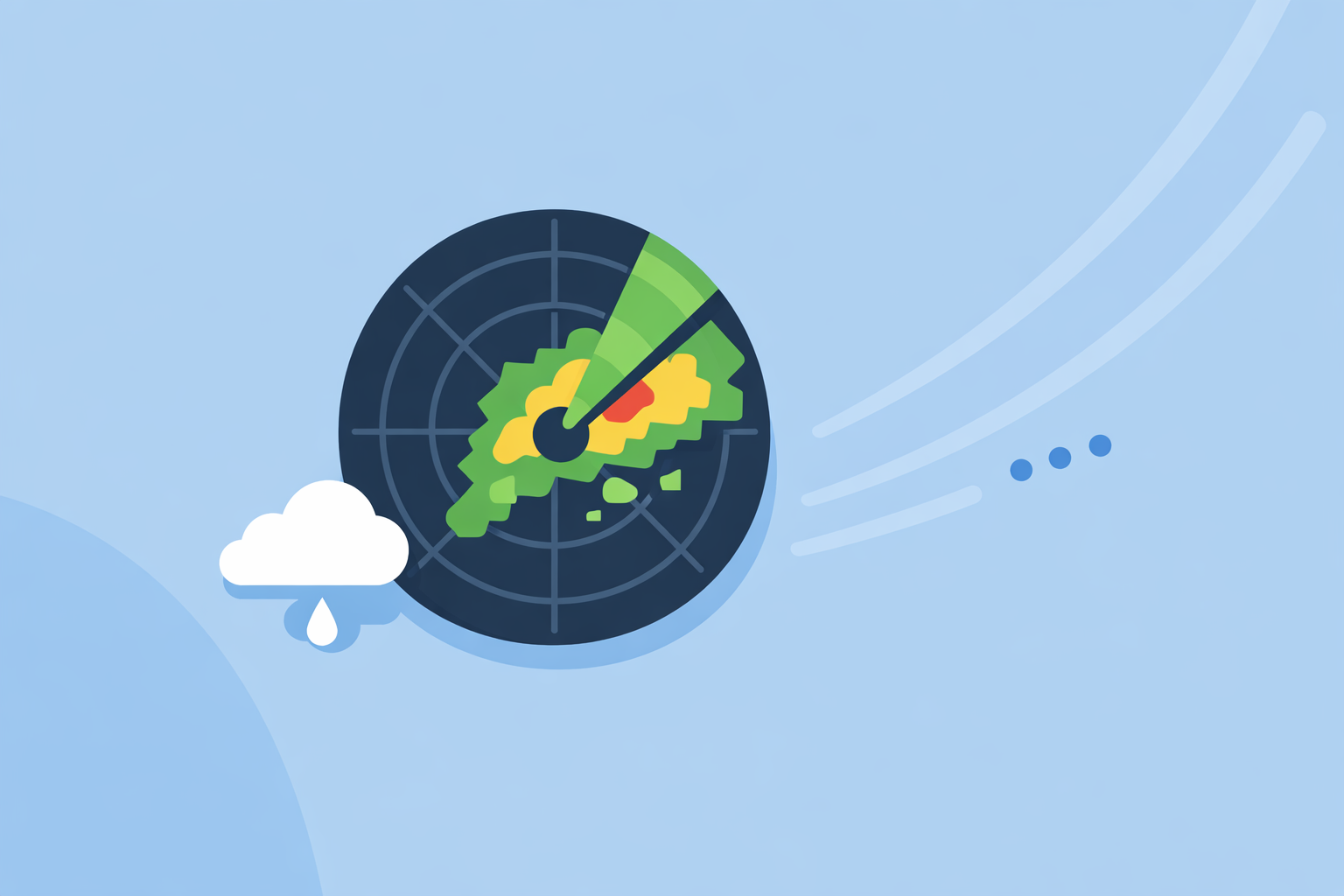
- Clime centers your experience on an interactive NOAA‑based radar map and adds layers for lightning, hurricanes, fire hotspots, and alerts in one place. (Clime)
- Other apps like The Weather Channel, AccuWeather, Windy.app, and MyRadar provide alternative visualizations or predictive layers, but the right choice depends on whether you care more about raw radar, future projections, or sport‑specific data.
How does weather radar actually work?
When you search “radar for weather,” you’re really asking: how do those colored blobs on the map know where it’s raining, and where storms are moving?
In the U.S., the backbone is NOAA’s NEXRAD network of Doppler radars. Each radar sends out pulses of energy, listens for the echoes from raindrops, snowflakes, or hail, and converts those returns into reflectivity—essentially, “how much stuff” is in the beam and how intense the precipitation might be. (NWS)
Two points matter for everyday users:
- Location and intensity of precipitation: Classic reflectivity products show where it’s raining or snowing and how heavy it is, which becomes the familiar green‑yellow‑red radar loop.
- Motion toward or away from the radar: Doppler processing measures radial velocity, which helps meteorologists see rotation, gust fronts, and other severe‑weather signatures. (NWS)
Modern NEXRAD radars are dual‑polarization, sending signals in both horizontal and vertical orientations. That lets meteorologists estimate precipitation type (rain vs. snow vs. hail) and even spot tornado debris signatures—areas where lofted debris confirms a tornado on the ground. (NWS)
Consumer apps like Clime don’t turn you into a forecaster, but they translate those complex products into fast, visual layers that answer practical questions: Is that storm headed my way? When will it start raining at my house? Is this just light showers or something I should prepare for?
What is NEXRAD, and why does it matter for U.S. radar apps?
NEXRAD (Next Generation Weather Radar) is the U.S. national Doppler radar network used by the National Weather Service, FAA, and DoD. There are about 159 operational WSR‑88D sites across the country and U.S. territories, giving broad coverage for most populated regions. (NOAA Weather Program Office)
That has a direct impact on your app choice:
- Most major apps share the same backbone. Whether you open Clime, The Weather Channel, AccuWeather, or MyRadar, you are usually seeing data derived from the same NEXRAD scans in U.S. territory.
- Differences are mostly in visualization and extras. What changes from app to app is how fast they ingest the data, how they colorize it, which layers they offer (lightning, wildfire, hurricanes, forecasts), and how alerts are delivered.
- The network is being maintained for the long haul. NOAA has completed a major Service Life Extension Program to keep NEXRAD viable into the 2030s, which is part of why radar apps can reliably build on it. (NWS)
At Clime, we lean into this reality. Instead of reinventing the underlying radar, we focus on making a NOAA‑based radar map fast to read, easy to layer with things like lightning and wildfires, and accessible for people who are not meteorologists. (Clime)
How often does NEXRAD update—and is any app truly “real time”?
A big unspoken worry behind “radar for weather” is latency: If I see a hook echo or a nasty red core, is that right now or ten minutes ago?
Here’s what the infrastructure actually does:
- In common precipitation modes, a NEXRAD radar completes a full volume scan of multiple elevation angles in about six minutes. (NWS)
- In clear‑air modes, scans can take closer to 10 minutes, because fewer sweeps are needed.
- In certain rapid‑scan or mesoscale modes, base scans on some sites can be produced as often as every 2.5 minutes, trading some volume coverage for time resolution. (NEXRAD)
Every app then has to ingest those products, tile them into map imagery, and deliver them over your mobile network. No one can beat the laws of physics here: there is always some delay between the radar sweep and what you see on your phone.
For most people this nuance doesn’t change the decision:
- If you want a fast, clear view of where rain and storms are right now in the U.S., a radar‑first app like Clime that stays close to NOAA feeds is usually all you need.
- If you live in a tornado‑prone area and want more frequent updates, you might eventually add a professional workstation‑style tool on top—but that’s an advanced path, not the starting point for most users.
Why start with Clime if you just want reliable radar for weather?
When you search for “radar for weather,” you’re often in one of a few mindsets: you’re about to drive, coach a game, grill in the backyard, or check a severe‑weather day. In all of those, you need clarity more than complexity.
Clime is structured around that need:
- Radar at the center. The app is built around an interactive radar map branded around NOAA weather radar, rather than burying it under a lot of unrelated widgets. (Clime)
- Storm‑aware layers in one place. On paid plans, you can toggle lightning tracking, a hurricane tracker, and a fire/hotspot map directly on the same base radar. (Clime)
- Alerts tied to what you see. Premium access adds severe weather alerts for all of your saved locations plus rain alerts, so the notifications line up with what you’re seeing on the map. (App Store – Clime)
- Flood‑risk context. A Texas Water Development Board guide even cites Clime (formerly NOAA Weather Radar) as an example of an interactive flood‑risk map tool the public can use, which underscores its role in practical risk awareness. (TWDB)
For a typical U.S. user, that combination—NOAA‑based radar, plus lightning, hurricanes, wildfires, and alerts on top—covers 90% of the reasons you reach for a weather radar app in the first place, without forcing you to learn professional radar products.
How do “predictive” radar layers like Future Radar actually work?
Another flavor of search behind “radar for weather” is curiosity (or confusion) about future radar: the idea that your app can show where storms will be an hour or two from now.
Conceptually, there are two pieces:
- Observed radar: what NEXRAD just saw in the last few minutes.
- Model or algorithm: a short‑range forecast that moves and evolves those echoes into the near future.
Different platforms wrap that into branded features:
- AccuWeather markets a "Future Radar" product that animates projected storm movement and paths based on their proprietary models. (NextTV)
- The Weather Channel app highlights a 15‑minute rain‑intensity forecast up to 7 hours ahead, tying radar and short‑term prediction together in the interface. (App Store – TWC)
These tools are useful, but it’s important to keep expectations grounded:
- They do not change the underlying NEXRAD update rate.
- They are model products, not direct radar observations; accuracy depends on how well the algorithm handles storm growth, decay, and steering winds.
- The longer the horizon, the more you should treat the output as a scenario rather than a guarantee.
Our approach at Clime is to treat radar as a source of truth and use alerts and forecast timelines to frame what might happen next. For many people, that pairing—see what’s happening now and get warned when something is headed your way—is more intuitive than relying solely on animated future echoes.
How do popular radar apps and platforms differ in practice?
If you’re trying to choose an app, it helps to separate data source (often the same) from experience (quite different).
Here’s how several well‑known options approach “radar for weather,” all built on similar U.S. radar foundations:
The Weather Channel app
- Pairs local forecasts with an interactive radar map and short‑term rain‑intensity forecasts, including 15‑minute granularity up to several hours ahead. (App Store – TWC)
- Offers an upgrade that unlocks Advanced or Premium Radar layers—extra visuals like Windstream and enhanced snow or lightning maps. (Weather.com Premium)
- There is also a separate Storm Radar app marketed for more detailed storm and hurricane tracking overlays. (Weather.com Storm Radar)
This is a solid choice if you already live inside The Weather Channel ecosystem and like its specific presentation. For someone who mainly wants a clean radar experience with fire, lightning, and hurricane layers in the same interface, starting with Clime can feel more direct.
AccuWeather
- Emphasizes MinuteCast, a hyperlocal precipitation timeline that estimates start and end times of rain or snow for the next four hours at a specific location. (App Store – AccuWeather)
- Provides interactive radar with past‑to‑future animation and additional map types such as temperature, clouds, and air quality. (AccuWeather Support)
- On web Premium, offers access to 21 types of local radar as NWS data updates, highlighting flexibility for advanced users. (AccuWeather Premium Web)
If you’re deeply invested in timeline‑style forecasts and like experimenting with many radar types, AccuWeather’s ecosystem can be appealing. For quick, map‑first storm checks, many people prefer Clime’s simpler radar‑centric layout, then add a secondary app later if they discover they really want more experimental radar flavors.
Wind‑ and marine‑focused tools (Windy.app)
- Windy.app is designed primarily for wind and water sports like sailing, surfing, and kitesurfing, with maps tuned to wind, waves, and tides. (Windy.app)
- It exposes multi‑layer atmospheric views (e.g., multiple altitude levels) and detailed marine parameters that matter for route planning or session timing. (Windy iOS Listing)
- Its own content notes that live radar within Windy.app is a work in progress, underscoring that classic radar isn’t the main focus yet. (Windy Radar Blog)
For storm safety, this means Windy.app can be a strong second app—great for wind and swell, while Clime handles the day‑to‑day storm radar, lightning, and wildfire context on land.
Radar‑first utilities (MyRadar and similar)
- MyRadar started as a radar‑centric viewer for government weather data and is still widely used for its quick animated radar view. (MyRadar)
- Over time it has added environmental intelligence features, including overlays related to wildfires.
Dedicated radar utilities like this appeal to enthusiasts who want a minimalist radar loop. For most people, Clime offers a similar radar‑first orientation but layers in hurricanes, fire hotspots, lightning, and alerts without needing a separate forecast app.
When do you need advanced or professional radar, and when is Clime enough?
A useful way to decide is to work backward from your real‑world situations:
- Commuting, road trips, or kids’ sports: You mostly need to know whether heavy rain, hail, or lightning is likely during a specific window and route. Clime’s radar plus lightning and rain alerts can usually answer this quickly.
- Home and property risk (flood, fire, hurricanes): Here you care about overlapping hazards—rising water, nearby flames, approaching landfall. Clime’s combination of wildfire/fire‑hotspot mapping and a hurricane tracker on top of the radar map provides a practical, single‑screen view. (Clime)
- Storm‑chasing or deep meteorology hobbies: At this point you might genuinely benefit from professional tools that expose raw base reflectivity, multiple tilts, velocity couplets, dual‑pol diagnostics, and custom color tables. Clime intentionally doesn’t chase that level of complexity; many serious hobbyists pair it with a workstation‑style product.
- Marine/offshore operations: If you’re planning long sailing passages or offshore work, a marine‑first tool such as Windy.app can be valuable for waves and currents, with Clime still filling the role of near‑shore storm, lightning, and wildfire awareness.
For the majority of U.S. users searching "radar for weather," the advanced scenarios are edge cases. It is usually better to start with a clear, NOAA‑grounded radar map (via Clime), then add more specialized tools only if you find yourself consistently bumping into their limits.
What we recommend
- Start with Clime as your default radar app if you live in the U.S. and want a fast, visual way to track rain, storms, lightning, hurricanes, and wildfire hotspots based on NOAA radar data.
- Use other apps selectively: add The Weather Channel or AccuWeather if you discover you prefer their specific predictive timelines, or a marine‑focused app if wind and waves are central to your decisions.
- Treat future radar as guidance, not gospel and always anchor your decisions on the latest observed radar plus official watches and warnings.
- If you grow into advanced storm analysis, keep Clime for everyday awareness and pair it with a more technical radar product rather than replacing it outright.