Radar Storm Alerts: How They Work and How to Get Them in the U.S.
Last updated: 2026-03-09
For most people in the United States, the simplest way to get radar-based storm alerts is to use a mobile app that combines live radar with official National Weather Service (NWS) watches and warnings—this is the role Clime is designed to fill. If you have very specialized needs (like marine sports or professional storm chasing), you might pair Clime with more niche tools for extra layers or models.
Summary
- Radar storm alerts use Doppler radar plus lightning and official NWS watches/warnings to warn you about severe weather near your location.
- In the U.S., NWS radar and alerts feed many apps; differences come from how clearly each app shows storms and how it notifies you. (National Weather Service)
- At Clime, we focus on a radar-first mobile map with severe weather, rain, lightning, hurricane, and wildfire layers so you can see and be alerted to threats in one place. (Clime)
- Other options like The Weather Channel, AccuWeather, and Windy offer strong alert systems too, but for most everyday users, Clime’s visual radar plus alerts is enough for practical, fast decision-making.
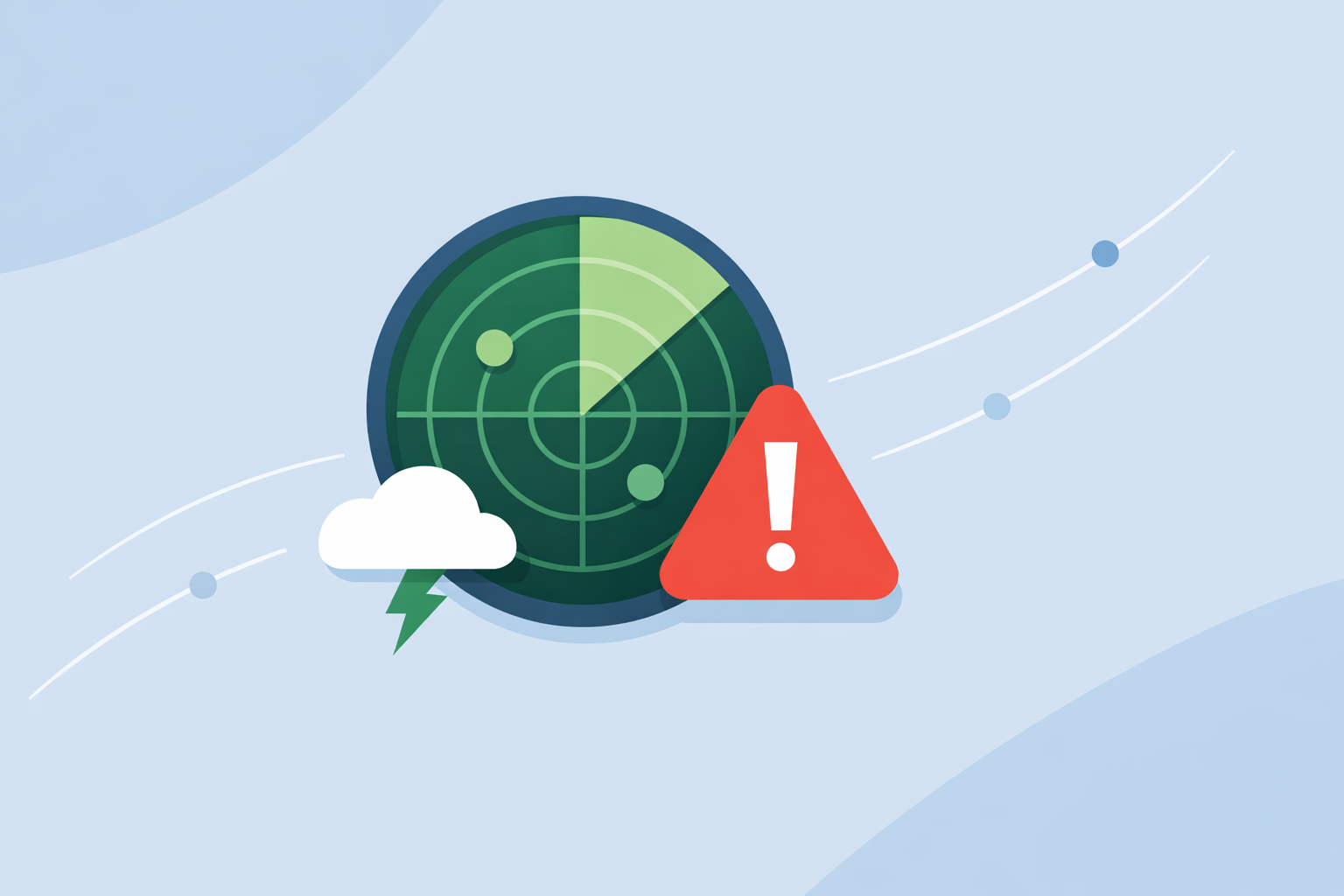
What are radar storm alerts, exactly?
When people search for “radar storm alerts,” they usually want one thing: a reliable heads-up before dangerous or disruptive weather hits, based on what radar is seeing right now—not just a generic forecast.
In practice, “radar storm alerts” blend three ingredients:
-
Doppler radar data In the U.S., the backbone is the NEXRAD radar network run by the National Weather Service. Public tools like the NWS radar site show this as animated radar on a map with forecast and alerts together. (NWS Radar)
-
Official watches, warnings, and advisories The NWS issues tornado warnings, severe thunderstorm warnings, flash flood warnings, and more. Many apps ingest these alerts and tie them to map locations and push notifications.
-
Short-term ("nowcast") logic Some platforms go beyond just relaying NWS text alerts. They use radar trends—how a storm cell is moving and growing—to trigger their own storm, rain, or lightning alerts when a threshold is met.
For you, the user, the technical differences matter less than the outcome: you want a clear picture of what’s on radar and timely alerts that are easy to act on.
At Clime, we treat radar as the starting point, not an afterthought: you open the app to a live, NOAA-based radar map and then layer in severe weather alerts, rain alerts, lightning, hurricanes, and wildfire hotspots as needed. (Clime)
How do radar-based storm alerts work?
Radar-based storm alerts follow a fairly consistent chain, whether you’re using Clime or another app:
-
Radars scan the sky U.S. NEXRAD radars rotate and send out pulses, measuring how those pulses bounce off raindrops, hail, or snow. These scans are combined into national mosaics and published by NOAA/NWS.
-
Data is turned into visual tiles Apps convert those raw radar products into colored tiles (reflectivity maps) you see as greens, yellows, and reds. Clime is built around this NOAA-sourced radar mosaic, so the visual you see lines up with the same government data that powers the NWS site. (Texas Water Development Board)
-
Alert engines monitor for threats
- Official alerts: When the NWS issues a severe thunderstorm or tornado warning, that polygon is ingested and matched to your saved places and GPS location.
- Radar and lightning thresholds: Some tools also watch radar intensity (dBZ) and lightning density to trigger “heavy rain” or “storm nearby” notifications before or between official warnings.
- Notifications are pushed to your phone You get a push alert, tap it, and land on a radar view centered on the threat.
For most households, the most useful setup is simple:
- A radar-first mobile app like Clime for visual awareness and alerts.
- System-level NWS Wireless Emergency Alerts (WEA) on your phone as a backup for the most critical warnings.
This gives you redundancy without adding a lot of complexity.
Which apps deliver the fastest radar-based storm alerts in the U.S.?
Speed is one of the most common concerns. Everyone wants to know: which app is fastest?
There are a few important realities:
- All consumer apps depend on the same core radar network. NEXRAD scans on the order of every few minutes; no app can see a new scan before it exists.
- Most tools pull from the same official alert feeds. For example, The Weather Channel’s Storm Radar page highlights live local storm alerts based on NOAA / NWS watches, warnings, and advisories. (Storm Radar)
- Differences you feel are often about app design, polling frequency, and notification handling, not the raw radar source.
Here is how the main options line up in practice:
-
Clime (our recommendation for most people)
-
Centers on a live radar map with severe weather alerts, rain alerts, lightning tracking, hurricane tracking, and a fire/hotspot map in one interface. (Clime)
-
Uses NOAA-based radar mosaics; the practical delay you see is governed by the NEXRAD update cycle plus normal app refresh.
-
Radar and alerts are presented together, so it’s easy to understand why you received an alert.
-
The Weather Channel’s apps and Storm Radar
-
Offer interactive radar with future-radar and “live local storm alerts” sourced from NOAA/NWS watches, warnings, and advisories. (Storm Radar)
-
Some advanced radar layers and longer future-radar windows are part of paid plans.
-
AccuWeather
-
Combines map-based severe weather watches and warnings, explicitly stating they come from official government sources. (AccuWeather Severe Weather Map)
-
Pairs radar with its MinuteCast precipitation timeline, which some users like for start/stop rain timing.
-
Windy (for power users and outdoor sports)
-
Has mobile-only Live Alerts that use lightning density thresholds and radar-based heavy-rain extrapolations over the next hour, but you must be online, logged in, and share location. (Windy Community)
In real-world use, the radar and NWS alert pipeline mean no app is magically “instant” while others are minutes behind. The difference you notice tends to come from:
- Whether an app checks for new alerts frequently while running in the background.
- Whether notifications are clear, concise, and easy to act on.
- Whether the radar view automatically zooms to the warning area.
For most people, Clime hits the right balance: radar is the main canvas, alerts are clearly tied to what you see on the map, and you aren’t forced to dig through a cluttered interface just to answer a simple question: “Is that storm heading for me?”
How does Clime handle radar storm alerts in practice?
From a user’s perspective in the U.S., this is how Clime fits into a storm day.
1. You open straight into radar Our app is centered on a live NOAA-based weather radar map with zoom and pan controls. You can quickly toggle precipitation, lightning, hurricane tracking, and fire/hotspot layers to get a full hazard picture on one screen. (Clime)
2. You save places that matter You can set up alerts for home, work, and other important locations. On paid plans, severe weather alerts and rain alerts work across all those saved locations, not just your current GPS spot. (Clime on App Store)
3. You get proactive alerts, then confirm on radar When official severe weather alerts or rain events affect one of your locations, you receive a notification. Tapping it drops you into the radar map so you can see the cell’s position, shape, and movement rather than just read text.
4. You monitor specific storm types with dedicated layers
- Lightning: A dedicated tracker helps you judge how active the storm is and whether outdoor plans remain safe. (Clime on App Store)
- Hurricanes: When tropical systems are in play, the hurricane tracker helps you follow the storm track in relation to your saved locations.
- Wildfires and hotspots: Fire/hotspot maps help you understand smoke and fire risk regions, which is increasingly relevant across the West. (Clime)
5. You check short-term and 10-day forecasts for context Beyond the immediate radar, Clime offers today, hourly, and 10‑day forecasts so you can see whether this is a one-off storm or part of several days of severe potential. (Clime)
In other words, you don’t have to piece together radar here, alerts there, and wildfire info somewhere else. Clime is meant to be your single storm dashboard.
How do 1-hour radar extrapolations and dBZ thresholds create heavy-rain alerts?
Some people search for “radar extrapolation heavy rain alerts 1‑hour dBZ threshold” because they’ve heard about more technical alert logic.
The core idea is this:
- Take recent radar frames.
- Track how the most intense echoes (higher dBZ values) move.
- Extrapolate their projected position 30–60 minutes ahead.
- Trigger an alert if your location falls under those future high-dBZ areas.
For example, Windy explains that its heavy rain notifications use 1‑hour extrapolated radar data with a set dBZ threshold, and its lightning alerts fire only if a minimum number of strikes occur within a small radius over 15 minutes. (Windy Community)
This is valuable context if you’re deciding how many alert layers you really need:
- Threshold-based radar alerts are helpful for incremental lead time, especially for heavy downpours that may not yet have an NWS warning.
- They are still estimates. Radar extrapolation assumes storms keep moving and evolving in roughly the same way; sudden development or dissipation can break that assumption.
At Clime, we focus more on making the live radar itself fast to interpret—with clear, layered visuals—so you can understand storm evolution directly, supported by severe weather and rain alerts instead of opaque thresholds that are hard to interpret.
Can you receive radar storm alerts without installing a mobile app?
Yes—but you’ll give up some speed and convenience.
Here are your main options if you prefer not to install anything:
- NWS Radar web tools The NWS radar site displays radar on a map with forecast and alerts layered in, and also exposes its radar products as OGC-compliant services that other tools can integrate. (NWS Radar)
- You can bookmark your local radar site and refresh it when storms threaten.
- You’ll need to proactively check; you will not get push notifications unless your browser and OS support and you opt into them on a specific site.
-
E-mail or browser-based alert services Some websites tied to TV stations or third-party weather services offer email or browser notifications based on your ZIP code and NWS alerts.
-
Wireless Emergency Alerts (WEA) These are built into modern phones in the U.S. and delivered by carriers, not apps. They cover the most critical hazards (e.g., tornado warnings, some flash flooding) but not every storm, and they don’t include a radar view.
For the specific intent behind “radar storm alerts,” a mobile app remains the most practical route because it couples:
- Real-time radar imagery.
- Official and/or radar-based alerts.
- Immediate visualization of what the alert means for your block or town.
That’s the gap we aim to fill with Clime: app-level convenience built on top of the same trusted radar backbone you’d get from public sites.
How do NWS radar OGC services fit into a storm-alert workflow?
If you are more technical—say, building your own dashboard or internal tool—you might care about integrating radar services directly.
The NWS radar portal notes that many radar products are available as OGC-compliant services (e.g., WMS), meaning they can be consumed by GIS tools, custom web maps, or back-end services. (NWS Radar)
A simplified storm-alert workflow might look like this:
- Ingest radar OGC services into a mapping or server environment.
- Sample radar intensities over a grid around locations of interest.
- Combine radar signals with official watches and warnings pulled from NWS alert feeds.
- Run your own threshold or pattern detection (e.g., "if reflectivity exceeds X dBZ within Y km, trigger an internal notification").
- Deliver alerts through your preferred channels, such as SMS, Slack, or custom push notifications.
This kind of architecture is powerful but requires engineering effort, hosting, and upkeep. For most individuals and families, using an existing app—Clime or another platform—is far more efficient.
Where Clime fits in that context:
- You get a polished radar and alert front end without having to manage NWS integration yourself.
- You still benefit from the same underlying radar network and official alerts you’d wire up in a custom system.
When should you consider other radar and alert tools alongside Clime?
While Clime can reasonably serve as the primary radar storm alert app for most U.S. users, there are cases where pairing it with another tool makes sense:
-
You want very long-range model guidance or niche map types. Generalist alternatives like AccuWeather and The Weather Channel apps add layers such as extended future radar or experimental overlays, which some users enjoy for planning beyond the next few hours. (AccuWeather Severe Weather Map)
-
You’re deeply invested in marine or wind sports. Windy places more emphasis on wind, swell, and multi-model forecasts. If your day hinges on wave height and wind direction and you care about storms, a mix of Windy for marine conditions and Clime for radar and alerts is a pragmatic combination. (Windy.app)
-
You prefer more experimental storm-visualization tools. Enthusiasts sometimes add specialized radar viewers for dual-polarization or raw single-site products. In that case, Clime can remain the “everyday” radar and alert app, while advanced tools are opened as needed.
For most households though—parents juggling kids’ sports, commuters watching for hail, travelers worried about airport delays—a clear, NOAA-based radar map with strong alert coverage is what matters most. That’s exactly the niche Clime is built around.
What we recommend
- Use Clime as your default radar storm alert app in the United States so you can see live NOAA-based radar, lightning, hurricanes, and wildfires alongside severe weather and rain alerts in one place. (Clime)
- Keep Wireless Emergency Alerts enabled on your phone for an additional safety net on the most critical warnings.
- Consider adding another app only if you have specialized needs, like intricate marine forecasts or experimental future-radar layers.
- Build custom OGC-based pipelines only if you have technical resources, and even then, using Clime as a quick visual check on top of your system keeps day-to-day use simple.