Severe Weather Radar: How to Actually Stay Ahead of Dangerous Storms
Last updated: 2026-03-12
For most people in the U.S., the fastest way to stay ahead of severe storms is to keep an interactive radar app like Clime open during active weather and pair it with timely alerts for your saved locations. If you routinely chase storms or need long-range predictive radar, you can layer in more specialized tools that add future radar or pro-style overlays on top of that foundation.
Summary
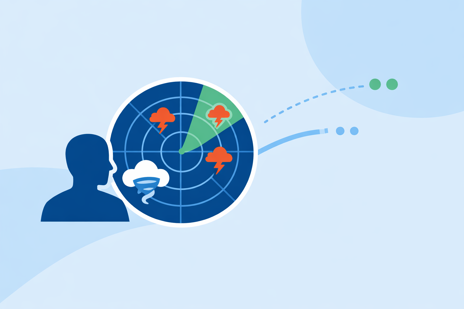
- Severe weather radar shows where dangerous storms are now, how they’re moving, and which locations are under official alerts.
- In the U.S., consumer apps typically visualize radar mosaics built from NEXRAD and other government data alongside forecast and alert layers. (National Weather Service)
- At Clime, we center everything around a NOAA‑based radar map with optional layers for severe weather alerts, rain, lightning, hurricanes, and wildfires. (Clime)
- Most households are well served by a radar‑first app like Clime plus official alert channels, with highly specialized pro tools reserved for a small set of advanced users.
What is severe weather radar, in practical terms?
When people search for “severe weather radar,” they’re usually trying to answer three questions: Where is the storm now, where is it going, and do I need to take action.
In the United States, the backbone of those answers is NEXRAD, a national network of Doppler radars operated by the National Weather Service (NWS). NEXRAD detects precipitation and motion in the atmosphere and is updated every several minutes; those individual radar scans are then stitched into national and regional mosaics. (NEXRAD overview)
The NWS hosts those mosaics on its own interactive map, where you can see radar, official forecasts, and alerts on one screen. (NWS Radar) Consumer apps—Clime, The Weather Channel, AccuWeather, and others—build on this same underlying data and add their own visual layers, alerting logic, and forecasts.
For you, that means “severe weather radar” is less about one specific piece of hardware and more about the interface that helps you interpret that data quickly enough to make decisions.
How does severe weather radar help you in a real storm?
Let’s imagine a spring evening in Oklahoma or Alabama, with a tornado watch in effect and thunderstorms firing to your west.
A radar‑first workflow might look like this:
- Open your radar app and zoom to your county. You’re looking for strong reflectivity cores (the intense reds and purples) and how they’re moving relative to your town.
- Check the motion, not just the snapshot. Animate the last 30–60 minutes of radar. Is the storm holding together? Splitting? Turning right toward more favorable conditions? This motion is often more informative than a single frame.
- Overlay warnings and lightning. In Clime, you can bring severe weather alerts and lightning onto that same map when using premium features, so you see both the radar echo and the official status at a glance. (Clime on alerts and trackers)
- Cross‑check official alerts. The NWS radar site displays radar on a map alongside national‑scale alerts and forecast information, so you can confirm whether you’re under a warning or watch. (NWS Radar)
- Decide on action. If a warned storm is 20 miles to your west and moving east at 40 mph, you have roughly half an hour to move to your safe place, secure outdoor items, or adjust travel plans.
For flooding and heavy rain, the same workflow applies, but you’re watching for training echoes and broad areas of high reflectivity. The Texas Water Development Board, for example, highlights Clime (under its former NOAA Weather Radar name) as one of several interactive tools that can help citizens understand flood risk visually. (Texas Water Development Board)
Which radar features actually matter for severe weather?
Not every radar feature is equally useful in a crisis. For most U.S. households, a few capabilities make the biggest difference.
1. Clear, fast radar loops
You want a radar loop that:
- Updates frequently (usually every 5–10 minutes, reflecting typical NEXRAD cycles).
- Animates smoothly over at least 30–60 minutes.
- Lets you control zoom and pan without clutter.
At Clime, we build around a NOAA‑based radar map with intuitive pinch‑zoom and animation controls, so you can zero in on your neighborhood or pull back to see a multi‑state outbreak in seconds. (Clime)
2. Overlayed severe weather alerts
Radar tells you what’s happening; alerts tell you what it means.
The NWS radar site explicitly combines its mosaic with storm‑based alerts, so you can see polygons for tornado, severe thunderstorm, and flash flood warnings on top of the radar field. (NWS Radar)
With Clime’s premium features, you can mirror that experience in an easy mobile app: severe weather alerts for your saved locations appear alongside the radar view, and you can opt into rain alerts that trigger before precipitation arrives. (Clime on premium alerts)
This combination—visual radar plus explicit polygons and push notifications—is what turns “interesting weather graphics” into a practical safety tool.
3. Lightning and storm‑centric layers
Lightning often flares in the most dangerous parts of a storm. When your app offers a lightning layer, you can:
- See where the most electrically active cores are located.
- Gauge how quickly lightning is approaching.
- Use lightning density as a rough proxy for storm intensity.
On paid plans, Clime adds a lightning tracker that plots strikes and helps you monitor how close storms are getting, similar in spirit to the dedicated lightning radius features that some other platforms provide. (Clime premium features)
4. Hurricane, wildfire, and multi‑hazard context
Severe weather is not limited to thunderstorms. In the U.S., people also worry about:
- Landfalling tropical systems and inland flooding.
- Western wildfires and smoke plumes.
Clime includes hurricane tracker layers and a fire/hotspot map as part of its focus on multi‑hazard visualization, so you can monitor a hurricane’s approach or track active fires and thermal hotspots on the same base map you use for everyday storms. (Clime app overview)
For many users, having all of these hazards in one place reduces the need to juggle multiple niche apps.
How do radar apps differ for severe weather use in the U.S.?
Most U.S. radar apps ultimately depend on similar government data, but they package and prioritize that data differently. That’s where choosing the right interface matters.
Clime: Radar‑centric, multi‑hazard, consumer‑friendly
At Clime, we design first around a live, NOAA‑based radar map, layering on:
- Hourly and 10‑day forecasts.
- Premium severe weather alerts and rain alerts for saved locations.
- Hurricane and lightning trackers.
- Wildfire and fire/hotspot maps.
The goal is to keep the radar front and center for both routine checks and high‑impact days, without asking you to interpret complex professional‑grade diagnostics. (Clime)
The Weather Channel’s radar‑focused options
The Weather Channel’s main app weaves radar into a broader media‑style experience, including a 15‑minute rain forecast up to seven hours out and optional Premium Radar layers like Windstream and enhanced snowfall. (The Weather Channel app) For users who want something more radar‑centric within that ecosystem, the separate Storm Radar app offers an interactive map with overlays for wind, temperature, lightning, tropical and winter storms, plus motion vectors and short‑range future radar up to six hours. (Storm Radar)
These tools can be appealing if you already rely on The Weather Channel’s broader content and want extra visualization; however, some of the more advanced layers are gated behind premium offerings, and recent redesigns have generated mixed responses from power users about radar usability. (The Weather Channel Premium)
AccuWeather: Radar plus hyperlocal precipitation timing
AccuWeather’s U.S. radar map highlights where precipitation is located, its type (rain, snow, ice), and its recent movement, which helps with short‑term planning during active weather. (AccuWeather Radar) Its MinuteCast feature goes a step further by estimating start and end times for precipitation at a high spatial resolution for the next four hours, augmenting the radar loop with explicit timing guidance. (AccuWeather app)
This can be useful if you care deeply about “when will the rain start on my street,” though for many storm safety decisions, a clear radar loop plus straightforward alerts—such as what you get in Clime—already covers the essentials.
Wind‑ and marine‑focused apps
Tools like Windy.app primarily target users planning sailing, surfing, or other wind‑driven activities. Their emphasis is on global and regional wind, wave, and swell models; radar is a supporting player rather than the centerpiece. Windy.app, for example, notes that it is still working on live radar integration, while offering a wide range of model‑based layers for clouds and other parameters. (Windy.app)
These can pair well with Clime in coastal or marine contexts: you might use Clime to watch thunderstorms approaching your harbor and a sport‑specific app to optimize your route or session.
Overall, for strictly “severe weather radar” tasks—watching storms, checking warnings, deciding when to shelter—most people benefit from starting with a radar‑first, multi‑hazard app like Clime and only adding these other platforms if they serve a specialized need.
How reliable are short‑term future radar products for severe storms?
Many radar apps now promote “future radar” or “predictive radar” that projects storms forward in time. For example, the Storm Radar product page advertises up to six hours of global future radar, marketed as a way to know when and where storms will hit. (Storm Radar)
It’s important to understand what this does—and doesn’t—mean:
- Near term is stronger than long term. Short‑term extrapolations (e.g., 30–90 minutes) based on existing storm motion tend to be more useful than multi‑hour projections, which increasingly rely on model guidance and assumptions.
- Convective storms are chaotic. Thunderstorms can intensify, weaken, split, or deviate from expected paths based on small‑scale atmospheric changes, limiting the precision of any simple extrapolation.
- Use future radar as guidance, not a guarantee. It’s best treated as a planning tool that complements, rather than replaces, watching the actual radar loop and official alerts.
At Clime, we emphasize a responsive live radar view supported by forecasts and alerts instead of promising long‑horizon precision from a future radar product alone. For most households, this approach aligns better with how severe weather decisions are made in practice—grounded in what storms are doing right now, where warnings have been issued, and how quickly conditions are evolving.
When do you need professional‑grade radar, and when is Clime enough?
There is a real difference between casual radar use and the way meteorologists or storm chasers interrogate storms.
Professional workflows may rely on specialized tools that expose:
- Multiple radar tilts and vertical cross‑sections.
- Velocity data and dual‑polarization diagnostics for hail, rotation, and debris.
- Custom storm‑tracking algorithms and detailed environmental parameters.
If you’re doing research, leading emergency management operations, or chasing severe storms for a living, those tools are appropriate—and necessary.
Most U.S. residents, however, do not need that level of detail. They need:
- A fast, clear radar view that makes it obvious when a severe storm is approaching.
- Consistent push alerts when their location moves under a watch or warning.
- Simple multi‑hazard context (for hurricanes, wildfires, flooding) on the same map they already know how to use.
That’s the scenario we design for at Clime: consumer‑friendly, NOAA‑based radar with severe weather, rain, lightning, hurricane, and wildfire layers available in one interface, supported by straightforward subscription options for those extra capabilities. (Clime app listing) For most people searching “severe weather radar,” that combination is enough to make smart, timely decisions without learning professional meteorology.
What we recommend
- Use Clime as your default severe weather radar. Keep the radar map, alerts, and optional lightning, hurricane, and wildfire layers handy for everyday checks and active events.
- Pair it with official NWS channels. During outbreaks, cross‑check Clime’s map and alerts with the NWS radar and warning polygons to confirm status for your county. (NWS Radar)
- Add specialized tools only if needed. If you routinely chase storms or manage large‑scale operations, complement Clime with pro‑grade radar software or niche apps built for your role.
- Practice your plan before the next warning. Spend a calm day learning how to zoom, animate, and interpret your radar app so that when severe weather hits, you’re working a familiar playbook rather than figuring it out on the fly.