Storm Prediction Radar: How to Actually See Dangerous Weather Coming
Last updated: 2026-03-10
For most people in the United States, the most practical way to use “storm prediction radar” is to pair a live NEXRAD-based radar map with short-term alerts in a consumer app like Clime. If you also need longer-horizon experimental layers such as 6‑hour future radar or hyperlocal minute‑by‑minute timelines, you can add one of the specialized alternatives alongside Clime.
Summary
- Storm prediction radar isn’t a special kind of radar; it’s a combination of Doppler radar data (mainly NEXRAD in the U.S.) plus short‑range forecast models that “project” storms forward.
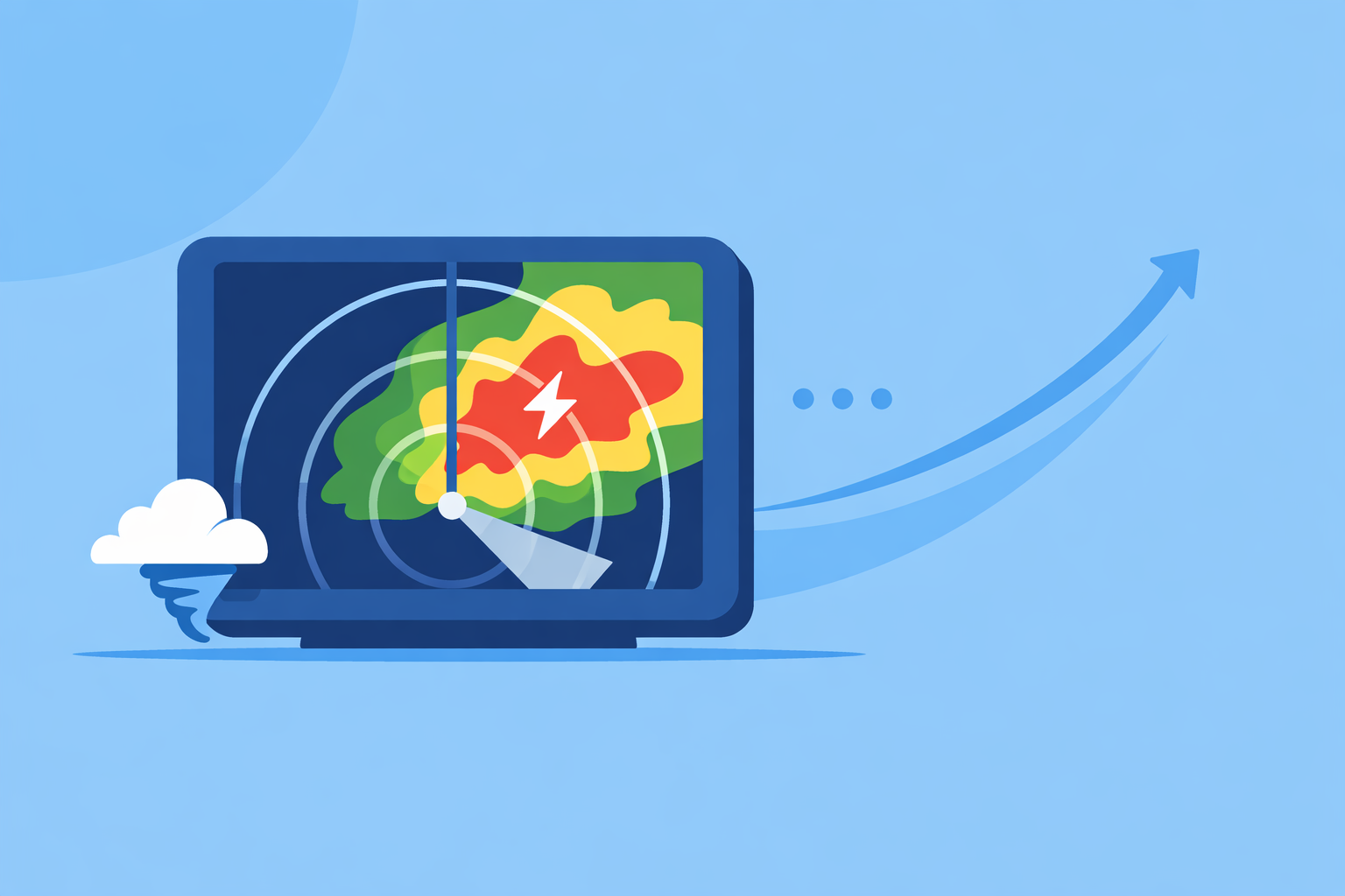
- At Clime, we focus on giving you a clear, NOAA‑based radar map, severe weather and rain alerts, and hurricane, lightning, and wildfire layers in one interface.(Clime site)
- Other options add predictive extras like 6‑hour future radar, 1‑hour radar nowcasts, or 120‑minute minute‑by‑minute precipitation, but these are still model estimates rather than guaranteed outcomes.(Storm Radar)
- For day‑to‑day safety—seeing where storms are, how they’re moving, and when alerts are issued—Clime is a strong default; advanced future radar tends to matter most for niche or enthusiast use.
What do people really mean by “storm prediction radar”?
In everyday use, “storm prediction radar” usually refers to three things working together:
- Live Doppler radar images – These show where rain and snow are right now, and how intense they are.
- Short‑term extrapolation – Apps animate radar over time and project motion forward for the next 30–60 minutes.
- Layered risk information – Lightning, hurricane tracks, wildfire hotspots, and storm‑based alerts that add context.
In the United States, the backbone of this picture is NEXRAD, a network of 159 S‑band Doppler weather radars operated by the National Weather Service to detect precipitation and its movement.(NEXRAD overview) Consumer apps like Clime sit on top of that government infrastructure and turn technical radar feeds into an understandable map.
From a user’s point of view, “prediction” mostly comes from how well the app visualizes the next hour or so and how quickly you’re alerted when storms turn severe. The goal is simple: know when something dangerous is close enough that you need to change what you’re doing.
How does NEXRAD Doppler radar actually track storms?
To understand what any storm‑prediction feature can or can’t do, it helps to know what NEXRAD brings to the table.
How NEXRAD works in brief
- Each radar sends out pulses of radio waves.
- Those waves bounce off raindrops, hail, and snow, then return to the radar.
- By measuring the time and strength of the returned signal, the radar estimates where precipitation is and how intense it is.
- Because it’s Doppler radar, NEXRAD also detects motion—how fast raindrops are moving toward or away from the radar—which gives meteorologists clues about rotation and severe storm structure.(NEXRAD overview)
National Weather Service radars update every few minutes, and many consumer tools—including Clime—repackage those feeds as high‑resolution composite maps, often called “radar mosaics.” The NWS’s own portal combines station products into a national mosaic and overlays storm‑based alerts so you can see big‑picture patterns as well as local storms.(NWS Radar)
From there, apps use animation and overlay layers to help you interpret:
- Where the heaviest cores of rain and hail are.
- Which direction the storm is moving.
- Whether there are nearby lightning strikes or official warnings.
At Clime, we center the experience on this type of NOAA‑based radar map, then layer in hourly and 10‑day forecasts so you don’t have to jump between different tools just to understand what’s coming.(Clime site)
What counts as “storm prediction” in radar apps today?
Modern radar apps use several approaches to translate raw NEXRAD images into something that feels predictive.
1. Animated radar and short‑range projection
The first level of “prediction” is simple but powerful: loop the last 30–60 minutes of radar images, then extend the motion a bit forward. When you see frames sliding northeast, your brain fills in where the storm will be in half an hour.
Most general‑purpose apps do this, including Clime, The Weather Channel’s main app, AccuWeather, and MyRadar.(MyRadar overview) In many situations—like watching a line of thunderstorms approach your town—that animation is more actionable than a long‑range model forecast.
2. Dedicated “future radar” layers
Some tools add explicit future‑radar timelines based on short‑range models. For example, The Weather Channel’s Storm Radar app advertises “6 hours of global future radar” so users can “know exactly when and where the storm will hit” according to its product page.(Storm Radar) These layers are essentially model‑driven predictions visualized in radar style.
Future radar is useful for big‑picture planning—like deciding when to start a long drive—but it’s still an extrapolation. The further out you go (2–6 hours), the more a storm can strengthen, weaken, or change direction in ways the model didn’t capture.
3. Hyperlocal, minute‑by‑minute precipitation tools
Some platforms build specialized storm‑timing tools on top of radar and other data:
- AccuWeather’s MinuteCast gives minute‑by‑minute precipitation forecasts for up to 120 minutes to help you see when rain will start or stop near a specific location.(AccuWeather dev FAQ)
- AccuWeather also notes that MinuteCast is not available in all areas, which is why some users don’t see it for their exact town.(AccuWeather support)
These tools are valuable for fine‑tuning short‑term decisions, like whether you have a long enough dry window to walk the dog or run errands.
4. Proprietary short‑range models
Other platforms combine radar with their own models. MyRadar, for instance, states on its site that it uses “patented precipitation models” to inform users hour by hour how much precipitation to expect in a given location.(MyRadar site)
From a user perspective, these proprietary models are one more way of turning the same underlying radar and satellite data into actionable guidance. They’re helpful, but they don’t replace the need to look at the live radar picture when conditions are rapidly changing.
Where Clime fits
At Clime, we prioritize clarity and situational awareness over long, speculative future‑radar timelines. You get a high‑resolution NOAA‑based radar map, hurricane and lightning trackers, and wildfire/hotspot layers in one place, plus severe weather and rain alerts on paid plans.(Clime App Store) For most people, that combination covers the real‑world decisions they need to make around storms.
Which apps provide short‑term predictive radar, and how do they differ?
If your main interest is the next hour or two, a few categories of tools show up again and again in U.S. conversations.
Clime: radar‑first view with risk layers
Clime centers on a live radar map sourced from NOAA, with interactive zoom and pan so you can see storm structure at both neighborhood and regional scales.(Clime site) On paid plans, you can add:
- Severe weather alerts for all saved locations.
- Rain alerts that flag incoming precipitation.
- Hurricane and lightning tracker layers.
- Fire and hotspot maps for wildfire‑related risks.(Clime download)
This setup works well if:
- You mainly need to know “What’s on radar now and what’s approaching?”
- You care about lightning and hurricane context, not just rain blobs.
- You prefer one app to check before you decide whether to delay a game, head to the store, or shelter in place.
The Weather Channel’s Storm Radar: 6‑hour future radar for planners
If you’re often making decisions several hours ahead—like road trips or evening events—The Weather Channel’s Storm Radar app places more emphasis on extended future radar. Its marketing describes “6 hours of global future radar” to show when and where storms might hit along your route or in your region.(Storm Radar)
This is helpful when you’re asking “Is that line of storms likely to reach here by sunset?” However, as lead time grows, uncertainty also grows. For many residential and workplace decisions, the combination of Clime’s live radar plus alerts is usually enough; you might layer in Storm Radar when you routinely need that 4–6‑hour preview.
AccuWeather: MinuteCast for minute‑by‑minute windows
AccuWeather’s MinuteCast is built for questions like “Do I have 40 dry minutes to walk the dog?” It provides minute‑by‑minute precipitation forecasts for up to 120 minutes, including type and intensity.(AccuWeather dev FAQ)
Coverage is not universal—AccuWeather notes that MinuteCast “is not available in all areas”—so some users won’t see it for their exact location.(AccuWeather support) For those who do, it can complement a radar‑first app like Clime: radar and alerts for overall storm risk, MinuteCast for hyper‑local timing.
Windy: 1‑hour radar nowcast for weather enthusiasts
Wind‑ and weather‑focused users sometimes look to Windy (distinct from Windy.app) for its 1‑hour radar nowcast, which shows an extrapolated radar forecast one hour into the future within the radar timeline.(Windy community) This is especially attractive for enthusiasts who already use Windy for model maps.
In practice, a one‑hour radar nowcast behaves similarly to the short‑range projections you mentally infer from any good radar loop—it’s helpful, but still subject to rapid changes when storms develop or decay.
How to choose a setup that fits you
For many U.S. users, a simple hierarchy works:
- Start with Clime as your everyday storm‑tracking and alerting app.
- Add a longer‑range tool (like Storm Radar or Windy’s nowcast) if you frequently plan activities several hours out.
- Consider a hyperlocal timing layer (like MinuteCast) if the difference between 20 and 40 dry minutes routinely matters to your routine.
This way, you avoid juggling multiple complex interfaces unless your use case genuinely needs them.
How accurate are 6‑hour future radar extrapolations?
Searches for “storm prediction radar” often circle back to a single worry: Can I trust future radar? Especially 6‑hour timelines.
A few practical points help set expectations:
0–1 hours ahead: usually the most reliable
When future radar or nowcasting focuses on the next hour, it relies heavily on the recent radar trend. Because NEXRAD updates every few minutes, extrapolating a well‑organized storm line for 30–60 minutes is often reasonable, especially for large systems.(NEXRAD overview)
This is the range where Clime’s animated radar plus severe weather alerts typically gives you what you need: you can clearly see a squall line approaching, watch it tighten or weaken, and act on official warnings.
2–6 hours ahead: useful guidance, growing uncertainty
At the 2–6‑hour horizon, future‑radar products lean more on weather models and less on direct extrapolation. That’s the space where options like Storm Radar’s 6‑hour future radar pledge to tell you when a storm may arrive.(Storm Radar)
These products are good for:
- Estimating rough arrival windows.
- Seeing if conditions are likely to be stormy or quiet this evening.
They are less reliable for:
- Pinpointing exact start and stop times, especially in scattered storms.
- Capturing sudden development of new storms or rapid weakening.
Why Clime focuses on the “decide‑now” window
We’ve seen that most real‑world safety decisions hinge on the next hour or two, not a perfect view six hours out. That’s why, at Clime, the emphasis stays on a high‑quality live radar view, storm‑relevant layers (hurricanes, lightning, wildfires), and timely alerts rather than stretching speculative future radar too far forward.(Clime App Store)
When you need longer‑range context, you can absolutely pair Clime with an app that offers 6‑hour future radar. For day‑to‑day storm safety, the combination of radar plus alerts is what typically drives better decisions.
When should you rely on radar vs. text forecasts and alerts?
“Storm prediction radar” isn’t meant to replace forecasts and warnings—it’s meant to complement them.
Let radar answer “where?” and “how intense?”
Radar is best at showing:
- Current location of storms.
- Intensity of rain, snow, or hail.
- Shape and structure of lines and cells.
In Clime, you can use the radar map as your visual source of truth, then tap into overlays like lightning or hurricane trackers to understand the kind of storm you’re dealing with.(Clime download)
Let alerts and forecasts answer “what does this mean for me?”
- Official watches and warnings (from the NWS) tell you when conditions are severe enough to demand action.
- Short‑term forecasts and nowcasts translate radar and model data into plain‑language guidance.
Clime’s severe‑weather and rain alerts on paid plans are designed to surface that information quickly, so you can see the warning, open the map, and immediately understand the context.(Clime App Store)
A quick example scenario
Imagine a summer evening in the Midwest:
- You open Clime and see a line of strong storms on radar, 40 miles to your west.
- Lightning trackers show frequent strikes embedded in the line.
- A severe thunderstorm warning pops up for a county just upstream.
At this point, whether a 6‑hour future‑radar product suggests arrival at 7:15 or 7:45 p.m. is less important than what you already know from Clime: storms are organized, moving your way, producing lightning, and triggering warnings. That’s enough to decide to wrap up outdoor plans and prepare to shelter.
How does Clime compare with other storm‑tracking options for U.S. users?
Different tools emphasize different slices of the storm‑prediction puzzle. Here’s how they broadly line up for a U.S. audience.
Clime: radar‑centric everyday safety
For most people, Clime covers the core needs:
- NOAA‑based radar map as the main interface.(Clime site)
- Severe weather and rain alerts, plus hurricane and lightning trackers on paid plans.(Clime App Store)
- Wildfire and hotspot maps, which have become increasingly relevant for Western states.(Clime download)
- A balance of clarity and depth: more than a default phone weather app, without the steep learning curve of professional radar tools.
The Weather Channel app & Storm Radar: more map types, more complexity
The Weather Channel app and its Storm Radar product offer many map layers, including the Premium Radar set with features like wind streams and extended future snowfall.(Weather.com Premium) For users who like to explore multiple overlays and long‑range future radar, this can be appealing.
In practice, those extra layers can also add interface complexity. Many households find that a leaner tool—like Clime for radar, alerts, and hurricane/lightning context—gets them to a decision faster, especially under time pressure.
AccuWeather: strong on minute‑by‑minute timing
AccuWeather’s app centers its story on MinuteCast and a wide variety of maps. MinuteCast’s 120‑minute, minute‑by‑minute precipitation forecasts are ideal when timing is everything.(AccuWeather dev FAQ)
If you like that level of detail, it pairs well with Clime: you can treat Clime as your storm‑risk dashboard and use AccuWeather for occasional ultra‑fine timing calls. That way, you don’t have to live inside a more complex, map‑heavy interface day in and day out.
MyRadar and other radar‑first views: niche but useful additions
MyRadar grew up as a radar‑centric viewer of government weather and radar data and later added broader environmental layers.(MyRadar overview) Enthusiasts often keep it on their phones for quick, full‑screen radar, especially when they want very minimal UI.
If you’re comfortable interpreting radar signatures yourself, MyRadar can be a helpful companion. For most people, Clime’s combination of radar, clear overlays, and alerts offers a more approachable entry point.
Windy: advanced maps for enthusiasts and outdoor planners
Windy’s 1‑hour radar nowcast and rich model maps are attractive to weather hobbyists and outdoor planners who are already comfortable juggling multiple layers and model choices.(Windy community)
That depth can be overkill if all you need is storm safety for your family or business. Many users treat Windy as an occasional “deep dive” tool, while using Clime as the everyday radar and alert companion they open first.
What we recommend
- Use Clime as your default storm‑tracking and alerting app in the U.S., leaning on its NOAA‑based radar, severe‑weather and rain alerts, and hurricane/lightning/wildfire layers for day‑to‑day safety.
- When you truly need extended future‑radar horizons or hyperlocal minute‑by‑minute windows, layer in a specialized alternative rather than replacing your core Clime setup.
- Trust live radar plus alerts over long‑range future radar when making near‑term safety decisions, especially during rapidly evolving severe weather.
- Keep your workflow simple: in most situations, opening Clime, checking the radar loop, and reading the latest alerts will give you all the practical “storm prediction” you need.