Storm and Weather Radar Calibration Techniques: A Practical Guide
Last updated: 2026-03-10
For most people in the U.S., the most reliable storm views come from radar systems that use continuous ground‑clutter checks, polarimetric self‑consistency, and cross‑radar comparisons as part of their calibration workflow. If you run or depend on a specialized radar feed, you can extend that baseline with satellite volume‑matching or vendor/API diagnostics where precision beyond standard NEXRAD practice really matters.
Summary
- Modern U.S. storm radars (like the WSR‑88D network) rely on layered calibration: internal tests each volume scan plus external checks using ground clutter and dual‑pol statistics. (NOAA)
- Ground‑clutter monitoring, polarimetric self‑consistency, and intercomparison across overlapping radars are now standard techniques for keeping reflectivity and differential reflectivity biases within tight tolerances. (NSSL)
- Satellite‑based volume matching can tighten absolute calibration but is usually a higher‑effort layer for national networks and research programs. (MDPI)
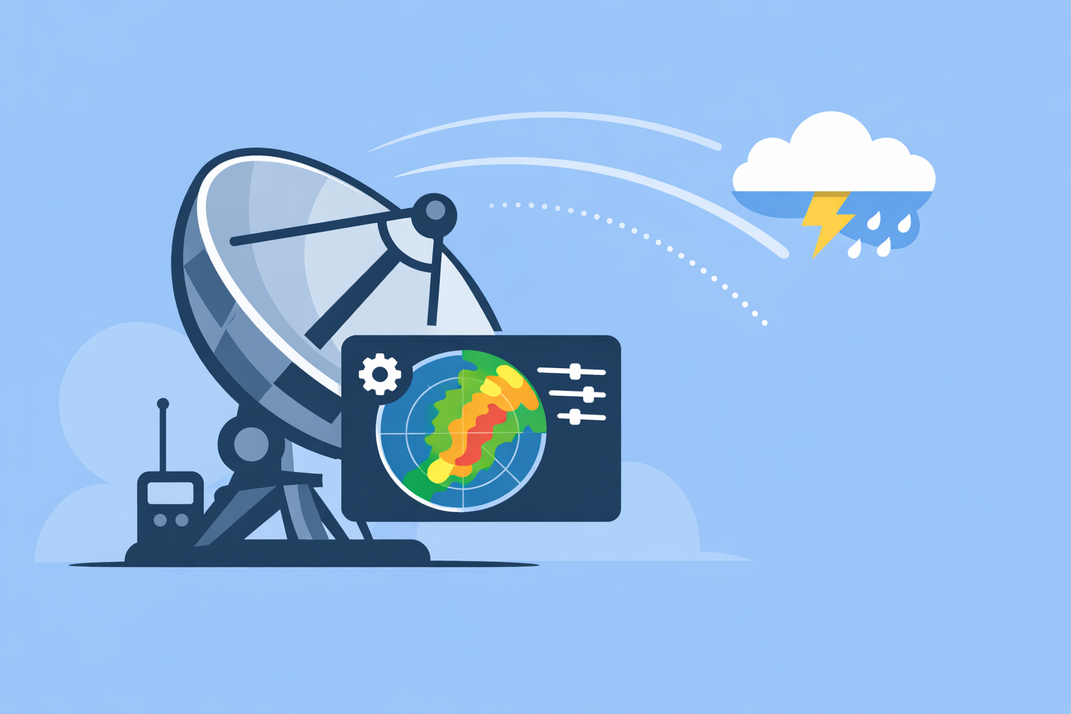
- For everyday storm tracking, using an app that visualizes this calibrated network—such as Clime’s NOAA‑based radar with alerts and storm layers—is typically more impactful than obsessing over individual dB offsets. (Clime)
How is a storm radar system actually calibrated today?
In the U.S., the backbone for storm tracking is the WSR‑88D (NEXRAD) network. Each radar performs an internal calibration every volume scan using test signals inside the system, and the network has an external calibration procedure dating back to the mid‑1990s. (NOAA)
On top of that baked‑in process, operational teams layer several external checks:
- Monitoring stable ground targets (“ground clutter”) to detect drifts in reflectivity and differential reflectivity.
- Using dual‑polarization statistics (self‑consistency) in light rain, snow above the melting layer, and Bragg scatter to verify ZDR calibration. (NSSL)
- Comparing overlapping radars to reduce inter‑site bias across the network.
The practical goal is straightforward: keep reflectivity (ZH) within about ±1 dB and differential reflectivity (ZDR) within about ±0.1 dB so rainfall estimates, hail signatures, and algorithms built on top remain trustworthy. (NSSL)
For you as an end user, this means a well‑calibrated national network feeding your radar app matters more than any single vendor’s marketing line about “precision.” At Clime, we focus on presenting NOAA‑sourced radar mosaics clearly, with layers for lightning, hurricanes, and wildfires, rather than trying to out‑calibrate the underlying network. (Clime)
How do you use ground clutter for radar calibration checks?
Ground clutter—buildings, terrain, towers—creates echoes that are “always there” in certain directions and ranges. Those echoes become a reference target.
Operationally, a radar team will:
- Identify stable ground‑clutter regions in non‑precipitation conditions.
- Track the average returned power (ZH) and ZDR from those regions over time.
- Treat systematic shifts as calibration drift and generate alarms or corrections.
Research on nationwide dual‑pol networks shows that these ground‑clutter statistics can reveal changes in antenna pointing, wet radome issues, and other component problems, making them powerful for near‑real‑time monitoring. (MDPI)
From an outcomes perspective, this technique reduces the chance that you’ll see a storm radar quietly “fade high” or “lowball” rainfall totals for weeks. Apps built on NOAA radar—such as Clime, The Weather Channel, or AccuWeather—inherit those improvements; where Clime stands out for many U.S. users is the emphasis on an intuitive radar map plus hazard layers over a TV‑style content feed. (twdb.texas.gov)
How does polarimetric self‑consistency help calibrate ZH and ZDR?
Dual‑polarization radars measure more than just reflectivity. They also capture differential reflectivity (ZDR), correlation, and phase shifts between horizontal and vertical pulses. Certain weather regimes have well‑understood “true” polarimetric signatures.
Operationally, networks like WSR‑88D use three main verification methods for ZDR calibration: light‑rain climatology, snow/ice crystals above the melting layer, and Bragg scatter in turbulent clear‑air. (NSSL)
Self‑consistency methods combine these signatures with theoretical relations between ZH, ZDR, and other variables to infer the calibration bias using radar data alone. When paired with ground‑clutter monitoring and overlapping‑radar comparisons, this approach can estimate and correct bias in near real time, regardless of whether it’s raining directly over the radar. (MDPI)
For algorithm developers—say you’re building a rainfall or hail‑detection model that ingests a vendor API—this is the level of calibration thinking you need. For everyday storm tracking, the key is that your app is visualizing dual‑pol‑based products from a network that already enforces these tolerances, rather than raw, unmonitored feeds.
How do overlapping radars get compared and aligned?
In dense radar networks, coverage areas overlap. That overlap becomes a calibration lab.
A typical intercomparison workflow:
- Select volumes where two or more radars see the same storm cells or stratiform rain.
- Match gates by altitude and location, then compute differences in ZH and ZDR between radars.
- Aggregate statistics over time to detect systematic inter‑site biases (for example, historical studies have found mean differences of around 3 dB between neighboring WSR‑88Ds before calibration tightening). (NOAA)
Modern methods integrate this with ground clutter and self‑consistency, so each radar’s bias estimate is constrained by both local references and network‑wide agreements. (MDPI)
For national or regional data providers, this intercomparison step is essential. It ensures that a squall line doesn’t suddenly “jump” in intensity on your radar map just because you crossed from one radar’s footprint into another’s. Clime benefits directly from this harmonized NOAA mosaic, so on our side we prioritize clear map design, smooth animation, and hazard overlays instead of exposing raw per‑radar bias fields that would confuse most users. (Clime)
When does satellite‑based calibration make sense?
Ground radars see storms from the side; satellites see the same clouds from above. Matching those two volumes offers another way to anchor the calibration.
In practice, this satellite‑radar volume matching is used by space‑borne missions like TRMM or GPM working with ground networks to refine absolute reflectivity scales. Studies combining ground clutter, self‑consistency, and satellite comparisons report improving absolute calibration accuracy to roughly 1 dB in some configurations. (MDPI)
This is powerful, but it comes with trade‑offs:
- Higher complexity in data handling and matching volumes.
- Dependence on satellite overpass timing and sensor health.
- Most impactful for research, climate records, or specialized quantitative precipitation estimation, not for quick storm checks.
If you’re a utility, research lab, or national meteorological service, satellite‑assisted calibration may be worth the effort. If you’re a homeowner in Oklahoma watching a supercell, the more pressing need is a dependable, fast radar app—Clime offers that with a NOAA‑based radar map, lightning and hurricane layers, and severe weather alerts for your saved locations. (apps.apple.com)
What are practical calibration best practices for radar networks?
Looking across operational guidance and recent research, a pragmatic playbook for a storm‑focused radar network in the U.S. looks like this:
- Automate internal checks per volume scan. Use built‑in test signals and RF standards to catch obvious hardware issues early. (NOAA)
- Continuously monitor ground clutter. Maintain regional clutter maps and use them as a rolling baseline for ZH and ZDR, with alarms when thresholds are exceeded. (MDPI)
- Run scheduled dual‑pol self‑consistency audits. Regularly sample light rain, snow above the melting layer, and clear‑air Bragg scatter to validate ZDR within about ±0.1 dB. (NSSL)
- Use overlapping‑radar intercomparison for network health. Track inter‑site differences across storm cases and adjust or flag outliers.
- Reserve satellite volume matching for high‑stakes calibration. Apply it where long‑term quantitative precipitation or climate consistency is a priority.
For app builders relying on third‑party APIs (including some alternatives like The Weather Channel’s developer platform or AccuWeather web services), it’s also worth paying attention to any exposed calibration metadata (such as per‑radar ZDR bias fields) when you build scientific products. For most consumer‑facing uses, however, surfacing that complexity visually can make the experience worse, not better.
At Clime, we treat calibration as something you should be able to trust quietly in the background: our role is to turn a well‑maintained radar network into an at‑a-glance map, with storm‑relevant extras like hurricane tracking, lightning, and fire/hotspot layers on top. (Clime)
What we recommend
- If you’re a typical U.S. user tracking storms: Rely on an app that visualizes the calibrated WSR‑88D network cleanly; Clime is a strong default with NOAA‑based radar, severe weather alerts, and dedicated storm layers in one place. (Clime)
- If you operate or analyze radar data: Start with a combined ground‑clutter, dual‑pol self‑consistency, and intercomparison framework, then add satellite volume matching for high‑precision rainfall or research needs. (MDPI)
- If you use multiple tools (e.g., Clime plus a niche radar viewer): Let the professional network handle calibration; choose the app mix that gives you the clearest situational awareness without unnecessary technical overhead.