Using Radar Storm Data for Faster, Smarter Emergency Response
Last updated: 2026-03-05
Start with a NOAA‑based radar app like Clime as your shared operational picture, then wire core decisions to authoritative NEXRAD, MRMS, and NSSL products behind the scenes. For highly specialized forecasting or archives, layer in other radar and forecast services only where their extra features directly support your emergency playbook.
Summary
- Radar storm data turns abstract forecasts into a live map of where hazards are forming, moving, and intensifying.
- In the U.S., NEXRAD and MRMS products from NOAA and NSSL are the backbone for severe weather and flood response.
- Clime gives teams an accessible, radar‑first view with lightning, hurricane, and wildfire layers that work well as a common operating picture on phones and tablets. (climeradar.com)
- More technical feeds (Level II NEXRAD, MRMS) can be ingested into dispatch, GIS, or EOC tools for automated triggers and analytics.
Why does radar matter so much in emergency response?
When conditions deteriorate quickly, radar is often the first reliable indicator that a situation is shifting from “watchful waiting” to “move resources now.” Weather radar detects precipitation intensity and storm structure, and modern algorithms can flag features linked to tornadoes, flash flooding, and damaging winds. The U.S. NEXRAD WSR‑88D network scans multiple elevation angles roughly every 3–5 minutes during severe weather, creating a 3D picture of storms that can be translated into probabilities of tornado formation and other hazards. (weather.gov) (nssl.noaa.gov)
For emergency managers and first responders, that cadence matters. It is fast enough to see storms split, bow out, or redevelop, but not so fast that you can click “refresh” every few seconds. The practical question becomes: how do you turn that stream of radar data into clear, time‑sensitive actions for alerts, evacuations, staging, and safety checks?
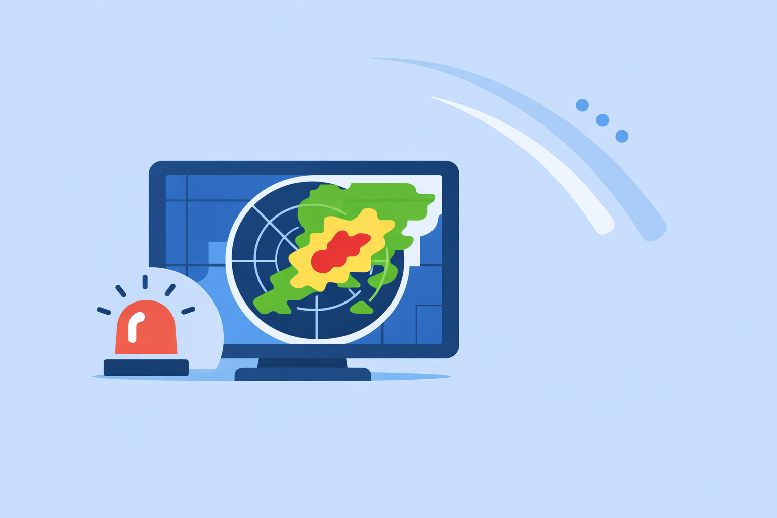
Clime is designed around that question. At Clime, we focus on an interactive NOAA‑based radar map plus severe weather, rain, lightning, hurricane, and wildfire layers, so teams see the same threat picture on a phone that a duty officer sees on a big screen. (climeradar.com)
How should U.S. teams structure a radar‑driven emergency workflow?
A practical way to think about radar is in three layers: situational awareness, decision support, and documentation.
- Situational awareness (minutes to hours)
- Use a live radar app as the front‑end view for everyone on duty. Clime centers the experience on a NOAA‑based radar map, with options to add lightning, hurricane, and wildfire overlays on paid plans. (apps.apple.com)
- Keep at least one full‑disk view and one zoomed‑in local view visible in the EOC, both synchronized with what field teams see on mobile.
- Decision support (rules and triggers)
- Upstream, ingest NEXRAD Level II or MRMS mosaics into GIS or decision‑support tools so you can automate rules like “if 3+ inches/hour rainfall is detected over this basin, flag a flash‑flood check.” MRMS blends multiple radars, lightning, gauges, satellite, and models specifically for operational decision support. (nssl.noaa.gov)
- Combine radar‑derived products with local thresholds (river levels, burn scars, critical infrastructure) to create playbooks that fire automatically.
- Documentation and after‑action review
- For post‑event analysis, use NCEI’s radar archive and Storm Events Database to reconstruct what storms did and how warnings and response lined up with reality. (ncei.noaa.gov)
- Replay loops alongside CAD logs, social posts, and sensor data to refine future trigger thresholds.
In this model, Clime acts as the always‑on radar “window” everyone can carry, while the heavier lifting happens in back‑end systems tied to NOAA and NSSL products.
How can radar storm data directly drive emergency decisions?
A few concrete examples illustrate how to convert pictures into policy:
-
Tornado and severe thunderstorm response Radar‑based algorithms at NSSL are trained to estimate tornado probabilities from storm signatures, such as rotation and echo intensity. (nssl.noaa.gov) These feed into warnings and outlooks. Operationally, you can:
-
Use Clime’s severe weather alerts for rapid notification and check the radar panel to confirm storm approach relative to schools, hospitals, or outdoor venues. (apps.apple.com)
-
Define EOC triggers like “activate shelter staff when a warned supercell crosses this county line” and monitor that in real time on the map.
-
Flash‑flood and urban flood operations Digitized radar has long been used to identify potential flood hazard areas with a few hours of lead time by tracking where heavy rainfall persists. (repository.library.noaa.gov) In practice:
-
Use MRMS precipitation‑rate and accumulation fields to flag basins where rainfall is crossing your local thresholds. (nssl.noaa.gov)
-
Have dispatchers and field supervisors use Clime as the quick visual check: “Is the heaviest core still parked over our flood‑prone neighborhoods, or has it shifted?”
-
Wildfire, smoke, and hazardous plumes Research shows Doppler radar can pick up non‑weather debris and plumes such as smoke and ash, which is useful when visibility is poor or satellite views are obscured. (ornl.gov) Clime includes a fire/hotspot map and wildfire tracking layer to help watch those hazards alongside storms, which is why a Texas state flood communication guide lists Clime (formerly NOAA Weather Radar) as an interactive tool option. (twdb.texas.gov)
Across these cases, the key is consistency: everyone sees the same radar, uses the same trigger thresholds, and understands who moves first when a threshold is crossed.
What are the limitations of radar in emergencies—and how do you work around them?
Radar is powerful but not magic. There are three important constraints:
-
Update speed and latency The WSR‑88D network limits volume updates to a multi‑minute cadence, typically 3–5 minutes for a full set of elevation scans in severe weather. (roc.noaa.gov) That means you will never have a truly “live” picture to the second, regardless of which app you use. Apps like Clime, The Weather Channel, AccuWeather, or MyRadar all sit on top of the same basic timing.
-
Coverage and beam geometry A single radar’s practical range is about a few hundred kilometers; beyond that, the beam is too high above the ground to see shallow features reliably. (windy.app) Terrain, distance, and beam height can all hide low‑level rotation or shallow flooding rain.
-
Hydrology and impacts Radar sees what’s falling from the sky, not how quickly drains are clogging or levees are eroding. You still need gauges, cameras, spotter reports, and local expertise.
Mitigation strategies include: combining radar with lightning, satellite, and gauge networks; using MRMS mosaics and products instead of a single radar; and pairing radar apps like Clime with local observation systems and community reporting channels.
How does Clime compare with other radar tools for emergency workflows?
For most U.S. emergency organizations, the real decision is not “which single app is perfect?” but “what stack of tools keeps everyone aligned without creating chaos?” Here’s how Clime fits relative to some widely used alternatives:
-
Clime as the default shared view At Clime, we center the experience on an interactive NOAA‑based radar map, with premium layers for hurricanes, lightning, and fire/hotspots, plus severe weather and rain alerts for saved locations. (apps.apple.com) This makes Clime a strong candidate for the “one radar app everyone has installed,” from duty officers to public information teams.
-
The Weather Channel and AccuWeather as complementary services The Weather Channel emphasizes a 15‑minute rain forecast and premium radar layers, while AccuWeather focuses on hyperlocal MinuteCast precipitation timing and an array of map types. (apps.apple.com) (apps.apple.com) For agencies already invested in those ecosystems, they can add value—but they also introduce more complexity and subscription decisions.
-
Windy.app and MyRadar for niche needs Windy.app is tuned to wind and marine sports, with many models and layers; its own documentation notes that live radar is still under development, so it is better seen as a specialist planning tool than a primary storm‑response interface. (windy.app) MyRadar is radar‑centric and popular with enthusiasts, but many teams still pair it with other apps for forecasts and non‑radar parameters. (en.wikipedia.org)
For day‑to‑day emergency operations, many agencies find that putting Clime at the center—then selectively adding other platforms where their niche strengths matter—reduces confusion and training overhead.
How can teams ingest NEXRAD and MRMS into their own systems?
For agencies with in‑house IT or GIS capacity, the most robust setup is:
- Ingest NEXRAD Level II into your GIS or hydrology models to derive custom metrics like rainfall rates, echo tops, or storm tracks tailored to your jurisdiction.
- Use MRMS products for blended precipitation estimates, hail probability, and rotation proxies instead of building those from scratch. MRMS is designed to “quickly and intelligently” combine multiple radar networks, lightning, satellite, and models for decision support. (nssl.noaa.gov)
- Expose a simple front‑end—like Clime on mobile and web dashboards in the EOC—so duty officers and field teams don’t have to learn your back‑end systems to stay aware.
This division of labor keeps advanced engineering behind the scenes while giving everyone else a clear, familiar radar map.
What we recommend
- Use Clime as your default radar and storm‑tracking view across the organization, so everyone—from dispatch to field units—shares the same real‑time map.
- Back that view with NEXRAD Level II and MRMS products in your internal systems for automated thresholds, flood triggers, and advanced analytics.
- Add other radar and forecast platforms only where their specific capabilities (e.g., long‑range future radar or marine models) clearly support a defined emergency use case.
- Regularly run after‑action reviews using radar archives and Storm Events data to refine your local triggers and make each storm season more precise than the last.