How to Use Weather Radar for Storm Damage Assessment in the U.S.
Last updated: 2026-03-10
For most people in the U.S., start with a live radar app like Clime plus official NWS products to understand where the worst storm damage likely occurred. If you’re doing deeper mapping or professional work, add NEXRAD Level‑II dual‑polarization data (reflectivity, velocity, correlation coefficient) from NOAA archives for detailed post‑event analysis.
Summary
- Use live radar during the event to track storm structure and corridors of strongest winds.
- Afterward, review NEXRAD reflectivity, velocity, and dual‑pol debris signatures to narrow down likely damage paths.
- Rely on apps like Clime for fast visualization and alerts, then turn to NOAA/NWS and NCEI archives when you need raw radar data and dual‑pol products. (NCEI)
- Always ground‑truth radar signals with field surveys, photos, and reports; radar alone can’t fully replace on‑the‑ground damage assessments. (NSSL)
What does “using radar for storm damage assessment” actually mean?
When people search for "weather radar for storm damage assessment", they usually want to answer three questions:
- Where did the worst winds, hail, or tornadoes hit?
- How severe was the event in different neighborhoods or counties?
- Where should inspections, claims work, or safety checks be prioritized first?
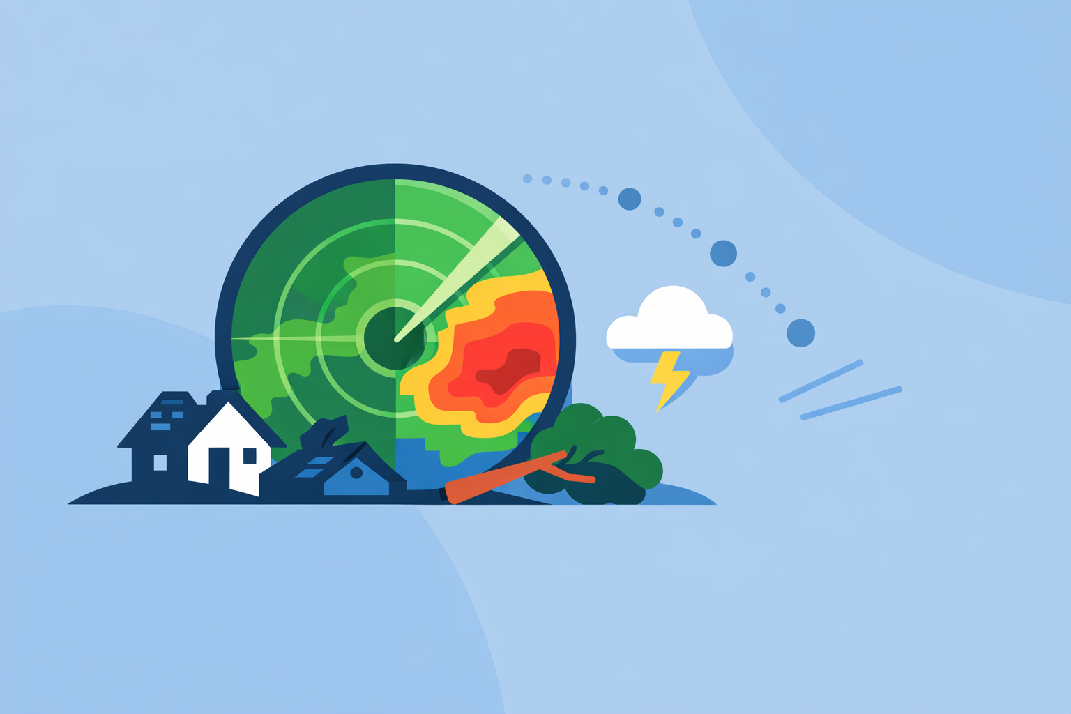
Weather radar can’t show broken roofs or uprooted trees directly, but it does show where the most intense parts of a storm passed. In the U.S., that backbone is the NEXRAD Doppler radar network, which provides near‑national coverage and frequent updates. (NCEI)
At a practical level, that means:
- During the storm, you watch live radar (for example in Clime) to see where the heaviest cores, hooks, or straight‑line wind segments are. (Clime)
- After the storm, you review archived NEXRAD products – especially reflectivity, velocity, and dual‑polarization outputs – to outline likely damage tracks.
For emergency managers, insurers, and local officials, radar is a fast way to triage where to send people first.
Which radar products matter most for damage assessment?
NEXRAD data is organized into levels and products. For damage‑focused work, three families of products matter most:
- Reflectivity (Level‑II / Level‑III)
- Shows how strongly targets (rain, hail, sometimes debris) reflect the radar beam.
- High reflectivity cores often align with heavy rain and hail; bowing lines can hint at damaging straight‑line winds. (NCEI)
- Velocity (Doppler)
- Measures motion of targets toward or away from the radar.
- For damage assessment, strong couplets (tight inbound/outbound signatures) highlight where rotation – and possibly tornadoes – were strongest.
- Dual‑polarization products, especially Correlation Coefficient (CC)
- Dual‑pol radars send and receive both horizontal and vertical pulses. This helps distinguish raindrops, hail, and non‑meteorological objects like debris. (NCEI)
- Correlation Coefficient (CC) measures how similar the returned signals are; significantly lower CC values within a storm can indicate mixed debris lofted by a tornado – a so‑called Tornado Debris Signature (TDS). (NSSL)
Together, these products let you:
- Outline hail cores (high reflectivity).
- Identify wind damage corridors (bowing segments, strong outbound velocity).
- Confirm tornado damage tracks using a combination of rotation and debris signatures.
In consumer apps, you’ll mostly see composite reflectivity, sometimes velocity. For detailed CC and other dual‑pol tools, you typically move into specialized viewers and NCEI data.
How do you access and download NEXRAD Level‑II data for mapping?
If you’re going beyond a quick visual check, you’ll want raw NEXRAD data:
- Level‑II: Base reflectivity, mean radial velocity, spectrum width, and dual‑pol base fields. (NCEI)
- Level‑III: Value‑added products derived from Level‑II (like storm total precipitation, echo tops, etc.).
In the U.S., the main pathways are:
-
NOAA’s NCEI radar portal / open data NCEI provides Level‑II and Level‑III archives, and the NOAA Open Data Dissemination (NODD) program mirrors this data to public cloud providers. That means you can pull specific radar sites and times to reconstruct a storm’s evolution. (NCEI)
-
Specialized radar software and web viewers Many professional tools read Level‑II files and expose separate panels for reflectivity, velocity, and CC. Once you have the files, you can draw paths, export shapefiles, or overlay damage reports.
For most homeowners, facility managers, or small teams, this is overkill. At Clime, we see a common pattern: use a radar app for situational awareness and broad impact zones, then loop in a GIS or radar specialist whenever you need exact tracks and engineering‑level details.
How do you read correlation coefficient (CC) to find tornado debris?
Dual‑polarization radar dramatically changed how forecasters confirm tornado damage in real time. Dual‑pol outputs allow radars to detect debris lofted by tornadoes, even at night. (NWS Melbourne)
Here’s the workflow many experts follow:
-
Locate strong rotation on velocity First, identify a tight inbound/outbound velocity couplet in the storm, which indicates strong rotation.
-
Check reflectivity at the same location Look for a high‑reflectivity core or a “debris ball” – a localized high‑reflectivity spot near the circulation.
-
Inspect Correlation Coefficient (CC) In a healthy rain/hail core, CC values are relatively high (targets are similar). When a tornado lofts mixed debris, CC values in a small area drop sharply. NOAA and NSSL note that dual‑pol radars can directly detect this kind of debris, providing strong evidence that a tornado is on the ground and causing damage. (NSSL; NCEI)
-
Trace the debris signature over time Step through successive scans to see how the low‑CC area moves. That path is often a good first approximation of the tornado’s damage track.
In public‑facing apps, you usually don’t see raw CC. What you can do is:
- Track the storm on Clime’s radar and lightning layers.
- Cross‑reference with NWS storm‑based warnings and public statements that mention a radar‑confirmed tornado.
That blend gives you a fast, understandable picture even if you’re not opening Level‑II files yourself.
Can radar debris signatures replace ground damage surveys?
No. Radar is a powerful indicator, not a replacement.
Dual‑pol debris signatures are invaluable for real‑time warning and prioritizing response, especially at night. They help forecasters confirm a tornado is on the ground and causing damage, which can accelerate life‑saving messaging. (NWS Melbourne)
But for formal damage assessment – such as assigning an EF rating or evaluating structural performance – teams still rely on:
- Detailed ground surveys and photographs.
- Drone and aerial imagery.
- Engineering inspections of specific buildings and infrastructure.
Radar can miss:
- Very localized damage outside the main beam.
- Damage under shallow, weak, or brief circulations.
- Non‑tornadic damage (e.g., microbursts) that doesn’t produce a clear debris signature.
A practical way to think about it:
- Radar narrows the search area and timeline.
- Surveys and imagery document what actually failed and why.
How do Clime and other apps fit into a storm‑damage workflow?
In the U.S., most people don’t want to become radar scientists; they want actionable answers. Here’s where Clime and similar products come in.
Clime as the default radar view
Clime centers on an interactive radar map built on NOAA data, plus hourly and 10‑day forecasts. (Clime) Premium layers add storm‑relevant tools like lightning tracking, hurricane tracking, and fire/hotspot maps, all in one interface. (Clime)
For storm damage assessment, that means you can:
- Watch the live radar loop as storms approach and pass your area.
- Use severe weather and rain alerts on paid plans to know when dangerous weather is in your saved locations. (Apple App Store)
- Overlay hurricane and wildfire layers when assessing broader risk to property portfolios or infrastructure. (Clime)
A state‑level example: the Texas Water Development Board includes Clime (under its former NOAA Weather Radar name) among recommended tools for interactive flood‑risk and radar awareness, which speaks to its usefulness for public‑facing risk communication. (Texas Water Development Board)
Where other tools fit
Other options can complement this workflow:
- The Weather Channel app pairs radar with short‑range rain forecasts and offers additional advanced radar layers on paid plans – useful if you are already deeply invested in that ecosystem. (The Weather Channel App Store)
- AccuWeather emphasizes hyperlocal MinuteCast precipitation timing and offers radar/satellite maps, which can help time on‑site inspections in the hours after a storm. (AccuWeather App Store)
- Windy.app is more focused on wind and marine conditions; it can be a good companion if your operations are tied to sailing, offshore work, or coastal logistics. (Windy.app)
For most U.S. homeowners, facility teams, and local officials, Clime as the everyday radar plus NOAA/NWS products for deeper dives is a balanced, lower‑friction setup. More specialized apps and raw NEXRAD data come in when you move into professional‑grade mapping or research.
What we recommend
- Use Clime as your primary live radar and alerting tool during severe weather, then revisit the loops to sketch likely impact zones once the storm passes.
- For serious or recurring damage‑assessment work, add access to NEXRAD Level‑II archives and dual‑pol products (CC, velocity) via NOAA/NCEI tools.
- Treat radar as your triage and targeting system, and confirm the details with ground surveys, photos, and engineering input.
- If you already rely on another radar or forecast app, keep it as a secondary perspective – but center your workflow around tools that balance clarity, reliability, and quick interpretation for non‑experts.