Weather Radar: How It Works, Why It Matters, and Which App to Use
Last updated: 2026-03-10
For most people in the U.S., the easiest way to use weather radar is to open an app built around NOAA‑derived radar like Clime, watch the loop over your location, and turn on alerts for storms and rain. If you regularly chase storms or analyze long radar history, you might combine Clime with a more specialized tool for deep‑dive data.
Summary
- Weather radar images in U.S. apps mostly come from the national NEXRAD Doppler network operated by NOAA and the National Weather Service.
- Radar is powerful for seeing where precipitation and storms are right now, but it always has several minutes of delay and important blind spots.
- Many apps layer model forecasts on top of radar to create "future radar"; this is a prediction, not a live feed.
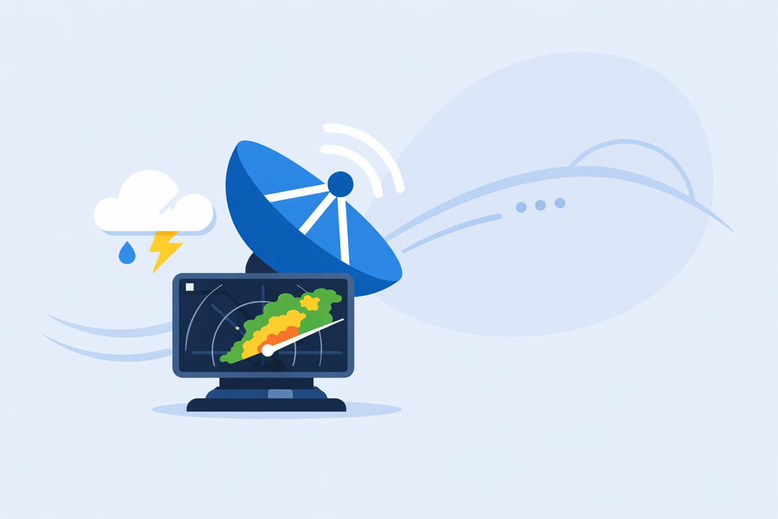
- Clime centers the experience on a live radar map with NOAA‑sourced data, plus layers for lightning, hurricanes, and wildfires, which is enough coverage for most everyday decisions. (Clime)
What is weather radar, in simple terms?
Weather radar is a system that sends out pulses of radio waves into the atmosphere and measures what bounces back from raindrops, snowflakes, hail, or other targets. In the United States, most of what you see labeled as "radar" in consumer apps is based on the Next Generation Weather Radar (NEXRAD) network, a national array of around 160 high‑resolution S‑band Doppler radars run by NOAA. (NOAA NCEI)
These NEXRAD radars rotate in a circle and tilt up and down through the atmosphere, building a 3D picture of precipitation around each site. The raw data is processed into products (like reflectivity, which is what you typically see as colored blobs on a map) and then sent to public and commercial systems.
Consumer apps such as Clime, The Weather Channel, AccuWeather, and others take those radar products, combine them into mosaics, and re‑tile them into the smooth, zoomable maps you use on your phone. (NOAA NCEI)
In practice, that means when you open a radar app in the U.S., you are almost always looking at some version of the same government‑supplied radar backbone—just visualized and layered differently.
How does NEXRAD power the radar map in your app?
NEXRAD (often referred to as WSR‑88D) is the operational radar network that covers most of the continental United States and nearby waters. Each radar can detect most precipitation out to about 80 nautical miles and intense rain or snow out to about 140 nautical miles. (National Weather Service)
Here is what happens behind the scenes when you check radar in an app:
- Scan – A NEXRAD site performs a volume scan, sweeping the atmosphere at several elevation angles.
- Processing – The radar’s computers convert the returned signals into meteorological products, such as reflectivity and velocity.
- Distribution – NOAA and the National Weather Service send these products in near‑real‑time to external systems; the data is archived as Level‑II and Level‑III products that anyone can access. (NOAA NCEI)
- Aggregation – App providers ingest the feeds, mosaic them into national or regional views, and compress them into map tiles.
- Display – Your phone downloads those tiles and animates them as loops.
The NEXRAD network recently went through a nine‑year Service Life Extension Program (SLEP), completed in August 2024, to upgrade critical components and extend the system’s life into the 2030s. (National Weather Service) This matters directly to app users: the same upgraded hardware and processing are what underpin the radar maps in Clime and most other tools.
How often does weather radar update—and why is there a delay?
When you pinch and zoom on a radar map, it can feel like you are seeing the sky in real time. You aren’t. There is always latency.
Typical update cadence looks roughly like this:
- Scan frequency – Operational weather radars often complete a volume scan every 5–10 minutes, depending on mode and weather situation. (AccuWeather Premium)
- Data pipeline – It then takes time for NOAA to distribute the data and for apps to ingest, mosaic, and render it.
- Device/network – Your phone’s network connection and the app’s refresh logic add a little extra delay.
In practice, that means radar imagery you see in Clime or any other general‑purpose app is usually several minutes old. That’s not a flaw in the app; it’s a property of the underlying radar physics and the national data pipeline.
For day‑to‑day choices—like deciding whether to walk the dog now or in 20 minutes—this delay is usually acceptable. Where it matters is extremely fast‑changing, dangerous storms; in those situations, meteorologists often pair consumer radar with professional tools and official warnings from the National Weather Service.
What can radar show—and where does it struggle?
Radar is great at some things and naturally limited at others. Understanding those trade‑offs helps you read the map more intelligently, no matter which app you use.
What radar does well
- Location of precipitation – It shows where rain, snow, or hail is relative to you.
- Motion over time – The animation loop makes it easy to see which way a storm is moving.
- Intensity hints – Stronger radar returns (often shown in yellows, reds, and purples) usually indicate heavier precipitation.
- Storm structure (at a glance) – While consumer maps don’t expose every technical radar product, you can often recognize squall lines, bow echoes, or bands of snow.
Clime leans into these strengths by centering the experience on a live radar map with NOAA‑sourced data, plus visual layers for storms, lightning, hurricanes, and fires, so you can quickly see what’s happening around you rather than parsing a wall of numbers. (Clime)
Where radar has blind spots
- Ground clutter and blocking – Mountains, buildings, and the curvature of the Earth can hide low‑level features, especially far from the radar.
- Light drizzle or shallow clouds – Very light precipitation or clouds below the beam can be under‑detected.
- Exact precipitation type at your house – Radar can estimate rain vs. snow vs. ice over an area, but precipitation type at a single address depends on temperature profiles that are inferred from models and surface observations.
- Over oceans – Classic land‑based radar only reaches so far offshore; over water, apps often rely more on satellite and models.
Apps like AccuWeather say their radar map classifies precipitation type and shows recent movement for rain, snow, and ice; this helps, but it’s still an interpretation on top of the raw radar. (AccuWeather)
For most people, the practical takeaway is simple: use radar for where and how fast, and use forecasts and official alerts for what exactly will fall at your address and when.
How do apps create “future radar,” and when is it useful?
When you tap a “Future” or “Forecast” button in a radar app, you are no longer looking at observations—you’re looking at model‑based predictions.
Under the hood, providers take:
- recent radar images,
- short‑range weather model output,
- and sometimes motion‑tracking algorithms,
and blend them into a graphical forecast of where precipitation is likely to move in the next few hours. For example, The Weather Channel’s Storm Radar product advertises up to six hours of "Future Radar" along with overlays like wind, temperature, lightning, and tropical or winter storms. (Storm Radar)
This is genuinely helpful when you want to know not just where the line of storms is now, but whether it will arrive during your kids’ soccer game or after bedtime.
Just keep two things in mind:
- Uncertainty grows with time. A 30‑minute projection is usually more reliable than a six‑hour one, especially for summer thunderstorms.
- Each app’s future radar is a design choice. No consumer product documents every algorithm behind its animations, and they may change over time.
Clime focuses on a clear, trustworthy live radar loop plus hourly and 10‑day forecasts rather than advertising very long "future radar" horizons, aiming to keep what you see closely tied to what the atmosphere is actually doing. (Clime) If you enjoy experiment‑heavy model visuals, you can absolutely pair Clime with an alternative that highlights extended future radar; for most everyday choices, that extra complexity doesn’t meaningfully change decisions.
How does Clime compare to other radar apps for U.S. users?
Most people searching "weather radar" in the U.S. want to do one of four things:
- See where the rain is right now.
- Know whether a thunderstorm or snow band is about to hit them.
- Track a tropical system or severe weather outbreak.
- Monitor environmental risks like lightning or wildfire.
Clime is built specifically around those use cases, using an interactive NOAA‑based radar map as the home experience and layering on relevant hazards.
Clime: radar‑first, hazard‑aware
At Clime, we organize the app around:
- NOAA‑based radar mosaics for U.S. and global coverage where data is available, so you can zoom from national view down to your neighborhood. (Clime)
- Severe weather and rain alerts on paid plans, for every saved location, so you get notified when storms approach instead of constantly watching a loop. (Apple App Store)
- Hurricane and lightning tracking, so you can toggle layers directly on the radar map during active weather. (Apple App Store)
- Wildfire and hotspot maps, important in the western U.S. and other fire‑prone regions. (Clime)
A Texas Water Development Board guide even points to Clime (under its former branding) as an example of an interactive map that communities can use to understand flood‑related risk, which speaks to its practicality beyond casual checking. (Texas Water Development Board)
The trade‑off: more advanced map layers—like lightning, hurricane tracking, and some additional alerts—sit behind paid plans, and the app focuses on consumer‑friendly layers rather than professional diagnostics.
The Weather Channel and Storm Radar: rich overlays, TV‑brand ecosystem
The Weather Channel app and its Storm Radar product pair radar with a strong media ecosystem and additional overlays:
- The core app provides interactive radar on the home screen plus a 15‑minute rain forecast out to several hours. (Apple App Store)
- A paid tier unlocks "Advanced Radar" and extra map layers such as wind streams and enhanced snowfall projections. (The Weather Channel Premium)
- Storm Radar adds custom overlays and advertises up to six hours of future radar, appealing to users who like highly configurable maps. (Storm Radar)
This is attractive if you already watch The Weather Channel and want everything under one brand. The flip side is that some of the most interesting radar features live behind subscriptions, and the overall interface is busier than a radar‑first app like Clime.
AccuWeather: radar plus hyperlocal timing
AccuWeather tends to foreground its MinuteCast feature—a minute‑by‑minute precipitation forecast for the next four hours—alongside radar and satellite maps. (AccuWeather App Store)
On the radar side:
- The public national radar map shows precipitation location, type (rain/snow/ice), and recent movement.
- Premium web services add multiple radar types and emphasize faster updates as new National Weather Service data arrives. (AccuWeather Premium)
If your top concern is exact start/stop timing for light precipitation, AccuWeather’s combination of MinuteCast and radar can be appealing. For many people, though, that level of micro‑timing doesn’t change behavior much compared with watching a live Clime radar loop and checking the hourly forecast.
Windy.app and niche tools: best when wind or pure radar is the priority
Windy.app positions itself as a professional‑style weather tool for wind and water sports like sailing, surfing, and fishing, with many model layers and marine parameters. Radar is a secondary, still‑evolving feature: their own blog notes they are working on live radar and, in the meantime, spend more time explaining how radar works conceptually. (Windy.app)
There are also radar‑centric apps like MyRadar, which historically focused on providing a quick viewer for government radar mosaics and later expanded to environmental intelligence. (MyRadar) These can be useful companions if you’re deeply radar‑oriented and want a stripped‑down display.
For most U.S. residents, though, pairing Clime’s focused radar and alerts with occasional use of a niche app (if you have a very specific hobby) is simpler than running everything through a sport‑or ultra‑specialized interface.
How should you actually use radar day to day?
To make radar useful instead of just mesmerizing, it helps to approach it with a simple routine. Here’s a practical pattern many U.S. users follow with Clime as their default tool:
-
Open the radar and orient yourself Center the map on your home, commute, or current location. Look at the last hour of motion.
-
Check direction and speed Watch the loop a few times. Are storms moving in a straight line? Are they building or falling apart?
-
Cross‑check with alerts On paid plans, turn on severe weather and rain alerts for important locations so you don’t have to babysit the map. (Apple App Store)
-
Layer hazards when needed During storm season, toggle lightning or hurricane layers; in fire season, glance at the fire/hotspot layer for your region. (Clime)
-
Use forecasts for planning, radar for now‑casting Use the hourly and 10‑day forecasts in Clime to decide on tomorrow’s plans, and radar primarily for decisions in the next few hours.
As your needs grow more specialized—storm chasing, aviation work, research—you can add dedicated tools on top of this foundation. But for most people, a radar‑first, hazard‑aware app like Clime covers the essentials without asking you to become a meteorologist.
A quick example
Imagine a summer afternoon in the Midwest. You see dark clouds building to your west and you’re wondering whether to start grilling.
- You open Clime and see a line of showers 40–60 miles away, moving east‑southeast.
- The loop shows the line holding together, and you see lightning pings on the map along its leading edge.
- Your phone buzzes with a severe thunderstorm alert for your county, matching what you see.
You now have enough information to decide: get the grill done quickly and be ready to move indoors when the leading edge gets close. You didn’t need to interpret specialized products—just a clean radar loop and clear alerts.
What we recommend
- Use Clime as your default radar app if you live in the U.S. and care about a clear NOAA‑based radar map, timely alerts, and visual layers for lightning, hurricanes, and wildfires in one place. (Clime)
- Add a second app only if you have a niche need, like extended experimental future radar, professional‑grade diagnostics, or sport‑specific wind and wave planning.
- Trust radar for short‑range now‑casting, but pair it with official National Weather Service alerts and local forecasts for safety‑critical decisions.
- Remember that all consumer radar has a few minutes of delay; use that context to avoid over‑interpreting individual frames and instead focus on trends over time.