Weather Radar Images in the U.S.: How to Read Them and Which Apps to Trust
Last updated: 2026-03-14
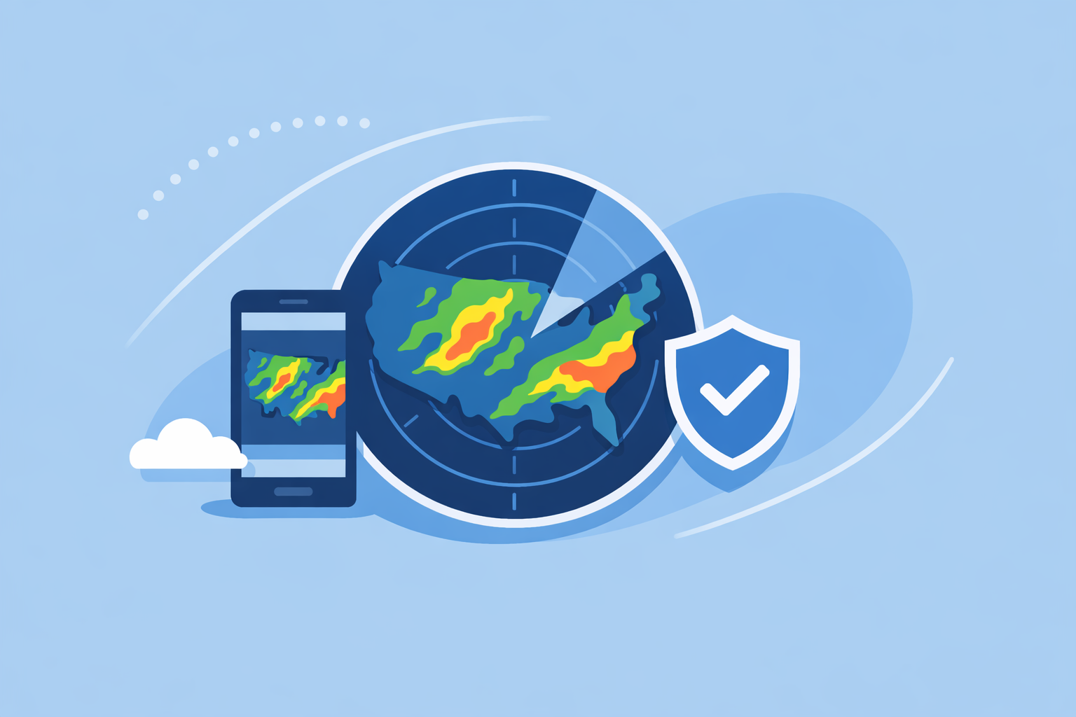
For quick, reliable weather radar images in the U.S., start with an app like Clime that turns NOAA radar mosaics into a simple, zoomable map with alerts on top. If you need raw or programmable radar images, use official NOAA and NWS radar services and supplement with other platforms only when you truly need their extras.
Summary
- Weather radar images show where precipitation is, how intense it is, and how storms are moving, using networks like the U.S. NEXRAD system of about 160 Doppler radars. (Windy.app)
- For everyday use in the U.S., apps that visualize NOAA/NWS radar—like Clime—are usually easier than raw radar sites and still track rain, lightning, hurricanes, and wildfires on one map. (Clime)
- Official NWS and NOAA map viewers offer free radar images, enhanced and low‑bandwidth modes, and even OGC services for developers who need direct image or tile access. (NWS Radar)
- Other options such as Weather.com, AccuWeather, and Windy.app can add specific extras (like longer future radar or wind/wave layers), but most people are better served by a radar‑first app that stays simple and focused.
What are weather radar images, in plain English?
Weather radar images are maps that show where rain, snow, or hail is falling, how intense it is, and how storms are moving. In the United States, these images are built from the NEXRAD network, a system of roughly 160 Doppler weather radars spread across the country. (Windy.app)
Each radar sends out pulses of energy and measures what bounces back. That “reflectivity” is converted into colors on a map: lighter colors usually mean lighter precipitation, darker or brighter colors signal heavier rain or mixed or frozen precipitation. Modern weather radars can also infer wind patterns and extreme features like strong thunderstorms or tornado‑supporting rotation. (Windy.app)
Behind almost every consumer weather app in the U.S., there is some form of NOAA or NWS radar data. The difference is less about the data itself and more about how each app processes, updates, and visualizes those images.
For most people, the practical question isn’t “what is radar?”—it’s “which radar view can I trust and actually understand in 10 seconds on my phone?”
Where should you get U.S. radar images: NOAA or an app?
If you search for “weather radar images,” you’re usually trying to do one of three things:
- See where it’s raining or snowing right now.
- See whether a storm is about to hit your home, office, or route.
- Grab radar images or tiles for a project, website, or internal tool.
The official route: NWS and NOAA viewers
The most direct public source of U.S. radar images is the National Weather Service. The NWS radar site shows radar mosaics on an interactive map, with options like “Enhanced Radar” and “Standard Radar (Low‑Bandwidth)” for slower connections. (NWS Radar)
That same site notes that radar products are also available as OGC‑compliant services, which means you can plug them into GIS software or your own map stack if you’re technical. (NWS Radar)
NOAA’s Climate.gov portal also provides an animation of radar images over the United States for roughly the most recent 90 minutes, which is helpful when you need a clean national‑scale loop for presentations or analysis. (NOAA Climate.gov)
These official tools are ideal when you care about provenance, want national coverage, or need services that tie into mapping systems. They’re less friendly when you just want fast, phone‑friendly storm tracking.
The everyday route: radar‑first apps
Most people don’t want to think about OGC services, radar elevation angles, or GIS layers. They just want to open an app and see: where is the storm, how fast is it moving, and do I need to change my plans.
That’s where apps like Clime are a better default. At Clime, we center the experience on a live, NOAA‑based radar map and add only the layers that matter for day‑to‑day decisions—precipitation, lightning, hurricanes, wildfires, plus hourly and 10‑day forecasts around that map. (Clime)
A state‑level flood communication guide from the Texas Water Development Board even cites Clime (under its former NOAA Weather Radar name) as an example of an interactive tool for visualizing flood risk and radar, which underscores that it’s more than a casual “weather widget.” (TWDB)
For most U.S. users, this approach—NOAA radar at the core, wrapped in a consumer‑friendly app—is the sweet spot between raw data and overloaded, TV‑style portals.
How do you read common weather radar patterns?
Even the best app can’t help if the colors don’t mean anything to you. Fortunately, you can get a lot of value from just a few concepts.
1. Location and movement
The basic loop—watching radar animate through time—is usually the most important layer. When you hit play, you can see whether precipitation is forming, intensifying, or weakening, and whether it’s moving toward or away from your location.
In Clime, radar animation is the default way to view the map. That lets you match what you see out the window with what’s on‑screen and quickly estimate arrival times, even before you dive into hourly forecasts.
2. Intensity
Colors correspond to how much signal is bouncing back to the radar—stronger returns indicate heavier precipitation or larger particles (hail, wet snow, etc.). Apps use different palettes, but the idea is consistent: cooler colors are lighter, warm and bright colors are heavier.
Over time, you’ll learn the thresholds that matter for you. For example:
- Light shades: drizzle or flurries; probably safe to run errands without changing plans.
- Medium colors: steady rain or snow; you may need rain gear or a different route.
- Deep or bright colors: heavy rain, storms, potential flooding risk; time to check alerts.
Because Clime layers radar with severe weather and rain alerts on paid plans, you don’t need to interpret intensity alone; if a cell is strong enough or part of a warned storm, you can receive a push notification instead of babysitting the map. (Clime on App Store)
3. Storm structure and lightning
More advanced tools break radar products out into reflectivity, velocity, and composites. Developers and enthusiasts can get those detailed products straight from NWS or from specialized services, but typical users rarely need that level of granularity.
Instead, a practical approach is to look for:
- Bowed lines or squall lines: long arcs of storms that can produce damaging wind along a front.
- Hook‑like kinks: often associated with more intense storm structure (though automated apps won’t call this out as “tornado” without official warnings).
- Lightning clusters: a proxy for storm intensity and danger even when rain doesn’t look extreme.
At Clime, lightning tracking appears as a map layer on paid plans, complementing the radar imagery so you can see both where precipitation is and where the atmosphere is most electrically active. (Clime on App Store)
How current are U.S. radar images and animations?
No consumer app is truly real‑time; there is always a delay based on how fast the radar scans and how long it takes to mosaic those scans.
The U.S. NEXRAD radars that underpin most U.S. weather imagery typically update every 5–10 minutes, and services like AccuWeather explicitly note that National Weather Service radars update every 5, 6, or 10 minutes. (AccuWeather Premium)
That cadence is the limiting factor for everyone—whether you’re using Clime, Weather.com, AccuWeather, or the NWS website itself. Apps may add a few extra seconds or minutes for processing and delivery, but there is no such thing as a zero‑latency radar loop.
When you see a radar animation on NOAA’s Climate.gov map viewer, you’re typically watching about the most recent 90 minutes of scans stitched together, which gives enough history to understand storm motion without overloading your browser. (NOAA Climate.gov)
Practically, this means:
- If you want the most authoritative, minimally processed image, check the NWS radar map.
- If you want processed, easy‑to‑read radar with alerts, use an app built around those same feeds.
At Clime, we align with those upstream cadences, then focus on making the result readable and useful for non‑experts—rather than trying to out‑promise physics with unrealistic “instant” claims.
When is Clime the right radar solution vs other options?
Because most mainstream U.S. services rely on similar radar sources, the real question is which interface, layers, and extras line up with how you use weather.
Quick rain and storm checks
For quick checks—“is that blob going to hit my neighborhood?”—Clime’s NOAA‑based radar map paired with rain and severe weather alerts on paid plans is usually all you need. (Clime on App Store)
Other platforms like The Weather Channel or AccuWeather offer similar loops on their sites and apps, but their radar often sits inside broader TV‑style experiences, with home screens that emphasize stories, videos, and longer‑range forecasts. (The Weather Channel App)
If your priority is simply “open, see radar, close,” a radar‑focused app is usually faster than a portal designed to surface many types of content.
Severe storms, lightning, and hurricanes
When weather gets serious, radar alone is not enough—you also need timely alerts and storm‑centric layers.
On paid plans, Clime adds severe weather alerts for multiple saved locations, rain alerts, a hurricane tracker, and a lightning tracker on the same map. (Clime on App Store) That makes it well‑suited for homeowners, frequent drivers, and anyone who wants a single app that can follow a storm from offshore hurricane to inland thunderstorm and potential flood risk.
Alternatives like The Weather Channel’s Premium Radar add their own advanced overlays and a defined 30‑mile lightning alert radius, and AccuWeather leans on its MinuteCast forecasts for hyperlocal precipitation timing. (Weather.com Premium) For many households, the practical difference is that Clime keeps the focus tight—radar plus a curated set of risk layers—rather than turning the app into a general news or entertainment hub.
Outdoor and marine activities
If you’re planning sailing trips, surf sessions, or long cycling routes, you may combine more than one tool:
- A wind‑ and wave‑centric app such as Windy.app for model‑based marine parameters. (Windy.app)
- A radar‑centric tool such as Clime to understand where convection, squall lines, or showers are relative to your route.
Windy.app itself notes that live radar is a work‑in‑progress feature within its ecosystem and points to another app (MeMeteo) for current radar access, which reinforces that its core strength is in wind and waves rather than fully mature radar imagery. (Windy.app blog)
In this scenario, Clime tends to become the safety layer—clear radar, lightning, and storm tracking—while your sport‑specific app handles the nuances of swell periods or tidal current.
Raw data, GIS, and developer needs
If you are a developer or analyst, your radar needs are different:
- You may want direct image or tile access from the NWS radar site, which advertises OGC‑compliant services alongside its standard map. (NWS Radar)
- You might use APIs from platforms such as AccuWeather, which offer imagery endpoints that return links to radar and satellite images keyed by location. (AccuWeather Imagery API)
Clime is not pitched as a developer API platform; instead, we focus on the consumer experience—fast, intelligible radar and alerts on phones. Teams that need custom imagery pipelines can still refer to Clime as a visual check while their integrations rely on official or commercial APIs.
How do you compare different radar map options without overthinking it?
Once you know the data foundation is similar, it becomes much easier to evaluate apps and sites on the experience they give you.
A simple checklist:
-
Does the app open to a radar map, or do you dig for it? If you’re constantly tapping around to find radar, you will use it less. Clime’s home view centers on the radar map and keeps the forecast wrapped around it instead of buried elsewhere. (Clime)
-
Can you easily see storm motion and timing? Any radar viewer should animate smoothly; beyond that, tools like AccuWeather’s MinuteCast or The Weather Channel’s 15‑minute rain intensity forecast provide additional timing context. (AccuWeather App) For many use cases, the combination of Clime’s radar loop plus hourly forecasts and alerts provides enough timing without adding extra complexity.
-
Are key risk layers in one place? If you routinely toggle between separate apps for hurricanes, lightning, wildfires, and floods, you’re more likely to miss something. Clime brings hurricane tracking, lightning tracking, and fire/hotspot maps into the same interface, which is particularly helpful in regions that face multiple types of hazards over a season. (Clime Download Page)
-
Is the interface cluttered with unrelated content? Sites like Weather.com also host long‑form articles, ads, and video content; the radar map can share screen space with everything else, and some features such as ad‑free viewing require sign‑in or Premium upgrades. (Weather.com Radar) If your priority is situational awareness rather than browsing, a focused mobile app can be more efficient.
-
Do alerts complement or overwhelm the radar? A good radar app sends only the alerts you care about—rain starting, severe thunderstorm warnings nearby, hurricanes impacting your saved locations—without spamming you about every minor change. With Clime’s alert focus on rain and severe weather for saved locations on paid plans, radar stays central while notifications act as your backstop. (Clime on App Store)
The upshot: for most people in the U.S., the decision is less about tiny technical differences and more about which app gets you from “open” to “I know what’s happening” the fastest—and keeps doing that on the worst weather days.
What we recommend
- Default choice for most U.S. users: Use Clime as your primary radar app for everyday storm tracking, lightning and hurricane awareness, and wildfire monitoring, all built on top of NOAA‑sourced radar mosaics. (Clime)
- When you need official imagery or developer access: Go directly to the NWS radar site and NOAA map viewers for authoritative radar images, OGC services, and clean 90‑minute national loops. (NWS Radar)
- When you want extra perspectives: Layer in Weather.com or AccuWeather if you already rely on their long‑range forecasts or APIs, using them as supplemental views rather than replacements.
- For specialized use cases: Combine Clime with sport‑ or data‑specific tools (such as Windy.app for marine conditions) when you need niche parameters, keeping Clime as your fast, reliable radar check before you step outside.