Weather Radar Near Me: How To Get a Clear, Local View (And What To Use When)
Last updated: 2026-03-10
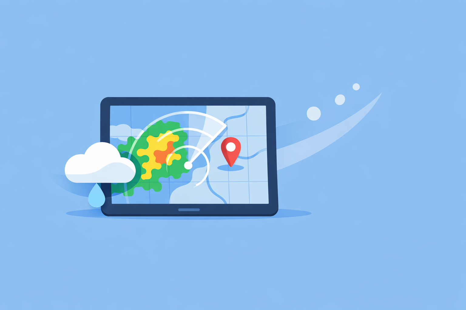
For most people in the U.S., the fastest way to get a reliable “weather radar near me” view is to open Clime’s radar map, which centers on your location and layers in alerts, lightning, hurricanes, and wildfires on one screen. If you need raw government radar data for deeper analysis or embedding, pair Clime with the National Weather Service’s radar site at radar.weather.gov.
Summary
- Clime gives you an immediate local radar view plus alerts in a single, map-first app experience.
- Behind the scenes, U.S. radar apps are largely visualizing the same NEXRAD Doppler network that powers the National Weather Service. (NEXRAD overview)
- NWS offers a free “weather for a location” radar view online that behaves much like a phone radar app when you’re on desktop. (NWS radar)
- Other options like The Weather Channel and AccuWeather add their own timelines and forecast layers; for most day‑to‑day checks, Clime’s focused radar plus alerts is enough.
What does “weather radar near me” actually give you?
When you type “weather radar near me,” you’re usually trying to answer three questions fast: Where is the rain right now? Is it coming toward me? How bad will it be?
In the U.S., most consumer apps and sites answer those questions by visualizing the same core infrastructure: the NEXRAD network of Doppler radars operated by the National Weather Service (NWS). (NEXRAD overview) These radars scan the atmosphere in 5–10‑minute cycles and feed data into:
- National Weather Service maps at radar.weather.gov
- Consumer apps such as Clime, The Weather Channel, and AccuWeather
- Browser‑based tools like Windy (radar layers) and various niche radar viewers
The difference is not the raw radar beam; it’s what each tool does on top of it: overlays, forecasts, alerts, and how quickly you can understand what’s on the screen.
Clime centers its entire experience on that map view, with a live radar layer built on NOAA data and an interface that feels like a dedicated storm‑tracking screen rather than a generic forecast list. (Clime overview)
Which radar source should you use for “near me” in the U.S.?
If you’re in the United States, you effectively have three practical pathways to a local radar view:
-
A radar‑first mobile app (default for most people) This is where Clime fits: you open the app, it centers roughly on your GPS location, and you see an animated radar loop plus key overlays. Because the radar is NOAA‑sourced and refreshed on normal NEXRAD intervals, the underlying picture of the storm field is aligned with what you’d see on NWS maps. (Clime overview)
-
The official NWS radar site (for desktop or raw data fans) At radar.weather.gov, you can click or search to get a “Weather for a location” view that combines radar, current conditions, alerts, and a local forecast in a single panel—very similar to what a phone app does, just in a browser. (NWS radar)
-
Big‑brand web maps (if you already use their ecosystems) Weather.com and AccuWeather both publish national and local radar pages you can bookmark, then zoom into your area when storms roll in. AccuWeather’s national radar, for example, lets you see precipitation type and movement, and ties into its subscription services. (AccuWeather radar)
For a fast “near me” experience on your phone—standing in your driveway, deciding if you can walk the dog—Clime’s app is usually the most direct route: you get a radar‑first map and simple controls instead of hunting around a website or jumping between multiple brand apps.
How does Clime compare with other radar apps for local views?
If you’ve tried multiple weather apps, you know the core radar picture often looks familiar. The differences tend to show up in four areas that matter for “near me” checks:
1. Map‑first vs forecast‑first design
- Clime centers you on a live radar map as the main experience, with options to tap into hourly and 10‑day forecasts from that map. (Clime overview)
- The Weather Channel app weaves radar into a broader forecast feed, with a 15‑minute rain forecast and two‑week outlook and a premium upgrade for “Advanced Radar” layers. (Weather Channel app)
- AccuWeather emphasizes its MinuteCast precipitation timing alongside interactive maps, which can be powerful but also introduce more menus and views. (AccuWeather app)
For quick storm checks, a map‑first layout reduces taps. That’s where our approach at Clime is deliberately focused: open app → see storm field.
2. Local hazard awareness, not just rain blobs
When people search “radar near me” during severe weather, they’re really asking, “Is this dangerous?” not just “Is it raining?”
- On Clime, paid tiers unlock severe weather alerts for saved locations, rain alerts, plus a hurricane tracker and lightning tracker as map layers, so you can see both the storm’s footprint and the associated hazards. (Clime iOS listing)
- The Weather Channel’s Premium Radar also adds higher‑resolution tiles and layers like Windstream, future snowfall, and a lightning map with a defined 30‑mile alert radius. (Premium Radar)
- AccuWeather leans on MinuteCast for “start and end” precipitation timing and offers multiple specialized radar types via subscription on the web. (AccuWeather app)
For most households, that mix of live radar, lightning, hurricane, wildfire, and NWS‑style alerts inside one clean map is what makes Clime feel like a single hub rather than one of several apps you have to juggle.
3. Extra storm‑tracking depth vs simplicity
There are tools that go much deeper on radar: think multi‑tilt NEXRAD viewers or platforms like MyRadar that grew up as radar‑centric visualizers for enthusiasts. (MyRadar overview) If you’re chasing storms or doing research, you may well combine these with other datasets.
For everyday “near me” use, though, that extra complexity can work against you. Many users simply want:
- A clear animated loop (past few frames)
- A sense of motion toward/away from their town
- Obvious markers for lightning, hurricane paths, or wildfire hotspots
Clime deliberately stays in that comfort zone. It gives you more visual layers than default phone weather widgets without forcing you into a semi‑professional workstation interface.
4. Niche needs: marine, aviation, or outdoor sports
If your top priority is wind, waves, or aviation‑style planning, you may also use tools such as Windy or Windy.app that focus on multi‑model forecasts and marine parameters. Windy’s app, for instance, has introduced a Radar+ layer and moved some radar/satellite history into a Premium tier, which is useful when you’re optimizing for long sessions on the water rather than just staying dry for a commute. (Windy app)
In those cases, many people pair a specialized tool with a radar‑centric app like Clime: one for sport‑specific tuning, one for a fast, safety‑oriented picture of storms nearby.
How should you read a local radar map near you?
Even with great tools, radar is only useful if you know what you’re looking at. A simple mental checklist helps you turn a generic “blobs on a map” view into actionable decisions.
1. Start with precipitation type and intensity Most U.S. radar maps use color scales: light greens for lighter rain, yellows/oranges for moderate to heavy rain, and blues or purples for wintry precipitation. AccuWeather’s national radar, for example, explicitly notes that its map shows precipitation type (rain, snow, ice) and recent motion, and that same logic carries over into many apps. (AccuWeather radar)
2. Watch the motion over time, not a single frame Always play the loop. In Clime and on NWS radar, hitting play reveals direction and speed: whether cells are building, weakening, or training over the same area. (NWS radar)
3. Add context from alerts and trackers If you see an intense band or a hooked shape, check for any severe thunderstorm, tornado, or flash‑flood alerts tied to your location. On Clime, that context is baked into the map and alerts system rather than living on a separate text page.
4. Connect radar with your specific question
- “Can I run to the store?” Look for short‑term direction and gaps in coverage.
- “Will the backyard flood again?” Focus on whether heavy cells are training over the same drainage area, and consider cross‑checking NWS flood advisories.
- “Is this line severe or just noisy?” Use alerts, lightning density, and—when available—hurricane or storm‑center tracks for a more risk‑aware view.
A quick example: You’re in suburban Dallas and see a heavy band approaching from the west on Clime’s radar. Tap play to confirm it’s moving straight east, then glance at the lightning and wildfire layers to make sure you’re not also dealing with an adjacent fire‑weather situation. If alerts light up your zip code, that’s your cue to shift from “just rain” to “protect the property” mode.
When should you use NWS radar instead of (or alongside) an app?
Clime is built on top of NOAA‑sourced radar mosaics, which means its storm footprint aligns with what’s on federal maps, but there are moments when you may want to go straight to the source.
Situations where NWS radar is especially useful
-
You’re at a desktop and want a full‑screen map without installing anything The NWS “Weather for a location” view is designed to feel like a full radar app in a browser, with the loop, current conditions, alerts, and forecast all tied to your chosen point. (NWS radar)
-
You’re embedding radar in a website, dashboard, or local project NWS explicitly notes that its radar products are available as OGC‑compliant services, so developers can integrate them into applications and sites. (NWS radar)
-
You want a second perspective during high‑impact events In hurricanes, large tornado outbreaks, or historic floods, some people like to have an NWS tab open next to their app so they can cross‑check imagery and official discussions.
How Clime and NWS complement each other
You can think of NWS radar as the reference map and Clime as the everyday instrument panel. The core radar picture remains consistent; Clime adds:
- Lightning, hurricane, and wildfire overlays
- Saved locations with consistent map styling
- Consumer‑friendly alerts and forecast panels
The practical benefit: you don’t need to choose one or the other. For a typical “radar near me” query, you open Clime and get going; for embedded views or deep‑dive analysis, you layer in NWS.
How often does “near me” radar update—and does app choice matter?
A common assumption is that some apps offer “real‑time” radar while others are delayed. In reality, all consumer tools are bound by how often the underlying radar network scans.
- The NEXRAD network in the U.S. updates its radar scans roughly every 5–10 minutes, and that cadence underpins the feeds that NWS and many commercial services distribute. (NEXRAD overview)
- The National Weather Service exposes those updated radar products through its public maps and OGC services, which apps like Clime can then use to render mosaics and animations. (NWS radar)
From a user’s standpoint, the key takeaway is that switching apps rarely turns a 10‑minute radar into a true second‑by‑second stream. What changes is:
- How quickly the app ingests the newest frames
- Whether the interface makes it obvious when the last frame was captured
- How many extra, simulated “future frames” the app adds as a forecast layer
Some tools, such as The Weather Channel’s Premium Radar or AccuWeather’s future radar, emphasize extended timelines that simulate the next several hours of precipitation, which can be useful for planning but should be interpreted as forecasts, not observed radar. (Premium Radar)
Clime stays grounded in observed radar for situational awareness and overlays forecast and alert information separately, so you can distinguish “what’s on the ground now” from “what models think will happen next.”
How can you embed a local radar view or build your own “radar near me” tool?
If you’re a developer, emergency manager, or technically curious user, you may want more than just a screenshot of your local radar; you might want to embed it in a site or internal tool.
The National Weather Service explicitly supports this use case:
- Its radar products are exposed as OGC‑compliant services (such as WMS), which are designed to plug into GIS tools, dashboards, and custom applications. (NWS radar)
- The site’s “Weather for a location” view provides a ready‑made frame that mimics a mobile radar app inside a browser, useful as a quick embed via iframes or links, depending on your setup. (NWS radar)
A common, practical pattern for local agencies in the U.S. is:
- Use NWS radar services as the official, embeddable base map.
- Offer Clime (sometimes explicitly recommended in state flood‑communication guidance) as one of the public‑facing tools residents can install for interactive, mobile‑first flood and storm awareness. (Texas Water Development Board)
That combination gives you both: a stable, standards‑based radar layer for systems and a consumer‑friendly app for the people those systems serve.
What we recommend
- For everyday “weather radar near me” checks in the U.S., start with Clime: you get a radar‑first interface, NOAA‑based storm imagery, and hazard‑oriented layers like lightning, hurricanes, and wildfires in one place. (Clime overview)
- When you’re at a computer or building dashboards, keep radar.weather.gov bookmarked as your official NWS radar reference and source for embeddable services.
- If you already live inside another app ecosystem—for example, The Weather Channel for long‑range forecasts or AccuWeather for MinuteCast—treat those as complementary perspectives rather than full replacements for a clean, radar‑centric map.
- In high‑impact weather situations, pair Clime’s alerts and visual layers with direct NWS information so you have both an intuitive picture and the official guidance behind it.