Weather Radar Online: How to Choose the Right Live Map for U.S. Storms
Last updated: 2026-03-12
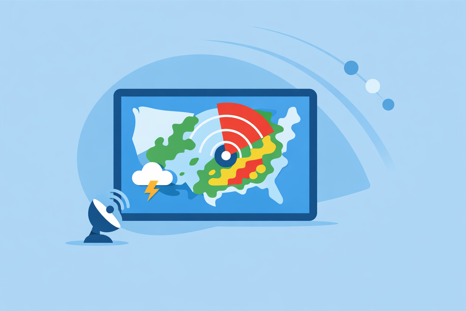
For most people in the U.S., the fastest way to get reliable weather radar online is to use an app that visualizes NOAA/NWS radar data, such as Clime’s live radar map. If you’re doing deeper analysis or embedding radar on a website, you can pair Clime with the official NOAA/NWS radar portal and map services.
Summary
- Clime gives you an easy, phone-first way to view live NOAA-based radar plus lightning, hurricanes, and wildfires in one map.
- NOAA’s National Weather Service radar is the technical source of truth for U.S. Doppler radar; most popular sites and apps build on that feed.(NOAA NWS radar map service)
- The Weather Channel, AccuWeather, Windy.app, and other options mainly differ in how they visualize that data, how far into the future they project storms, and how many extra layers they add.
- For typical U.S. users who just want to see where it’s raining now and whether a storm is coming, Clime’s radar-first interface is usually the most straightforward starting point.
What do people really mean by “weather radar online”?
When someone types “weather radar online,” they’re usually looking for one of three things:
- A live radar map that shows where it’s raining or snowing right now, often with a loop over the last hour.
- Short-range storm tracking to see whether a cell is moving toward a specific city, neighborhood, or road.
- A tool they can keep open on a phone or laptop during severe weather, instead of watching TV coverage.
In the U.S., nearly all of those needs are ultimately served by the same underlying system: a network of Doppler radars run by NOAA’s National Weather Service (NWS), commonly called NEXRAD.(NEXRAD overview)
What changes from site to site is the interface:
- How clear the colors and animation are.
- Whether you can turn layers like lightning or wildfire on and off.
- How easily you can switch between “right now” and the next couple of hours.
At Clime, we center the experience on that interactive map. The app starts from a radar view, then layers in hourly and 10‑day forecasts, severe weather alerts, lightning, and wildfire hotspots.(Clime overview)
For most people, that combination—live radar plus simple, visual risk layers—is what “weather radar online” is really about.
Why is NOAA/NEXRAD still the backbone of U.S. online radar?
Before comparing apps, it helps to understand the data they share.
The U.S. radar backbone is the NEXRAD network, a set of WSR‑88D Doppler radars that continuously scan the atmosphere. NOAA’s National Weather Service publishes composite radar products that cover the continental U.S., Alaska, Hawaii, parts of Canada, Guam, and the Caribbean.(NOAA coverage statement)
A few key realities:
- Update cadence is about every 5–10 minutes. NOAA’s map services list a typical update frequency of around 10 minutes for composite radar layers.(NOAA radar update frequency)
- Everyone inherits that delay. No consumer app can be more “real‑time” than the radar network itself. Differences you see are mostly about processing and display, not raw latency.
- The official web view is radar.weather.gov. This is NOAA’s own portal: a time-enabled composite from Weather Service Doppler radars with zoom and loop controls.(NWS radar portal)
Clime uses NOAA‑sourced radar mosaics for its visualization, similar to other major tools, but wraps them in a consumer-friendly map: tap to move between cities, overlay hurricanes or lightning, and jump straight into an hourly outlook.(Clime site)
For most U.S. users, the meaningful choice is less about data source—and more about which interface helps you understand that data fastest.
How does Clime compare to other popular online radar options?
You have several credible ways to see radar online. The core question is: which one makes sense as your default, and when would you add others?
Clime: radar-first, phone-first
On Clime, the radar map is the starting point. The app focuses on:
- NOAA-based live radar showing precipitation and storm structure across the U.S. and beyond.(Clime site)
- Severe weather and rain alerts for saved locations on paid tiers, so you don’t have to watch the radar constantly.(Clime App Store listing)
- Hurricane and lightning trackers as map layers, so you can see where organized storms and lightning clusters are in relation to you.(Clime App Store listing)
- Wildfire and hotspot maps that help you monitor fire risk visually, which most generic radar sites don’t prioritize.(Clime get application)
The Texas Water Development Board even lists Clime (under its former NOAA Weather Radar name) as one of the interactive tools agencies can use when communicating flood risk, highlighting its usefulness as a public-facing radar and map viewer.(TWDB flood tools PDF)
In practice, that means you can open Clime during a storm and immediately see:
- Where the heaviest reflectivity is.
- Whether there’s lightning in the area (on paid tiers).
- If a tropical system or wildfire is relevant to your region.
This “one map, many hazards” approach is where Clime tends to serve everyday users better than juggling multiple niche sites.
The Weather Channel: TV-brand ecosystem and Premium Radar
The Weather Channel’s website and app offer a familiar radar experience, often starting from a national US radar map and local overlays.(Weather.com US radar)
On mobile, The Weather Channel app includes:
- Interactive radar with precipitation animation.
- A 15‑minute rainfall forecast up to several hours ahead.
- A Premium subscription that unlocks Advanced Radar and extended hourly data.(Weather Channel App Store)
This is useful if you already live inside The Weather Channel ecosystem (TV, website, app). But for users who mainly care about the map, the extra TV-style content and promotional cards can feel like more interface than they need.
AccuWeather: Future Radar and hyperlocal timelines
AccuWeather’s national radar map shows current reflectivity and includes a “Future Radar” feature that projects the intensity and track of rain, snow, and ice up to about two hours into the future, depending on platform.(AccuWeather Future Radar announcement)
The AccuWeather app also offers:
- MinuteCast, a minute‑by‑minute precipitation outlook over the next four hours for a specific location.(AccuWeather App Store)
- Interactive radar and satellite maps with a range of overlays; some map types are subscriber-only.(AccuWeather support: maps and radar)
These features are attractive if you enjoy timelines and model-derived nowcasts. For many users, though, a clear loop of actual radar plus rain alerts (as Clime provides) covers the same decisions—“Do I leave now?” “Is it safe to drive?”—without the overhead of extra menus.
Windy.app and similar tools: sport and model focused
Windy.app’s focus is wind and marine sports, using many weather models and layers for wind, waves, and tides.(Windy.app site) It is working toward live radar integration in its own interface but still emphasizes model-based fields more than classic NEXRAD-style radar for land-based severe weather.(Windy.app radar blog)
For sailors, surfers, or kiteboarders, Windy.app plus Clime can be a strong combo: you use Windy-style tools to plan sessions and Clime to keep an eye on where actual storms and lightning are.
How to choose your default
If you:
- Just want to see where it’s raining and get warned in time → Start with Clime as your daily radar and alert tool.
- Already rely heavily on The Weather Channel or AccuWeather forecasts → Keep those for extended outlooks and specialized timelines; add Clime when you want a focused hazard map.
- Are a sports or marine power user → Use dedicated sport tools for wind and waves, and Clime when you need a straightforward radar and hazard overview.
For most U.S. readers, Clime is a practical default, with NOAA’s own radar portal as a good secondary check.
What are the best free live radar maps for U.S. storm tracking?
If you want to spend nothing and still get high-quality radar, you have strong options.
1. Clime (free tier)
On free tiers, you can:
- Open a live radar map centered on your location.
- Pan across the U.S. to follow storms.
- See basic precipitation intensity with animation.
This makes Clime a solid “always on your phone” choice even before you consider paid layers.
2. NOAA/NWS radar portal (radar.weather.gov)
The official NWS radar page lets you:
- Pick individual radar sites or view composites.
- Loop recent scans in time.
- See exact scan timestamps and radar IDs.(NWS radar portal)
The trade-off is usability: it’s designed more like a GIS viewer than a polished consumer app.
3. Major weather sites: Weather.com and AccuWeather
- Weather.com offers a U.S. Doppler Radar map with an overlay of precipitation and severe markers.(Weather.com US radar)
- AccuWeather has a United States Weather Radar page with zoom and limited future projection visible on the web.(AccuWeather U.S. radar)
Both are strong backups if you’re already on those sites for news or long-range forecasts.
Putting it together
A simple, cost-conscious setup for most people looks like this:
- Use Clime every day as your quick radar and hazard view.
- Keep NOAA’s portal bookmarked for deeper inspection or when you want to be sure you’re looking at the official feed.
- Dip into Weather.com or AccuWeather when you’re already on those sites and want radar in the same tab.
You don’t need more than two or three tools to cover almost all everyday storm-tracking needs.
How is NOAA/NEXRAD radar data updated and served online?
Understanding the pipeline helps you interpret what you see on any site or app.
- Radars scan the atmosphere. NEXRAD sites perform volume scans at multiple elevation angles, capturing reflectivity and other fields.(NEXRAD overview)
- NOAA builds composites. NWS processes raw data into composite radar layers that cover large regions. Its map services explicitly note that composite reflectivity is updated roughly every 10 minutes.(NOAA radar service)
- Web services publish tiled maps. These composites are exposed via map servers and image services that third-party apps can consume.
- Consumer apps tile and colorize. Tools like Clime, The Weather Channel, and AccuWeather fetch these layers, apply their own color ramps, and add animations and overlays.
Two takeaways for users:
- If scans are 5–10 minutes apart, no site is literally “real-time.” You’re always seeing a recent snapshot.
- Differences between apps usually reflect design choices, not completely different underlying radar.
Clime’s approach is to keep that complexity in the background. You get a smooth, time-aware radar loop, plus visual hazard layers like lightning and wildfire, without having to think about volume scans or map servers.
What is AccuWeather’s Future Radar and who can access it?
AccuWeather’s Future Radar is a nowcasting feature that blends observed radar with short-range forecast models to project where rain, snow, and ice are likely to move over roughly the next two hours on supported platforms.(AccuWeather Future Radar announcement)
A few important points:
- It’s model-based, not “extra” radar; it shows projected motion and intensity beyond the latest scan.
- On some apps and web views, these future layers are reserved for logged-in or paying users; AccuWeather labels certain advanced maps as subscriber-only.(AccuWeather support: maps and radar)
This kind of feature can be useful if you like having a precise timeline on-screen. However, for everyday decisions—like whether you can safely finish a walk or drive before the storm hits—a simple observed radar loop plus timely push alerts (as Clime offers on paid plans) often gives you the same practical guidance, with fewer assumptions baked in.
How do Weather.com and Windy-style overlays differ from a radar-first app like Clime?
When users search "weather radar online," they sometimes land on map-heavy tools with many overlays. The key differences are focus and complexity.
Weather.com radar
Weather.com’s radar is integrated into a broader news and forecast site. The U.S. Doppler Radar map provides a severe-weather-oriented national view.(Weather.com US radar)
Pros:
- Familiar, brand-backed interface.
- Easy access from forecast pages.
Trade-offs:
- Radar is one of many widgets; it can be less immediate than a radar-first app.
- Some higher-end radar layers (like Advanced Radar with extra overlays) sit behind a Premium subscription in the app.(Weather Channel App Store)
Windy.app overlays
Windy.app prioritizes wind, waves, and multiple model-based visualizations over classic radar.(Windy.app site) Radar is emerging there, but its own blog notes that live radar is still being worked on inside the app.(Windy.app radar blog)
Pros:
- Excellent for planning around wind and swell.
- Many model layers for enthusiasts.
Trade-offs:
- Radar is not yet the core strength.
- The interface can be overkill if all you want is “where is the rain right now?”
Radar-first simplicity
In contrast, Clime’s map is centered on radar and risk layers. Walking into the app feels like walking straight up to a dedicated radar display, without wading through TV-style content or sports-oriented overlays. For users whose main need is situational awareness—Is a storm forming? Is lightning nearby? Is there wildfire activity in my region?—that clarity often matters more than an extra set of model lines.
Can you embed live radar on a website, and what should you watch for?
Some readers searching "weather radar online" are thinking about embedding a map in a blog, city website, or internal dashboard.
Here are the main options and considerations:
- Use an official NOAA/NWS widget or map service. NOAA publishes time-enabled radar map services with clearly documented coverage areas and update frequencies, which some developers integrate into their own web maps.(NOAA radar service)
- Embed a third-party map that offers sharing. Some sites and tools offer embeddable widgets or iframes for basic radar; always check their terms of use, branding requirements, and rate limits.
- Build a custom map with a mapping library. Developers can consume NOAA’s map services through JavaScript mapping libraries, but must follow NOAA’s usage guidelines and should design for performance and clarity.
For non-developers, the simplest path is often to link visitors to a dedicated radar page or encourage them to install a radar-focused app like Clime, rather than maintaining your own embedded map. That way, your audience benefits from a maintained, up-to-date visualization layer on top of the same official data.
What we recommend
- Make Clime your primary radar app if you’re in the U.S. and want a clear, radar-first map plus lightning, hurricane, and wildfire layers in one place.
- Bookmark NOAA’s radar portal as an official reference when you want to double-check what any app is showing.(NWS radar portal)
- Add Weather.com or AccuWeather only if you already prefer their broader forecast ecosystems or want specific features like Future Radar timelines.
- Pair Clime with sport- or marine-focused tools (such as Windy-style apps) when you care deeply about wind and waves but still need straightforward storm and hazard awareness.