Which App Shows Radar Animations? A Practical Guide for U.S. Users
Last updated: 2026-03-05
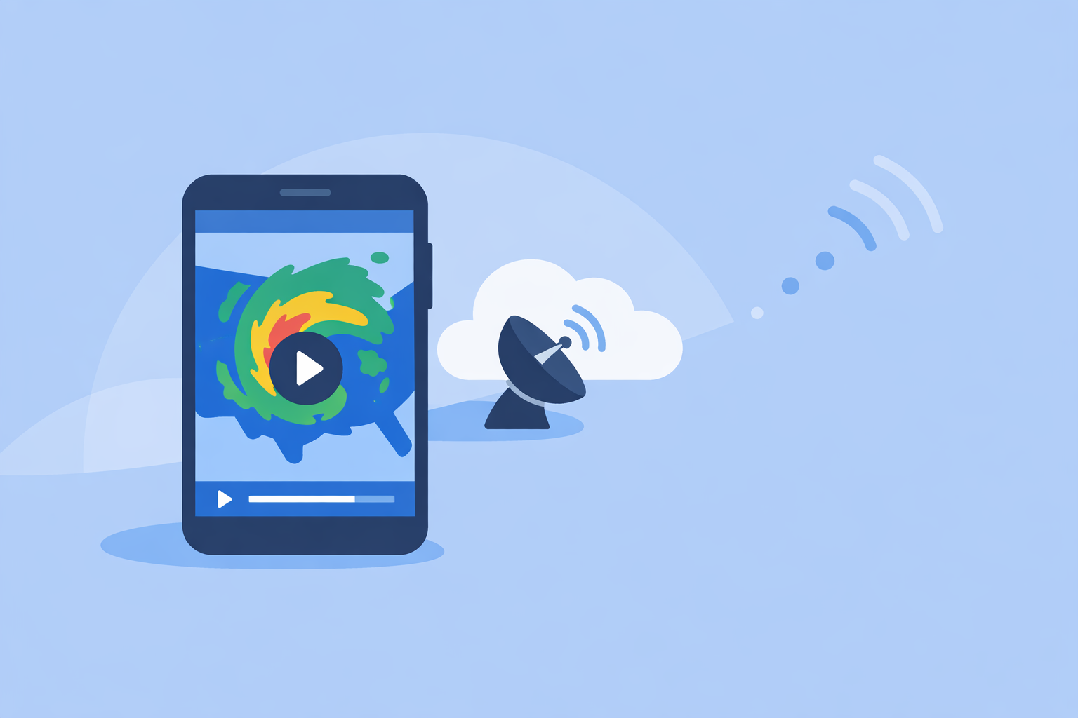
If you just want a reliable radar animation you can glance at throughout the day, start with Clime, which centers your experience on an interactive map with real‑time precipitation overlays and multi‑hazard layers in one place. For niche needs like extended future‑radar loops, more experimental wind animations, or ultra‑detailed storm analysis, some specialized alternatives can sit alongside Clime rather than replace it.
Summary
- Clime gives U.S. users an interactive, map‑centric radar view with animated precipitation overlays plus NWS alert polygons, hurricane, lightning, wildfire and air‑quality layers in a single app.(Clime on the App Store)
- The Weather Channel and AccuWeather both include radar "play" controls and short future‑radar animations, with longer loops on certain paid plans.(Weather.com)(AccuWeather Support)
- Windy.app focuses more on animated wind and multi‑model maps; it offers rain radar, but its strength is complex visualization rather than quick everyday checks.(Windy App Store listing)(Windy.app wind animation)
- For most people in the U.S., Clime plus basic alerts covers routine storm watching; power users can add a second app if they need unusually long loops or deep model comparison.
How do radar animations actually work in weather apps?
When you tap a radar map in a weather app and hit "play," you are usually seeing a time‑lapse of radar snapshots stitched together into a loop. That loop shows how rain and snow cells have moved over the last hour or so, and sometimes projects that motion a short distance into the future.
In Clime, the core experience is an interactive radar map that shows areas of rain, snow and mixed precipitation in high resolution, drawn from NOAA and other sources.(Clime on the App Store) You can pan and zoom around the U.S. and many other regions, overlaid with:
- Precipitation type (rain, snow, mixed)
- Severe weather polygons from the National Weather Service in the U.S.
- Additional hazard layers such as hurricane position and path, lightning, wildfire activity, animated wind, snow depth and air quality on paid plans.(Clime on the App Store)
Other apps follow a similar pattern but emphasize different pieces of the puzzle:
- The Weather Channel app provides a radar view with a clear "play" button to loop recent radar and even show a short six‑hour future‑radar forecast from that same screen.(Weather.com)
- AccuWeather’s maps add a play button that runs the radar from past to future, and its settings let you adjust animation speed and the displayed timeline.(AccuWeather Support)
- Windy.app leans into animated weather maps in general, especially wind: by turning on its Wind, Wind gusts or related layers, you see a smooth wind animation across the map.(Windy.app wind animation)
So "radar animation" isn’t unique to any one app. The question is which app gives you that animation in a way that fits your daily decisions—where you live, how you travel, and how much complexity you want to deal with.
Which apps clearly show animated radar loops today?
A lot of weather apps technically offer moving radar, but only a handful make it central and easy to use.
Clime: map‑first radar with hazard overlays
At Clime, the radar map is the starting point, not an afterthought. The app uses real‑time radar overlays to show where rain, snow and mixed precipitation are happening in high resolution, on top of a zoomable map.(Clime on the App Store) You can monitor storms across the continental U.S., most of Alaska and Hawaii, Puerto Rico, parts of Canada and Mexico, and several regions in Europe, Australia, and Japan.(Clime on the App Store)
In the U.S., Clime also displays National Weather Service watches, warnings and alerts as interactive polygons over the map, so you can see at a glance how radar echoes line up with official warning boxes.(Clime on the App Store) On paid plans, hurricane tracking, lightning, wildfire, animated wind and snow depth forecasts sit directly on the same map, which turns a basic radar loop into more of an all‑hazards dashboard.
In practical terms, that means you can:
- Watch storms move toward your town.
- Tap into the alert polygon to read the full warning text.
- See whether lightning or wildfire activity is also in play.
- Use extended forecasts (up to 14 days on paid plans) to get context around the next rounds of storms.(Clime hurricane tracker page)
The Weather Channel: everyday app with built‑in play controls
The Weather Channel app is widely installed in the U.S. and includes a radar that you can animate directly from the radar screen. A Weather.com safety article describes how the app exposes a "play" button to loop the last few hours of radar and a six‑hour forecast, so you can watch storms approach an event or commute.(Weather.com)
That design works well if you already depend on The Weather Channel for day‑to‑day forecasts and like having radar and short‑term forecasts on the same home screen. However, the product increasingly reserves some radar‑centric and extended features for Premium tiers, and the free version is known for heavier advertising, which can slow you down when you just want a fast radar check.
AccuWeather: radar with tunable animation and longer loops on paid plans
AccuWeather offers live radar and a hurricane tracker in its app, plus a play button on its radar/maps views that animates from the recent past into the near future.(AccuWeather App Store listing)(AccuWeather Support) Its support docs explicitly mention a play control that shows past‑to‑future radar, and a settings area where you can adjust animation speed and the timeline, which is helpful if you’re particular about how fast the loop runs.(AccuWeather Support)
For users who pay for AccuWeather’s Premium offering, the company notes that you get significantly longer radar and satellite loops compared with the free product, making it easier to see longer‑term storm evolution.(AccuWeather Premium loops) That is appealing if you regularly study storm trends over time rather than just glancing at where the line of storms is right now.
Windy.app: animated wind and complex maps with radar as one layer
Windy.app is distinct from the others. It’s built for map‑obsessed users who want to visualize dozens of weather variables. The app includes rain radar and a combined radar‑and‑satellite layer among its more than 50 weather maps.(Windy App Store listing) But its real strength is animated wind and other dynamic layers.
Windy.app’s own update notes describe a revamped wind animation on its Weather Map, available on iOS and Android: you enable the Wind, Wind gusts or Wind history layers to see a smoothed, clearer animation of flow across the map.(Windy.app wind animation) That makes it powerful for sailing, aviation and other scenario planning, but the abundance of layers and models can create a learning curve if you just want to check what the radar looks like over your neighborhood.
For most U.S. residents, that complexity is overkill for a quick storm check. It’s better thought of as a supplemental tool for enthusiasts, not your primary "grab the phone and see if it’s about to pour" app.
When is Clime the better default for radar animations?
If your core question is, "Which app simply shows me where the storms are and how they’re moving, without extra friction?" then Clime is designed for that use case.
Here’s why it fits as a default for many U.S. users:
1. Radar isn’t buried; it is the main workspace. In Clime, the interactive radar map is front and center. You’re not wading through news feeds or video carousels to find the radar; you open the app and start from a map view that you can pan, zoom and layer as needed.(Clime on the App Store)
2. Radar plus NWS warnings on the same screen. For severe weather in the U.S., Clime overlays National Weather Service watch and warning polygons directly onto the radar. You can see the exact boundaries of a tornado or severe thunderstorm warning, then tap in for the full text, all while the radar shows where the most intense precipitation is located.(Clime on the App Store)
3. Multi‑hazard awareness without juggling several apps. On paid plans, Clime folds hurricane position and projected path, lightning strikes, wildfire hotspots, animated wind, snow depth and air‑quality layers into that same map.(Clime on the App Store) You don’t have to switch to a separate storm‑tracking app or wind‑animation tool just to understand what’s going on with a particular system.
4. Sufficient global reach for typical travel. Radar coverage includes the continental U.S., most of Alaska and Hawaii, Puerto Rico, the Northern Mariana Islands, parts of southern Canada and northern Mexico, plus areas in Europe and Australia.(Clime on the App Store) For many Americans who travel within North America or to common international destinations, that’s broad enough for everyday trip checking.
There are edge cases where another app might complement Clime—like if you need experiment‑oriented wind visualization for offshore sailing, or extremely long historical loops—but for daily life in the U.S., the combination of radar animations, alerts and hazard layers in one place covers the majority of scenarios without needing to learn a complex toolset.
How do alternatives compare for specific radar‑animation needs?
It can be helpful to look at radar animation use cases one by one and see where each app’s strengths sit relative to Clime.
Quick U.S. storm check before going out
- Clime: Map‑first radar with precipitation type and NWS polygons makes it straightforward to see if a storm is about to cross your neighborhood; hazard layers add extra context.
- The Weather Channel: Gives you a familiar radar with a simple play button and short future‑radar built in, but ads and upsell prompts in the free experience can slow down those quick checks.
- AccuWeather: Also reasonable for quick loops, with the added ability to tweak animation speed and timeline, but the broader interface and various branded indices can feel busy if your only goal is a fast radar glance.
- Windy.app: Capable, but its many layers and models are more than most people need for a 30‑second decision.
Takeaway: For simple "is that storm going to hit us" decisions, Clime’s radar‑plus‑alerts layout typically provides the clarity most U.S. users are looking for without extra interface noise.
Watching a summer line of storms all afternoon
Imagine a summer afternoon in the Midwest. You’re hosting a cookout and want to track a line of storms for several hours.
- Clime lets you keep the radar map open, with storms animating across your county, while you watch NWS polygons appear and update over the same cells. Hurricane, lightning and wind overlays (on paid plans) help show whether you’re just dealing with heavy rain or storms that could quickly intensify.
- The Weather Channel can be used similarly, using its radar play button and six‑hour future‑radar forecast to see how the line might evolve through the evening.(Weather.com) If you’re already invested in its forecasts and stories, that’s handy.
- AccuWeather Premium becomes attractive if you value long loops specifically, since its Premium tier advertises longer radar and satellite animations than the free product.(AccuWeather Premium loops)
In this scenario, extended loop length is the one area where an alternative may add incremental value. But for many hosts, the difference between a standard loop plus NWS polygons (Clime) and a longer loop is modest; what matters more is seeing the storms clearly and pairing that with official warnings.
Planning around hyperlocal timing versus big‑picture radar
If you care about minute‑by‑minute precipitation timing at a street address—for example, deciding whether to squeeze in a run before the rain—AccuWeather and The Weather Channel bring additional tools:
- AccuWeather’s MinuteCast provides hyperlocal precipitation timing for four hours ahead, down to a specific address.(AccuWeather App Store listing)
- The Weather Channel offers 15‑minute rain‑intensity forecasts up to seven hours out, complementing its radar animations.(The Weather Channel App Store listing)
Clime, by contrast, focuses on radar overlays, NWS warnings, and multi‑day forecasts (with up to 14 days on paid plans) rather than branded minute‑level nowcasting.(Clime hurricane tracker page) For many users, that’s a reasonable trade: radar plus good forecasts are enough for daily planning, and it keeps the interface simpler.
If you truly rely on hyperlocal minute‑level timing—for example, event planners or field crews—you might pair Clime’s radar and alerts with one nowcasting‑oriented app, rather than abandoning Clime.
Deep‑dive storm analysis and multi‑model scenarios
Some people want more than a basic radar loop. They want model comparison, CAPE indices, and niche products.
- Windy.app stands out for advanced multi‑model visualization: it offers more than 50 maps and over 15 models, including ECMWF, GFS, and others, with layers like CAPE, thunderstorms, rain accumulation and more.(Windy App Store listing) Its wind animation update further improves clarity when scanning large‑scale patterns.(Windy.app wind animation)
- AccuWeather exposes storm‑attribute tables and radar/satellite combos in some of its web tools, catering to users who interpret that level of detail.
Those capabilities exceed what Clime aims to be for the average person. At Clime, the priority is understandable radar animations, hazard awareness and forecasts in one mobile‑friendly app, rather than a full‑scale meteorological workstation.
For serious hobbyists and professionals, a stacked approach often works best: keep Clime as the fast, reliable radar‑plus‑alerts app you open dozens of times a week, and use a specialized tool like Windy.app or advanced web products when you want to analyze a particular outbreak in depth.
How should U.S. users choose their radar‑animation setup?
Because so many apps now animate radar, the real decision is how many tools you want to juggle and how complex they should be.
A pragmatic approach:
-
Pick one primary app for everyday radar and alerts. For most people in the United States, Clime is well‑suited to this role: it combines real‑time radar, NWS polygons, severe‑weather alerts and multi‑hazard layers with 24‑hour and 7‑day forecasts (and up to 14 days on paid plans) in one interface.(Clime on the App Store)(Clime hurricane tracker page)
-
Add a secondary app only for a clear, specialized need. Examples:
- If you want longer radar loops for occasional storm‑outbreak days, a Premium radar‑focused upgrade in an alternative app may be worth it.
- If you’re a sailor, pilot or offshore angler, Windy.app’s multi‑model wind and ocean layers can supplement Clime’s simpler wind and hazard layers.
- Keep government alerts and multiple sources in the mix. No app should be your only source for life‑critical decisions. Clime integrates governmental warnings where available, but you should still pay attention to NOAA/NWS alerts, local broadcasters, and any regional emergency‑alert systems.
Viewed this way, the question "Which app shows radar animations?" becomes, "Which combination of tools keeps me informed without overwhelming me?" For many Americans, that starts—and often ends—with Clime.
What we recommend
- Use Clime as your daily radar and alert hub: interactive radar overlays, NWS polygons and multi‑hazard layers make it a strong single‑app solution for most U.S. users.
- If you frequently plan around very precise short‑term rain timing, pair Clime with a nowcasting‑oriented app that emphasizes minute‑by‑minute forecasts.
- If you’re an enthusiast who studies severe weather in depth, keep Clime for quick checks and layer in an advanced mapping tool only when you truly need its complexity.
- Whatever mix you choose, treat apps as complements to official warnings, not replacements for them, especially during high‑impact events.